Skip to search
Skip to main content
Skip to first result
Search
You Searched For
Language
German
Publication Place
Weimar :
New Search
Search Results
Creator:
Published / Created:
1814
Call Number:
88 M57 1814
Container / Volume:
BRBL_00647
Image Count:
1
Resource Type:
Maps, Atlases & Globes
Description:
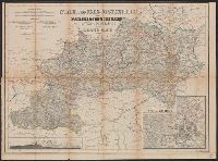
"Schleuen, sc.", Includes "Profil des Canals oder Desague Real von Huehuetoca.", and Relief shown by hachures.
Publisher:
Verlage des Geograph Instituts,
Subject (Geographic):
Mexico Valley (Mexico)--Maps
Subject (Name):
Schleuen
Found in:
Beinecke Rare Book and Manuscript Library > Neue Charte des Thales von Mexico : und der benachbarten Gebirge / an Ort und Stette gezeichnet im J. 1804, von Don Louis Martin, ausgearbeitet und verbesfert im J. 1807 nach den trigonometrischen Vermesfungen von Don Joaquin Velasquez und den astronomisc
Published / Created:
1814
Call Number:
853 1814
Container / Volume:
BRBL_00640
Image Count:
1
Resource Type:
Maps, Atlases & Globes
Publisher:
Geographische Institut,
Subject (Geographic):
Hispaniola--Maps
Found in:
Beinecke Rare Book and Manuscript Library > Neue Charte von S. Domingo ...
Published / Created:
[1865?]
Call Number:
423 1865
Container / Volume:
BRBL_00245
Image Count:
1
Resource Type:
Maps, Atlases & Globes
Description:
In bottom margin: Schrift von W. Kratz ; Terrain v. V. Geyer. and Insets: [1.] Wien und Umgegend, 1:72,000 -- [2.] Profil: Lundenburg-Wien-Semmering-Gratz.
Publisher:
Geographisches Institut,
Subject (Geographic):
Austria--Maps
Found in:
Beinecke Rare Book and Manuscript Library > Nieder und Ober-Oesterreich oder das Erzherzogthum Oesterreich unter & ob der Enns und das Herzogthum Salzburg / Bearbeitet von C. Gräf.
Creator:
Published / Created:
1833
Call Number:
71 1833
Container / Volume:
BRBL_00369
Image Count:
1
Resource Type:
Maps, Atlases & Globes
Description:
Inset: Meer von Kamtschatka., Prime meridian: Ferro., and Relief shown by hachures.
Publisher:
Im Verlage des Geograph: Instituts,
Subject (Geographic):
North America--Maps
Subject (Name):
Geographisches Institut (Weimar, Thuringia, Germany)
Found in:
Beinecke Rare Book and Manuscript Library > Nord America / entworfen und gezeichnet von C.F. Weiland ; Gest. v. C. Jungmann, W. 30.
Published / Created:
1808
Call Number:
36gmd 1808
Container / Volume:
BRBL_00131
Image Count:
1
Resource Type:
Maps, Atlases & Globes
Publisher:
im Verlage des geograph Instituts.,
Subject (Geographic):
Germany--Maps
Found in:
Beinecke Rare Book and Manuscript Library > Post Charte von Teutchland neue berichtegte Ausagabe von F.L. Güssefeld.
Published / Created:
[1862?]
Call Number:
367 1862
Container / Volume:
BRBL_00145
Image Count:
1
Resource Type:
Maps, Atlases & Globes
Description:
With one inset map: "Berlin und Umgegend".
Publisher:
Geographisches Institut,
Subject (Geographic):
Brandenburg (Germany)--Maps
Found in:
Beinecke Rare Book and Manuscript Library > Preussische Provinz Brandenburg im Maasstabe von 1/600000 der natürl. Grösse / bearbeitet von Adolf Gräf.
Published / Created:
[1895?]
Call Number:
34 1895
Container / Volume:
BRBL_00091
Image Count:
1
Resource Type:
Maps, Atlases & Globes
Description:
Situation u. Schrift v. Wibel u Haubold.
Publisher:
Geographisches Insitut,
Subject (Geographic):
Scandinavia--Maps
Found in:
Beinecke Rare Book and Manuscript Library > Schweden und Norwegen/ Bearbeitet von C. Gräff.
Published / Created:
[1857]
Call Number:
642 1857
Container / Volume:
BRBL_00338
Image Count:
1
Resource Type:
Maps, Atlases & Globes
Description:
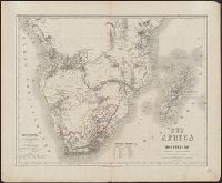
Appears in "Hand-Atlas der Erde und des Himmels ...".
Publisher:
Geographisches Institut,
Subject (Geographic):
South Africa--Maps
Subject (Name):
Geographisches Institut (Weimar, Thuringia, Germany) and Gräf, Adolf
Found in:
Beinecke Rare Book and Manuscript Library > Sud-Africa mit Madagascar ... / Bearbeitet von Adolf Gräf.
Creator:
Published / Created:
1807-1813.
Call Number:
BrSides Folio 2017 22
Image Count:
2
Resource Type:
Maps, Atlases & Globes
Alternative Title:
Carte topographique et militaire de L'Allemagne
Description:
4. Heigoland -- 15. Jever., Accompanied text: Nachricht. [4] p. ; 48 cm., Imperfect: all sheets but 4 and 15 wanting. Addressed in manuscript to Louis C. Karpinski from Fr. Karafiat, with postage stamps, on verso. Printed key for sheets 4, 14 and 15 pasted on verso., Indexed., and Relief shown pictorially by hachures and form lines.
Publisher:
Geographischen Institute,
Subject (Geographic):
Germany--Maps.
Subject (Name):
Karpinski, Louis Charles,--1848-1923--Ownership.
Subject (Topic):
Cities and towns--Germany--Maps.
Found in:
Beinecke Rare Book and Manuscript Library > Töpographisch-militairische charte von Teutschland [cartographic material] : in 204 sectionen / unternommen von dem Geographischen Institute zu Weimar, 1807 = Carte topographique et militaire de L'Allemagne : en 204 feuilles / publiée par l'Institut gé
Creator:
Published / Created:
[1885?]
Call Number:
63 1890
Container / Volume:
BRBL_00334
Image Count:
2
Resource Type:
Maps, Atlases & Globes
Alternative Title:
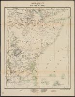
Deutsche Kolonialkarten nr. 7. and Übersichtskarte des mittleren Ostafrika
Description:
"Deutsche Kolonialkarten nr. 7"--in upper left hand corner., "Korrigierter Ausschnitt aus Kettler-Mèuller's Wandkarte von Afrika in 4 Bl., Preis 10 M"--in lower right hand corner., Title from panel., and Verso includes list of publications and map of Tanzania.
Publisher:
Geographisches Institut,
Subject (Geographic):
Africa, East--Maps
Subject (Name):
Geographisches Institut (Weimar, Thuringia, Germany)
Found in:
Beinecke Rare Book and Manuscript Library > Übersichtskarte des mittleren Ost-Afrika : und der deutschen Erwerbung / red. v. J.I. Kettler
Branch:v1.64.3 ,Deployed:2024-09-25T10:52:58-04:00