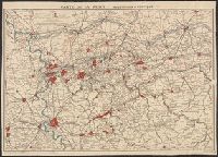
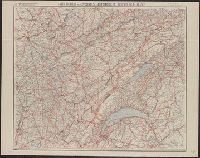
Carta postale dei diversi passaggi delle Alpi e del Piemonte
Description:
Hand colored. and Relief shown by hachures.
Subject (Geographic):
Alps--Maps, Mountain passes--Alps--Maps, Piedmont (Italy)--Maps, Post roads--Alps--Maps, Post roads--Italy--Piedmont--Maps, Post roads--Switzerland--Maps, Road, and Roads--Alps--Maps
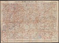
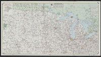
Nouvelle carte de France à l'usage des cyclistes et automobiles.
Description:
"7-09"--Bottom right corner., "No. 10"--Upper left corner., No. 10 in series "Nouvelle carte de France à l'usage des cyclistes et automobiles.", Relief shown by spot heights., Scale of kilometers., and Shows the France-Comté region of eastern France and French speaking western Switzerland from Montbeliard, France in the north to Geneva, Switzerland in the south, and west from Macon, France to Berne, Switzerland in the east. Includes the Jura Mountains, Lake Geneva and Lake of Neuchatel.
Publisher:
A. Taride,
Subject (Geographic):
Franche-Comté (France)--Maps, Jura Mountains (France and Switzerland)--Maps, and Switzerland, French-speaking--Maps
Subject (Name):
Bineteau, P
Subject (Topic):
Bicycle trails--France--Franche-Comté--Maps, Bicycle trails--Jura Mountains (France and Switzerland)--Maps, Bicycle trails--Switzerland, French-speaking--Maps, Roads--France--Franche-Comté--Maps, and Roads--Jura M
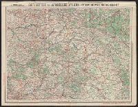
Interstate travel map, north central section. and Interstate travel map, south central section.
Description:
Interstate travel map, north central section -- Interstate travel map, south central section., Panel title., Publication date inferred from advertisement showing 1959 date., and Relief shown by spot heights and pictorially.
Publisher:
Rand McNally,
Subject (Name):
Mobil Oil Company
Subject (Topic):
Roads--Middle West--Maps and Roads--Southern states--Maps
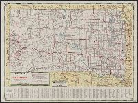
Cities Service territorial road map, [of Midwestern states]., South Dakota, and South Dakota, 1937 road map
Description:
"Cities Service territorial road map, [of Midwestern states]" (scale [ca. 1:3,500,000]), map of "Black Hills region, South Dakota" (scale [ca. 1:600,000]), 4 local route maps, text, ill., and distance table on verso., In lower left: 347-S.C. 12-K., and Indexed.
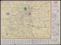
Sectional trip map., Texaco sectional trip map., Texaco touring map of Colorado., and Touring map of Colorado.
Description:
"X 3805" in lower right of Colorado map and "X.4113(N)" in lower right of Sectional trip map., Includes index, 4 local route maps, distance table, and text., Panel title., Relief shown pictorially and by spot heights., and Texaco touring map of Colorado -- Texaco
Publisher:
Rand McNally and Co.,
Subject (Geographic):
Colorado--Maps
Subject (Name):
Texas Company
Subject (Topic):
Roads--Colorado--Maps and Roads--West (U.S.)--Maps