Skip to search
Skip to main content
Skip to first result
Search
You Searched For
Resource Type
Maps, Atlases & Globes
Language
German
Publication Place
Gotha :
New Search
Search Results
Published / Created:
1834
Call Number:
59196 1834
Container / Volume:
BRBL_00319
Image Count:
1
Resource Type:
Maps, Atlases & Globes
Description:
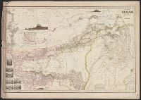
Sections of India, Birma, Tibet, Bhotan.
Publisher:
J. Perthes,
Subject (Geographic):
Assam (India)--Maps
Found in:
Beinecke Rare Book and Manuscript Library > Karte von Assam ... Gest. V.W. Brose v.W. Iaeck, Berlin.
Published / Created:
1843
Call Number:
56 1843
Container / Volume:
BRBL_00295
Image Count:
1
Resource Type:
Maps, Atlases & Globes
Description:
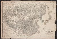
Berghaus' Atlas of Asia.
Publisher:
Justus Perthes,
Subject (Geographic):
China--Maps
Found in:
Beinecke Rare Book and Manuscript Library > Karte von China und Japen den manen D'Anville's und Klapproth's ... 1843. Gest. u. Mädel II u.s. Sch.
Published / Created:
1843
Call Number:
56 1843
Container / Volume:
BRBL_00295
Image Count:
1
Resource Type:
Maps, Atlases & Globes
Description:
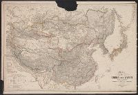
Berghaus' Atlas of Asia.
Publisher:
Justus Perthes,
Subject (Geographic):
China--Maps
Found in:
Beinecke Rare Book and Manuscript Library > Karte von China und Japen den manen D'Anville's und Klapproth's ... 1843. Gest. u. Mädel II u.s. Sch.
Published / Created:
1835
Call Number:
507 1835
Container / Volume:
BRBL_00277
Image Count:
1
Resource Type:
Maps, Atlases & Globes
Description:
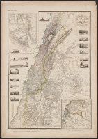
Insets: Sinai Peninsula, Road of Suez, Views Sinai Pen & section north of main map 1:1,800,000.
Publisher:
J. Perthes,
Subject (Geographic):
Syria--Maps
Found in:
Beinecke Rare Book and Manuscript Library > Karte von Syrien .. Berghaus. Gest. V. Herterich, Siebert v. Rolle.
Published / Created:
1837
Call Number:
276cea 1837
Container / Volume:
BRBL_00023D
Image Count:
1
Resource Type:
Maps, Atlases & Globes
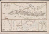
Description:
Insets: Laccodiven Is.; Malediven Is.; Tschagos Is.; Keeling Is.; Singapore; Bangka Strait; Bangka; Bliton. and Preliminary record.
Publisher:
J. Perthes,
Subject (Geographic):
Sumatra (Indonesia)--Maps
Found in:
Beinecke Rare Book and Manuscript Library > Karte von der Insel Sumatra ... Berghaus. Gest. V. W. Jattnig in Berlin.
Creator:
Published / Created:
1879
Call Number:
66 1879
Container / Volume:
BRBL_00347
Image Count:
1
Resource Type:
Maps, Atlases & Globes
Alternative Title:
Stieler's Hand-Atlas ; no.69 and Stieler's Hand-Atlas no.69.
Description:
Inset maps (scale 1:7,500,000) of Senegambia, Sierra Leone, and the Gold Coast., Meridian also noted from Paris and Ferro., and Relief shown by hachures and spot heights.
Publisher:
Justus Perthes,
Subject (Geographic):
Africa, Northwest--Maps
Subject (Name):
Habenicht, Hermann (1844-1917), Hanemann, Fritz, Kramer, A, and Kühn, E
Found in:
Beinecke Rare Book and Manuscript Library > Nordwest-Afrika : Maβstab 1:12,500,00. / von A. Petermann ; Bearbeitet von Hanemann & Habenicht ; gest. v. E. Kühn ; Terrain v. A. Kramer.
Creator:
Published / Created:
1868
Call Number:
643 1868
Container / Volume:
BRBL_00339
Image Count:
1
Resource Type:
Maps, Atlases & Globes
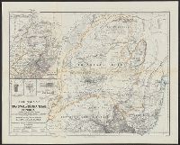
Alternative Title:
Ergänzungsheft ... zu Petermanns geographischen Mitteilungen. and Transvaal or South-African Republik
Description:
"From surveys and observations by Survr. Genl. M. Forssmann, C. Mauch, F. Hammar, Survr. J. Brooks, and other official documents, combined with the results of their own explorations by F. Jeppe and A. Merensky, Potchefstroom & Botsabelo, 1868." and In top mar
Publisher:
Justus Perthes ,
Subject (Geographic):
South Africa--Maps and Swaziland--Maps
Subject (Name):
Justus Perthes (Firm : Gotha, Germany)
Found in:
Beinecke Rare Book and Manuscript Library > Original map of the Transvaal or South-African Republik / reconstructed and augmented with data from various exploring travellers &c. by A. Petermann.
Published / Created:
1901
Call Number:
615 1901
Container / Volume:
BRBL_00332
Image Count:
1
Resource Type:
Maps, Atlases & Globes
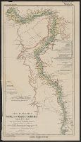
Description:
In German.
Publisher:
Justus Perthes,
Subject (Geographic):
Nile River Valley--Maps
Found in:
Beinecke Rare Book and Manuscript Library > Originalkarte des Nithal's von Farschūt bis Kom-Ombo, Ober-Ägypten ... / gez. v. Dr. B. Hassenstein ; aut. v. C. Schmidt.
Published / Created:
1943
Call Number:
308 1943
Container / Volume:
BRBL_00037
Image Count:
1
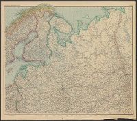
Resource Type:
Maps, Atlases & Globes
Alternative Title:
Perthes-Karten
Publisher:
Perthes,
Subject (Geographic):
Europe, Eastern--Maps
Found in:
Beinecke Rare Book and Manuscript Library > Osteuropa und Vorder-Asien Nordblatt.
Published / Created:
1890-1891.
Call Number:
41 1891
Container / Volume:
BRBL_00241
Image Count:
2
Resource Type:
Maps, Atlases & Globes
Description:
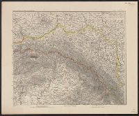
Insets: [1.] Budapest und weitere Umgegend, 1:150,000 -- [2.] Südspitze von Dalmatien.
Publisher:
Justus Perthes,
Subject (Geographic):
Austria--Maps and Europe, Eastern--Maps
Found in:
Beinecke Rare Book and Manuscript Library > Österreich-Ungarn in 4 Blättern / von C. Vogel.
Branch:v1.64.0 ,Deployed:2024-09-11T10:25:40-04:00