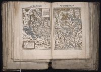
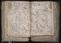
[Atlas factice of 96 maps by Blaeu, Visscher, Jansson, Hondius and others]
Image Count:
1
Description:
Each map hand col. Sheet measures 38.8 x 48 cm. Reinforced along edges with manuscript waste. No. 46 of 92 maps bound together. and Numbered 50 on verso.
Publisher:
Christoffel Froschauer
Subject (Geographic):
Zurich (Switzerland : Canton) --Maps --Early works to 1800
Froschauer, Christoph, d. 1564, printer Stumpf, Johannes, 1500-1576?
Published / Created:
[ca. 1556?]
Call Number:
1983 Folio 19
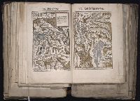
Collection Title:
[Atlas factice of 96 maps by Blaeu, Visscher, Jansson, Hondius and others]
Image Count:
1
Description:
Each map hand col. Sheet measures 38.5 x 47.9 cm. Reinforced along edges with manuscript waste. No. 47 of 92 maps bound together. and Numbered 51 on verso.
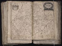
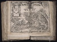
[Atlas factice of 96 maps by Blaeu, Visscher, Jansson, Hondius and others]
Image Count:
1
Description:
Imperfect: cartouche cut out and replaced in ms. with title Wurtemberg Ducatus; edges reinforced with ms waste. Sheet measures 38.5 x 48.9 cm. No. 68 of 92 maps bound together. and Numbered 73 on verso.
Publisher:
Willem Janszoon Blaeu
Subject (Geographic):
Wurttemberg-Baden (Germany) --Maps --Early works to 1800
Froschauer, Christoph, d. 1564, printer Stumpf, Johannes, 1500-1576?
Published / Created:
[ca. 1556?]
Call Number:
1983 Folio 19
Collection Title:
[Atlas factice of 96 maps by Blaeu, Visscher, Jansson, Hondius and others]
Image Count:
1
Description:
Each map hand col. Sheet measures 38.8 x 47.5 cm. Reinforced along edges with manuscript waste. No. 49 of 92 maps bound together. and Numbered 52 on verso.
Publisher:
Christoffel Froschauer
Subject (Geographic):
Basel (Canton) (Switzerland) --Maps--Early works to 1800 and Valais (Switzerland)--Maps--Early works to 1800
Guessefeld, F. L. (Franz Ludwig), 1744-1807 Harenberg, Johann Christoph, 1696-1774 Hase, Johann Matthias, 1684-1742 Homann Erben (Firm) Homann, Johann Baptist, 1663-1724 Lopez, D. T. Mayer, Tobias, 1723-1762 Rizzi-Zannoni, Giovanni Antonio, 1736-1814 Sperges, Joseph, Freiherr von, 1725-1791
Published / Created:
[1710-1786]
Call Number:
1983 Folio 23
Image Count:
2
Abstract:
A collection of maps issued by the Johann Baptist Homann or the Homann Erben firm between 1710 and 1786, made by various cartographers besides the Homann and the Homann Erben firm.
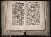
[Atlas factice of 96 maps by Blaeu, Visscher, Jansson, Hondius and others]
Image Count:
1
Description:
Imperfect: torn and mutilated along fold and edges, partially repaired, with some loss of text. Sheet measures 37.4 x 48.3 cm. No. 65 of 92 maps bound together. and Numbered 70 on verso.