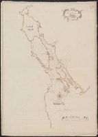
Appears in Thomas Kitchin's General atlas describing the whole universe., Inc, Mounted on linen. Sheet measures 64.4 x 101 cm. Cross Collection no. 176., Relief shown pictorially. Soundings shown in fathoms., and With dedication to John Montagu, Earl of Sandwich.
Publisher:
Printed for Robt. Sayer, map & printseller,
Subject (Geographic):
Saint Lawrence River Valley--Maps--Early works to 1800 and Saint Lawrence River--Maps--Early works to 1800
Subject (Name):
Kitchin, Thomas, d. 1784. General atlas describing the whole universe and Sayer, Robert, 1725-1794
Subject (Topic):
Nautical charts--Saint Lawrence River--Early works to 1800
Appears in Thomas Kitchin's General atlas describing the whole universe., Includes text., and Insets: The Seven Islands -- A continuation of the river from Quebec to Lake Ontario -- St. Nicholas or English Harbor -- The mountains of our Lady or Notre Dame -- Th
Publisher:
Printed for Robt. Sayer, map & printseller,
Subject (Geographic):
Saint Lawrence River Valley--Maps--Early works to 1800 and Saint Lawrence River--Maps--Early works to 1800
Subject (Name):
Kitchin, Thomas, d. 1784. General atlas describing the whole universe and Sayer, Robert, 1725-1794
Subject (Topic):
Nautical charts--Saint Lawrence River--Early works to 1800
Great Britain. Hydrographic Dept Stokes, J. Lort (John Lort), 1811-1885
Published / Created:
Aug. 16th. 1852 [i.e. 1865]
Call Number:
26cea 1851B
Container / Volume:
BRBL_00023
Image Count:
1
Resource Type:
Maps, Atlases & Globes
Description:
"Corrections to ... Mar. 65.", Chart "2142.", and Chart of coast from Barriga Point to Jervis Bay with relief shown by hachures, bathymetric soundings and spot heights.
Publisher:
Published according to Act of Parliament at the Hydrographic Office of The Admiralty : and Sold by J.D. Potter Agent for the Admiralty charts 31 Poultry,