Search
You Searched For
Search Results
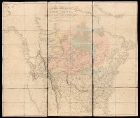
- Creator:
- Arrowsmith, Aaron, 1750-1823, cartographer
- Published / Created:
- [1820]
- Call Number:
- 71 1820B
- Image Count:
- 1
- Resource Type:
- cartographic image
- Found in:
- Beinecke Rare Book and Manuscript Library > A map exhibiting all the new discoveries in the interior parts of North America : inscribed by permission to the honorable governor and company of adventurers of England trading into Hudsons Bay, in testimony of their liberal communications to their most obedient and very humble servant, A. Arrowsmith, Hydrographer to His Majesty
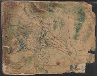
- Creator:
- Mitchell, Donald Grant, 1822-1908, cartographer
- Published / Created:
- [1870?]
- Call Number:
- Manuscript 766 N46 1870F
- Image Count:
- 1
- Resource Type:
- cartographic image
- Found in:
- Beinecke Rare Book and Manuscript Library > Map of Horse Railroad, Westville, & part of New Haven : enlarged four-fold from the county survey
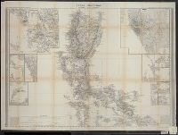
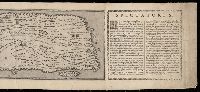
- Published / Created:
- 1852.
- Call Number:
- 28 1852B
- Image Count:
- 2
- Resource Type:
- cartographic image
- Found in:
- Beinecke Rare Book and Manuscript Library > Islas Filipinas [cartographic material]
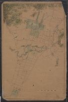
- Creator:
- Mitchell, Donald Grant, 1822-1908, cartographer
- Published / Created:
- [not before 1876]
- Call Number:
- Manuscript 766 N46 1870E
- Image Count:
- 1
- Resource Type:
- cartographic image
- Found in:
- Beinecke Rare Book and Manuscript Library > Manuscript map of New Haven Green to Edgewood by Donald G. Mitchell
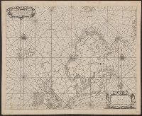
- Creator:
- Blaeu, Joan, 1596-1673, cartographer
- Published / Created:
- [1655]
- Call Number:
- 21 1670A
- Image Count:
- 1
- Resource Type:
- cartographic image
- Found in:
- Beinecke Rare Book and Manuscript Library > Paskaerte van de Oosterse en Noordse Schipvaert van Nederlandt tot Nova Zembla
- Creator:
- United States. War Department. Corps of Engineers, cartographer, publisher
- Published / Created:
- [1875?]
- Call Number:
- 831 1875
- Image Count:
- 1
- Resource Type:
- cartographic image
- Found in:
- Beinecke Rare Book and Manuscript Library > Montana Territory
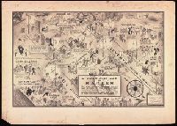
- Creator:
- Campbell, E. Simms (Elmer Simms), 1906-1971, creator
- Call Number:
- BrSides Double Folio 2016 34
- Image Count:
- 1
- Resource Type:
- cartographic image
- Found in:
- Beinecke Rare Book and Manuscript Library > A night-club map of Harlem : the stars indicate the places that are open all night, the only important omission is the location of the various speakeasies but since there are about 500 of them you won't have much trouble
- Published / Created:
- MDXCVIII [1598]
- Call Number:
- 2016 +333
- Image Count:
- 13
- Resource Type:
- cartographic image
- Found in:
- Beinecke Rare Book and Manuscript Library > Tabula itineraria ex illustri Peutingerorum Bibliotheca quae Augustae Vindel est beneficio Marci Velseri Septemuiri Augustani in lucem edita. Nobilissimo viro Marco Velsero r.p. Augustanae Septemuiro Ioannes Moretus typographus Antverp s.p.d. ... [cartographic material].
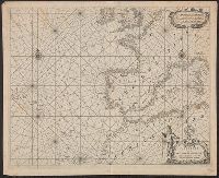
- Creator:
- Blaeu, Joan, 1596-1673, cartographer
- Published / Created:
- [1655]
- Call Number:
- 21 1670B
- Image Count:
- 1
- Resource Type:
- cartographic image
- Found in:
- Beinecke Rare Book and Manuscript Library > Paskaerte van de Westersche Schipvaert van Nederland af tot de Canarise en Vlaemse Eylanden