Search
You Searched For
Search Results
- Published / Created:
- 1794
- Call Number:
- 755 1794D
- Container / Volume:
- BRBL_00436
- Image Count:
- 1
- Resource Type:
- Maps, Atlases & Globes
- Found in:
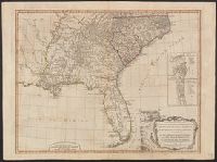
- Beinecke Rare Book and Manuscript Library > A new and general map of the Southern dominions belonging to the United States of America, ... Indian countries, and the Spanish Possessions of Louisiana and Florida.
- Published / Created:
- 1794
- Call Number:
- 755 1794
- Container / Volume:
- BRBL_00436
- Image Count:
- 1
- Resource Type:
- Maps, Atlases & Globes
- Found in:
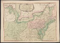
- Beinecke Rare Book and Manuscript Library > A new and general map of the middle dominions belonging to the United States of America, ...
- Published / Created:
- 1794
- Call Number:
- 755 1794
- Container / Volume:
- BRBL_00436
- Image Count:
- 1
- Resource Type:
- Maps, Atlases & Globes
- Found in:
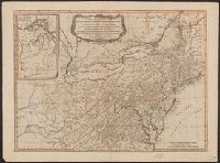
- Beinecke Rare Book and Manuscript Library > A new and general map of the middle dominions belonging to the United States of America, ...
- Published / Created:
- 1794
- Call Number:
- 755 1794
- Container / Volume:
- BRBL_00436
- Image Count:
- 1
- Resource Type:
- Maps, Atlases & Globes
- Found in:
- Beinecke Rare Book and Manuscript Library > A new and general map of the middle dominions belonging to the United States of America, ...
- Published / Created:
- 1794
- Call Number:
- 755 1794
- Container / Volume:
- BRBL_00728
- Image Count:
- 1
- Resource Type:
- Maps, Atlases & Globes
- Found in:
- Beinecke Rare Book and Manuscript Library > A new and general map of the middle dominions belonging to the United States of America, ...
- Published / Created:
- 1794
- Call Number:
- 755 1794A
- Container / Volume:
- BRBL_00436
- Image Count:
- 1
- Resource Type:
- Maps, Atlases & Globes
- Found in:
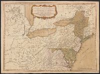
- Beinecke Rare Book and Manuscript Library > A new and general map of the middle dominions belonging to the United States of America, viz. Virginia, Maryland, the Delaware-Counties, Pennsylvania, New Jersey &c., with the addition of New York, & of the greatest part of New England &c. as also of the
- Published / Created:
- 1802
- Call Number:
- 907cea 1802
- Container / Volume:
- BRBL_00668
- Image Count:
- 1
- Resource Type:
- Maps, Atlases & Globes
- Found in:
- Beinecke Rare Book and Manuscript Library > A new chart of Surinam river (and the coast approaching it) to Paramarabo. Accompanied with sailing directions - views of the land, &c. - 1801.
- Published / Created:
- 1827
- Call Number:
- 85cea 1842
- Container / Volume:
- BRBL_00639
- Image Count:
- 1
- Resource Type:
- Maps, Atlases & Globes
- Found in:
- Beinecke Rare Book and Manuscript Library > A new chart of the Caribbean Isles ... from Porto Rico to Trinidad ...
- Published / Created:
- [1760?]
- Call Number:
- 3211cea 1760
- Container / Volume:
- BRBL_00055
- Image Count:
- 1
- Resource Type:
- Maps, Atlases & Globes
- Found in:
- Beinecke Rare Book and Manuscript Library > A new chart of the Channell between England and France.
- Published / Created:
- 1794
- Call Number:
- 60cea 1794
- Container / Volume:
- BRBL_00329
- Image Count:
- 1
- Resource Type:
- Maps, Atlases & Globes
- Found in:
- Beinecke Rare Book and Manuscript Library > A new chart of the Coast of Africa from the Straits of Gibralter to Cape Blanco with Madeira & the Canary Islands ...