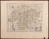
Keere, Pieter van den, 1571-approximately 1646, cartographer.
Published / Created:
[between 1652 and 1684]
Call Number:
BrSides Double Folio 2019 103
Image Count:
1
Resource Type:
Maps, Atlases & Globes
Description:
Appears in Jansson's historical atlas editions from 1652-1684., Manuscript number in upper left corner: 13., and Relief shown pictorially.
Publisher:
Apud Joannem Janssonium,
Subject (Geographic):
Benelux countries--Historical geography--Maps--Early works to 1800., Benelux countries--Maps--Early works to 1800., Europe, Central--Historical geography--Maps--Early works to 1800., and Europe, Central--Maps--Early works to 1
Subject (Name):
Jansson, Jan, 1588-1664, publisher.
Subject (Topic):
Ethnology--Europe--Maps--Early works to 1800. and Germanic peoples--Maps--Early works to 1800.
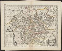
Appears in Jansson's historical atlas editions from 1652-1684., Hand colored., and Relief shown pictorially.
Publisher:
Apud Joannem Janssonium,
Subject (Geographic):
Benelux countries--Historical geography--Maps--Early works to 1800., Benelux countries--Maps--Early works to 1800., Europe, Central--Historical geography--Maps--Early works to 1800., Europe, Central--Maps--Early works to 1800., Europe, Eastern--Historical geography--Maps--Early works to 1800., Europe, Eastern--Maps--Early works to 1800., Germany--Historical geography--Maps--Early works to 1800., and Germany--Maps--Early works to 1800.
Subject (Name):
Jansson, Jan, 1588-1664
Subject (Topic):
Ethnology--Europe--Maps--Early works to 1800. and Germanic peoples--Maps--Early works to 1800.
Astronomy--Study and teaching--Early works to 1800--Facsimiles., Celestial globes--Early works to 1800--Facsimiles., Globes--Early works to 1800--Facsimiles., and Navigation--Study and teaching--Early works to 1800--Facsimiles
Appeared in Valk and Schenk's Atlantis sylloge compendiosa, ca. 1702., Backed with paper. Ms. no. "29" in upper left-hand corner. Sheet measures 53.5 x 62.5 cm. No. 29 of 87 maps bound together., Includes five bar scales., Prime meridian: Ferro., Relief shown pictorially., and Watermark.
Publisher:
Gerard Valk,
Subject (Geographic):
Switzerland--Maps--Early works to 1800.
Subject (Name):
Schenk, Peter, 1660-1718 or 1719. Atlantis sylloge compendiosa. and Valck, G. (Gerard), 1651 or 1652-1726. Atlantis sylloge compendiosa.
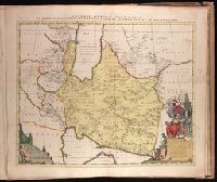
Appeared in Peter Schenk's Atlas contractus., Backed with paper. Ms. no. "90" in upper right-hand corner. Sheet measures 53.6 x 62.7 cm. No. 82 of 87 maps bound together., Bar scale given in "milliaria Germanica.", Prime meridian: Ferro., Relief shown pictorially., Watermark., and With dedication to
Publisher:
Ex formis [Pe]tri Schenk,
Subject (Geographic):
Iran--Maps--Early works to 1800. and Middle East--Maps--Early works to 1800.
Subject (Name):
Schenk, Peter, 1660-1718 or 1719. Atlas contractus. and Witsen, Nicolaas, 1641-1717.
Hase, Johann Matthias, 1684-1742, cartographer. http://id.loc.gov/authorities/names/n85044571
Published / Created:
1739
Call Number:
1973 Folio 30
Collection Title:
[Atlas factice of 32 maps and 1 distance table, produced by the Homann Erben firm]
Image Count:
2
Resource Type:
Maps, Atlases & Globes
Alternative Title:
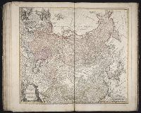
Imperii Russici et Tatariae universae tam majoris et Asiaticae, quam minoris et Europaeae tabula
Description:
Bar scale about 38 German miles to a centimeter., BEIN 1973 Folio 30: No. 30 of 32 maps bound together., In lower left margin: Notati etiam in hac mappa extant limites inter Russiam et Tatariam minorem post pacem recentissime a[nn]o 1739 initam., Includes dedicatory cartouche to Anna, Empress of Russia in upper left corner., Prime meridian: Paris., Relief shown pictorially., Sea of Korea referred to as "Mare Orientale Minus.", and Variant without privilege statement following imprint and engraver statement in lower left corner.
Publisher:
Impensis Homannianorum Heredum
Subject (Geographic):
China--Maps--Early works to 1800., India--Maps--Early works to 1800., Japan--Maps--Early works to 1800., Korea--Maps--Early works to 1800., Russia--Maps--Early works to 1800., and Tibet Autonomous Region (China)--Maps--Early works to 1800.
Subject (Name):
Anna,--Empress of Russia,--1693-1740.--http://id.loc.gov/authorities/names/n50051926, Homann Erben (Firm), publisher. http://id.loc.gov/authorities/names/n80051855, and Schneider, R.A., engraver. http://id.loc.gov/authorities/names/no2012106139
[Atlas factice of 42 maps, produced by the Homann Erben firm]
Image Count:
1
Resource Type:
Maps, Atlases & Globes
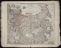
Alternative Title:
Imperii Russici et Tatariae universae tam majoris et Asiaticae, quam minoris et Europaeae tabula
Description:
"Cum privil. S.C.M. nec non R.M. Pol. et E. Sax.", Bar scale about 38 German miles to a centimeter., Decorated title cartouche depicts two hunters with rifles, a bear, and dog., Imperfect: edges frayed, torn along fold, with no loss of text. No. 33 of 42 maps bound together., In lower left margin: Notati etiam in hac mappa extant limites inter Russiam et Tatariam minorem post pacem recentissime a[nn]o 1739 initam., Includes dedicatory cartouche to Anna, Empress of Russia in upper left corner., Prime meridian: Paris., Relief shown pictorially., and Sea of Korea referred to as "Mare Orientale Minus."
Publisher:
Impensis Homannianorum Heredum
Subject (Geographic):
China--Maps--Early works to 1800., India--Maps--Early works to 1800., Japan--Maps--Early works to 1800., Korea--Maps--Early works to 1800., Russia--Maps--Early works to 1800., and Tibet (China)--Maps--Early works to 1800.
Subject (Name):
Anna,--Empress of Russia,--1693-1740., Homann Erben (Firm), and Schneider, R. A., engraver.
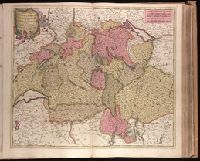
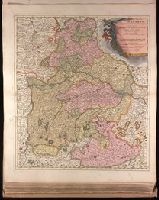
Backed with paper. Ms. no. "27" in upper right-hand corner. Sheet measures 52.7 x 53.7 cm. No. 27 of 87 maps bound together., Bar scales given in "milliaria Germanica" and "mill. Gallica"., Prime meridian: Ferro., and Relief shown pictorially.
Publisher:
Peter Schenk,
Subject (Geographic):
Austria--Maps--Early works to 1800. and Bavaria (Germany)--Maps--Early works to 1800.
"Cum Privilegio Ordin: General: Belgii Foederati.", Backed with paper. Ms. no. "95" in upper right-hand corner. Sheet measures 53.6 x 62.1 cm. No. 85 of 87 maps bound together., Bar scales given in "sesqui milliare Germanicum" and "milliaria Gallica.", Date given by Koeman, v. 5, p. 201, col. 2., and Relief shown pictorially.
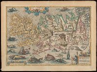
Blank on verso., Cartouche in lower right corner begins: "Islandia insula, iacet sub Polo Arctico ...", From unidentified edition of Ortelius's Theatrum orbis terrarum., Relief indicated pictorially., and Watermark.
Subject (Geographic):
Iceland--Maps--Early works to 1800.
Subject (Name):
Ortelius, Abraham, 1527-1598. Theatrum orbis terrarum