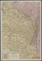
1. Rand McNally war map of the French front : northern section : strategic map of the battle ground in Creator: Rand McNally and Company Published / Created: [1918] Call Number: 11hc 1917C Container / Volume: BRBL_00010D Image Count: 2 Resource Type: Maps, Atlases & Globes Found in: Beinecke Rare Book and Manuscript Library > Rand McNally war map of the French front : northern section : strategic map of the battle ground in northern France from St. Quentin to St. Mihiel, showing the farthest advance of the Germans in 1914 and the battle line in September, 1917.
2. Rand McNally war map of the French front : southern section : strategic map of the battle ground in Creator: Rand McNally and Company Published / Created: [1918?] Call Number: 11hc 1917D Container / Volume: BRBL_00010D Image Count: 2 Resource Type: Maps, Atlases & Globes Found in: Beinecke Rare Book and Manuscript Library > Rand McNally war map of the French front : southern section : strategic map of the battle ground in northern France from St. Mihiel to the Swiss border / compiled from the latest military maps of the army staffs in Washington, London, and Paris, and from
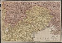
3. Rand McNally war map of the Italian front [cartographic material] : northern section : strategic Creator: Rand McNally and Company Published / Created: [1917?] Call Number: 40hc 1914 Container / Volume: BRBL_00232 Image Count: 4 Resource Type: Maps, Atlases & Globes Found in: Beinecke Rare Book and Manuscript Library > Rand McNally war map of the Italian front [cartographic material] : northern section : strategic map of the battle ground in northern Italy from Swiss border to Adriatic Sea / compiled from the latest military maps of the army staffs in Washington, London