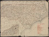
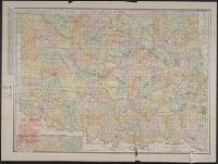
Rand, McNally & Co.'s New 11 x 14 map of North Carolina
Description:
Inset: Western portion of North Carolina)., Prime meridian: Greenwich., Printed in red: "North Carolina Railroads", Relief shown by hachures., and Verso:Index to counties and cities, figures on the extent of land and water areas, and population statistics.
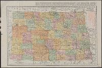
Rand McNally & Co.'s new business atlas map of North Dakota.
Description:
Below scale: Rand McNally & Co.'s new business atlas map of North Dakota. Copyright 1911 ... Copyright 1909 by Rand McNally & Co., Indexed., Relief shown by hachures., and Shows railroads, counties, and drainage.
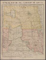
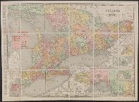
Rand McNally & Co.'s business atlas map of Dakota.
Description:
"Copyright, 1886, by Rand McNally & Co. ....", "Office of the Commissioner of Immigration, Bismarck, Dakota. This map has been corrected to January 1, 1889, F.H. Hagerty, Commissioner.", "Rand McNally & Co.'s business atlas map of Dakota. Copyright 1888 ....", and Relief shown by hachures.
Publisher:
Office of the Commissioner of Immigration?,
Subject (Geographic):
Dakota Territory--Maps
Subject (Name):
Dakota Territory. Dept. of Immigration and Statistics
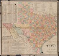
Copyright: Rand, McNally & Co., Includes tables of taxable property and rainfall measures, list of railway lines, and text of state finances., Relief shown by hachures., and Shows counties and railroads.
Publisher:
Rand, McNally & Co.,
Subject (Geographic):
Texas--Administrative and political divisions--Maps and Texas--Maps
Subject (Name):
Spaight, A. W and Texas. Dept. of Agriculture, Insurance, Statistics and History. Resources, soil, and climate of Texas
Rand McNally & Co.'s New Business Atlas Map of Ontario
Description:
"Rand McNally & Co.'s New Business Atlas Map of Ontario. Copyright, 1909, by Rand McNally & Co. Copyright, 1892, by Rand McNally & Co.", "The Municpal Counties are shown in tints.", and Includes insets of varying scales: Western Portion of Ontario, River St. Ma