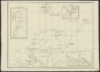
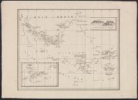
East West Greenland, Scoresby 1822, 1:2,800,000., Insets: Straat of Waaigat 1:100,000., Mauritius of Jan Mayen Eil. 1611, 1:533,000., and Siberia to Cape Chelyuskin.
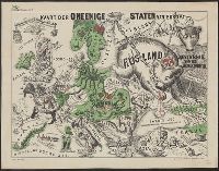
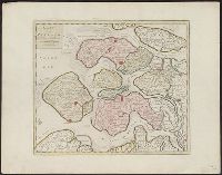
Caricature map., Ill. of people and animals represent international relations., In top margin: Voorwaarts., and Includes text.
Publisher:
W.L. Stoeller,
Subject (Geographic):
Europe--Maps
Subject (Topic):
Franco-Prussian War, 1870-1871--Caricatures and cartoons, Franco-Prussian War, 1870-1871--Maps, and International relations--History--19th century--Maps
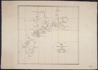
From atlas "Venhandeling over de nederlandsche ontdekkingen in Amerika ... ", R.G. Bennet en J. van Wijk Roelandszoon, Utrecht, J. Altheer, 1827. Cf. Phillips, vol. 1, no. 3252.
Publisher:
J. Altheer,
Subject (Geographic):
Middle Atlantic States--Maps and New England--Maps
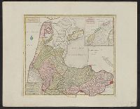
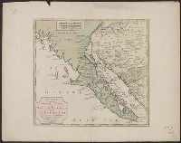
Prime meridian: Amsterdam? and Relief shown pictorially.
Publisher:
[s.n.],
Subject (Geographic):
Baja California (Mexico : Peninsula)--Maps--Early works to 1800, Mexico, North--Maps--Early works to 1800, Sonora (Mexico : State)--Maps--Early works to 1800, and Southwest, New--Maps--Early works to 1800
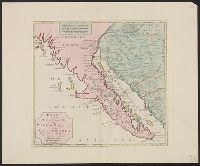