Skip to search
Skip to main content
Skip to first result
Search
You Searched For
Genre
Maps
Resource Type
Maps, Atlases & Globes
Language
Japanese
New Search
Search Results
Creator:
Published / Created:
1945
Call Number:
57 T578 1945A
Container / Volume:
BRBL_00304
Image Count:
1
Resource Type:
Maps, Atlases & Globes
Alternative Title:
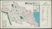
Ōmori-ku shōsaizu, Tōkyō, Ōmori-ku, guide to postal districts [cartographic material] = 大森區詳細圖., and 大森區詳細圖
Description:
"No. 34.", "No. 6234--R & A, OSS.", "Provisional edition.", In English and Japanese; place names in Japanese., and Includes index to ku and index map.
Publisher:
Reproduction Branch, OSS,
Subject (Name):
United States. Office of Strategic Services. Reproduction Branch
Subject (Topic):
Postal service--Japan--Tokyo--Maps
Found in:
Beinecke Rare Book and Manuscript Library > Tōkyō, Ōmori-ku, guide to postal districts = Ōmori-ku shōsaizu.
Published / Created:
1942?]
Call Number:
11hc 1942
Container / Volume:
BRBL_00010I
Image Count:
2
Resource Type:
Maps, Atlases & Globes
Description:
"Supplement to all dailies published by Manila Shinbun-sha"., English, Japanese., Imperfect: Mutilated, with some loss of text., Map on verso: Greater East Asia war and brilliant achievements., and Tables of Allied and Axis statistics on verso.
Subject (Topic):
World War, 1939-1945--Maps
Found in:
Beinecke Rare Book and Manuscript Library > Up-to-date map of the world war.
Published / Created:
1870
Call Number:
57 Y771 1870
Container / Volume:
BRBL_00304
Image Count:
2
Resource Type:
Maps, Atlases & Globes
Subject (Geographic):
Yokohama-shi (Japan)--Maps
Found in:
Beinecke Rare Book and Manuscript Library > Yokohama annai ezu [Illustrated guide to Yokohama, Japan].
Published / Created:
1945?]
Call Number:
289CBF 1945
Container / Volume:
BRBL_00027
Image Count:
3
Resource Type:
Maps, Atlases & Globes
Description:
In Japanese. and Title supplied by cataloger.
Subject (Geographic):
Leyte Island (Philippines)--Maps
Found in:
Beinecke Rare Book and Manuscript Library > [3 maps of Leyte Island, Philippines, in Japanese.]
Published / Created:
1945?]
Call Number:
281CBF 1945A
Container / Volume:
BRBL_00026
Image Count:
4
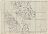
Resource Type:
Maps, Atlases & Globes
Description:
In Japanese. and Title supplied by cataloger.
Subject (Geographic):
Luzon (Philippines)--Maps
Found in:
Beinecke Rare Book and Manuscript Library > [4 maps of Luzon, Philippines, in Japanese.]
Published / Created:
1945?]
Call Number:
26cbf 1945
Container / Volume:
BRBL_00023A
Image Count:
1
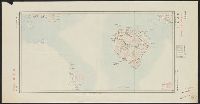
Resource Type:
Maps, Atlases & Globes
Description:
Shows part of Northern Territory and Papua New Guinea.
Subject (Geographic):
Arafura Sea--Maps
Found in:
Beinecke Rare Book and Manuscript Library > [Map of Arafura Sea, in Japanese].
Published / Created:
[1833] and 天保 4 年.
Call Number:
BrSides 2018 136
Image Count:
1
Resource Type:
Maps, Atlases & Globes
Description:
Ikeda Tōritei, editor; Nakamura Yūrakusai, cartographer, Nishihara Jūbei, engraver., Imperfect: torn along fold, with some loss of text. Accompanied by paper envelope with printed title "Map of Kioto at Tenpai period" and manuscript note "Kyoto, 1833.", North oriented towards the left., Relief shown pictorially., Title devised by cataloger., and 池田東籬亭, 考正; 中村有楽斎, 画図; 西原十兵衛, 彫.
Publisher:
Takehara Kōbei,
Subject (Geographic):
Kyōto (Japan)--Maps.
Subject (Topic):
East Asia Library Special Collections.
Found in:
Beinecke Rare Book and Manuscript Library > [Map of Kyoto] [cartographic material].
Published / Created:
1863
Call Number:
57 K99 1834
Container / Volume:
BRBL_00303
Image Count:
1
Resource Type:
Maps, Atlases & Globes
Publisher:
Published by Takebara Kahei (or Yoshibei),
Subject (Geographic):
Kyoto (Japan)--Maps--Early works to 1800
Found in:
Beinecke Rare Book and Manuscript Library > [Map of Kyoto].
Published / Created:
[1863?]
Call Number:
57 K99 1834A
Container / Volume:
BRBL_00303
Image Count:
1
Resource Type:
Maps, Atlases & Globes
Publisher:
Published by Takebara Kahei (or Yoshibei),
Subject (Geographic):
Kyoto (Japan)--Maps--Early works to 1800
Found in:
Beinecke Rare Book and Manuscript Library > [Map of Kyoto].
Published / Created:
1945?]
Call Number:
283CBF M339 1945A
Container / Volume:
BRBL_00026
Image Count:
1
Resource Type:
Maps, Atlases & Globes
Description:
In Japanese. and Title supplied by cataloger.
Subject (Geographic):
Marinduque (Philippines)--Maps
Found in:
Beinecke Rare Book and Manuscript Library > [Map of Marinduque, Philippines, in Japanese.]
Branch:v1.61.6 ,Deployed:2024-06-12T09:55:19-04:00