[Atlas nouveau contenant toutes les parties du monde ou sont exactement marques les empires
Image Count:
1
Resource Type:
Maps, Atlases & Globes
Abstract:
Factitious collection of about 549 maps taken from the atlases of the 17th and the beginning of the 18th century, put together with the title "Atlas" and bound in 6 volumes. These volumes originally bore the imprint: Amstelaedamii apvd Reiniervm & Josvam Ottens. Over these words on the title pages of volumes 1-2 and 4-6 is the name of Henrik de Leth who painted them.
Description:
Verso blank.
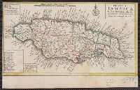
Subject (Geographic):
British Isles --Maps --Early works to 1800
Subject (Name):
Leth, Hendrik de, 1703-1766, Reiner et Josua Ottens (Firm), Schenck, Peter, 1661-1715, Schenck, Peter, ca. 1698-1752, Valck, G. (Gerard), 1651 or 2-1726, and Wit, Frederik de
Subject (Topic):
Atlases --Early works to 1800
Collection Created:
[A Amsterdam, chez J. Covens & C. Mortier, ca. 1730-ca. 1800]
Appears in various eds. of Atlas geographicus maior., Includes German text relating to English and French territorial claims., Neat lines measures 45.8 x 50.8 cm. on sheet 50 x 57.5 cm. Ms. note on verso: No. 151, Nord America nach d'Anville. Franklin Collection no. 131 1756-9., Place names and descriptive notes in English., Prime meridian: Ferro and London., and Relief shown pictorially.
Publisher:
[Homann Erben],
Subject (Geographic):
North America--Maps--Early works to 1800 and United States--History--French and Indian War, 1755-1763--Maps--Early works to 1800
Subject (Name):
Anville, Jean Baptiste Bourguignon d', 1697-1782 and Homann Erben (Firm). Atlas geographicus maior
755 1756E: Mounted on paper. Neat line measures 45.9 x 51 cm. on sheet 46 x 51.2 cm. Ms. no.: 54., Includes German text relating to English and French territorial claims., Prime meridian: Ferro and London., Relief sh, and Sheet measures 49.5 x 57.2 cm.
Publisher:
[Homann Erben],
Subject (Geographic):
North America--Maps--Early works to 1800 and United States--History--French and Indian War, 1755-1763--Maps--Early works to 1800
Subject (Name):
Anville, Jean Baptiste Bourguignon d', 1697-1782 and Homann Erben (Firm). Atlas geographicus maior
Appears in various eds. of Atlas geographicus maior., Includes German text relating to English and French territorial claims., Mounted on paper. Neat line measures 45.9 x 51 cm. on sheet 46 x 51.2 cm. Ms. no.: 54., and Place names and descriptive notes in Englis
Publisher:
[Homann Erben],
Subject (Geographic):
North America--Maps--Early works to 1800 and United States--History--French and Indian War, 1755-1763--Maps--Early works to 1800
Subject (Name):
Anville, Jean Baptiste Bourguignon d', 1697-1782 and Homann Erben (Firm). Atlas geographicus maior
Appears in various eds. of Atlas geographicus maior., Includes German text relating to English and French territorial claims., Place names and descriptive notes in English., Prime meridian: Ferro and London., Relief shown pictorially., and Sheet measures 47.1 x 52 cm. Ms. no. on verso: No. 5. Cross Collection no. 194.
Publisher:
[Homann Erben],
Subject (Geographic):
North America--Maps--Early works to 1800 and United States--History--French and Indian War, 1755-1763--Maps--Early works to 1800
Subject (Name):
Anville, Jean Baptiste Bourguignon d', 1697-1782 and Homann Erben (Firm). Atlas geographicus maior
Appears in various eds. of Atlas geographicus maior., Includes German text relating to English and French territorial claims., Place names and descriptive notes in English., Prime meridian: Ferro and London., Relief shown pictorially., and Sheet measures 49.5 x 61.7 cm. Title in ms. on verso. Franklin Collection no. 131 1777-1.
Publisher:
[s.n.],
Subject (Geographic):
North America--Maps--Early works to 1800 and United States--History--French and Indian War, 1755-1763--Maps--Early works to 1800
Subject (Name):
Anville, Jean Baptiste Bourguignon d', 1697-1782 and Homann Erben (Firm). Atlas geographicus maior
United States. Office of Strategic Services. Research and Analysis Branch
Published / Created:
1944
Call Number:
42gmb 1944
Container / Volume:
BRBL_00245
Image Count:
1
Resource Type:
Maps, Atlases & Globes
Description:
Indicates left- and right- hand driving zones and snow clearing., Map in German; legend and overlays in English., and Relief indicated by spot heights.
Publisher:
Lithographed in the Reproduction Branch, OSS,
Subject (Geographic):
Austria--Maps
Subject (Name):
United States. Office of Strategic Services. Reproduction Branch
Subject (Topic):
Roads--Austria--Maps and Snow removal--Austria--Maps
Appears on sheet Die Englische Colonie-Laender ... [Nürnberg] : Homaennische Erben, [ca. 1740], with, Cross Collection no. 282., Relief shown pictorially., and Title in Latin, explanations in German, and map locations in English.