Skip to search
Skip to main content
Skip to first result
Search
You Searched For
Format
cartographic
Publication Place
[Washington] :
New Search
Search Results
Creator:
Published / Created:
[1881]
Call Number:
851 1881
Container / Volume:
BRBL_00639
Image Count:
1
Resource Type:
Maps, Atlases & Globes
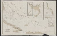
Description:
Imperfect. Chipped with possible loss of text., Includes references and 5 insets., and Relief shown by hachures and spot heights. Depths shown by soundings.
Publisher:
U.S. Coast and Geodetic Survey,
Subject (Geographic):
Bahamas--Discovery and exploration--Maps and Bahamas--Maps
Subject (Name):
Columbus, Christopher--Travel--Caribbean Area--Maps
Found in:
Beinecke Rare Book and Manuscript Library > Chart of part of the Bahama Islands showing the tracks ascribed to Columbus on his discovery of the New World / compiled and drawn, under the direction of W.T. Bright, in charge of Drawing Division, U.S. Coast and Geodetic Survey Office ; by T.J. O'Sulliv
Creator:
Published / Created:
1945
Call Number:
56 Sh43 1945
Container / Volume:
BRBL_00297
Image Count:
1
Resource Type:
Maps, Atlases & Globes
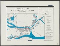
Description:
"No. 5944--R & A, OSS." and Includes location map.
Publisher:
Reproduction Branch, OSS,
Subject (Geographic):
Shih-lung (Kwangtung Province, China)--Maps
Subject (Name):
United States. Office of Strategic Services. Reproduction Branch
Found in:
Beinecke Rare Book and Manuscript Library > China, south coast [cartographic material] : city of Shih-lung (Sheklung).
Creator:
Published / Created:
1950
Call Number:
509 1942
Container / Volume:
BRBL_00277
Image Count:
1
Resource Type:
Maps, Atlases & Globes
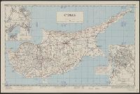
Alternative Title:
AMS K512, AMS series (United States. Army Map Service.) ; K512., GSGS (Great Britain. War Office. General Staff. Geographical Section.) ; 3974., and GSGS 3974
Description:
"Gradient tints and isogonic data deleted by AMS, 1949.", Insets: Nicosia; Ktima & Pahos; Famagusta & Varosha; Limassol; Kyrenia; Larnaca., Military grid., Relief shown by contours and spot heights., and Third GSGS ed., 1942.
Publisher:
U.S. Army Map Service,
Subject (Geographic):
Cyprus--Maps
Found in:
Beinecke Rare Book and Manuscript Library > Cyprus [cartographic material] / compiled by land Registration and Surveys, Cyprus.
Creator:
Published / Created:
[1941]
Call Number:
354eb 1941
Container / Volume:
BRBL_00113
Image Count:
1
Resource Type:
Maps, Atlases & Globes
Description:
"No. 32.", Includes lengend and inset showing relative size of cities., and Transfer line print.
Publisher:
C.O.I.,
Subject (Geographic):
Caucasus--Maps
Subject (Topic):
Population density--Caucasus--Maps
Found in:
Beinecke Rare Book and Manuscript Library > Density of population (rural) / Geographic Div. - C.O.I.
Creator:
Published / Created:
1866
Call Number:
815fcm 1866
Container / Volume:
BRBL_00561
Image Count:
1
Resource Type:
Maps, Atlases & Globes
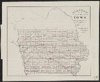
Description:
"No. 7." and Also shows railroads, and coal, iron, and lead regions.
Publisher:
U.S. General Land Office,
Subject (Geographic):
Iowa--Maps
Subject (Topic):
Mines and mineral resources--Iowa--Maps and Railroads--Iowa--Maps
Found in:
Beinecke Rare Book and Manuscript Library > Diagram of the public surveys in Iowa.
Creator:
Published / Created:
[1945]
Call Number:
62f 1945
Container / Volume:
BRBL_00333
Image Count:
1
Resource Type:
Maps, Atlases & Globes
Description:
"No. 8320 - R & A, IRIS, 31 December 1945."
Publisher:
Reproduction Branch, SSU,
Subject (Geographic):
Africa, East--Maps
Found in:
Beinecke Rare Book and Manuscript Library > Eritrea, Ethiopia, and Somaliland / R & A, IRIS.
Published / Created:
1919
Call Number:
30ed 1919A
Container / Volume:
BRBL_00037B
Image Count:
1
Resource Type:
Maps, Atlases & Globes
Publisher:
G-2-C 1x Army Corps,
Subject (Geographic):
Europe--Maps
Found in:
Beinecke Rare Book and Manuscript Library > Ethnographic Map of Europe.
Published / Created:
1919
Call Number:
30 1919A
Container / Volume:
BRBL_00032A
Image Count:
4
Resource Type:
Maps, Atlases & Globes
Publisher:
Printed at base Printing Plant, 29th engineers, U.S. Army,
Subject (Geographic):
Europe--Maps
Found in:
Beinecke Rare Book and Manuscript Library > Europe.
Published / Created:
1919
Call Number:
30 1919A
Container / Volume:
BRBL_00032A
Image Count:
4
Resource Type:
Maps, Atlases & Globes
Publisher:
Printed at base Printing Plant, 29th engineers, U.S. Army,
Subject (Geographic):
Europe--Maps
Found in:
Beinecke Rare Book and Manuscript Library > Europe.
Published / Created:
1882
Call Number:
771 F53 1882
Container / Volume:
BRBL_00482A
Image Count:
1
Resource Type:
Maps, Atlases & Globes
Description:
Reproduction of original topographial sheet.
Publisher:
USC & GS,
Subject (Geographic):
Fishers Island (N.Y. : Island)--Maps
Found in:
Beinecke Rare Book and Manuscript Library > Fisher's Island, New York / Surveyed by E. Hergesheimer, JE Hilgard, Supt.
Branch:v1.61.8 ,Deployed:2024-06-20T11:14:48-04:00