Neptune françois, ou, Atlas nouveau des cartes marines.
Description:
Appears in: Le Neptune françois, ou, Atlas nouveau des cartes marines, various eds., Covers coasts of Virginia, Maryland, Delaware, New, Described in Coolie Verner's Printed maps of Virginia, 1590-1800, p. 402., Nautical chart., and Oriented with north to right.
Publisher:
Chez P. Mortier,
Subject (Geographic):
Middle Atlantic States--Maps--Early works to 1800
Subject (Name):
Mortier, Pierre
Subject (Topic):
Coasts, Coasts--Delaware--Maps--Early works to 1800, Coasts--Maryland--Maps--Early works to 1800, Coasts--New Jersey--Maps--Early works to 1800, and Nautical charts--Chesapeake Bay (Md. and Va.)--Early works to 1800
Copy 2 shows new boundary line following the banks of crossing to the east branch of the Cooper River. Several coastal islands and Indian settlements are colore differently from the mainland; these vary in some cases from the jurisdiction as indicated in
Colored map of the coast from just south of the Santee River to just south of the So. Edistow R. Shows many names of early settlers along rivers and near Charleston. Given as No. 105 in Vol.7, Ottens, R., Atlas maior, 1641-1729, by Phillips, Neptune Franc
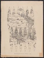
In top margin of sheet 1: Le tout pour l'intelligence des dissertations suivantes., Includes portraits of explorers, illustrations of indigenous peoples, wildlife, flora, historical notes, and ecclesiastical plot ownerships in Havana and Veracruz., and Shows sa
Publisher:
s.n.,
Subject (Geographic):
North America--Maps--Early works to 1800, Pacific Ocean--Maps--Early works to 1800, and South America--Maps--Early works to 1800
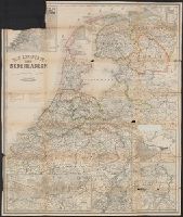
Inset: [1.] Hoogtekaart, tevens aanwijzende de veranderingen van land en water sedert het einde der 13de eeuw (17 x 19 cm); [2.] Omstreken van Arnhem (scale 1:100 000; 13 x 32 cm); [3.] De spoorweg- en havenwerken te Amsterdam (scale 1:40 000; 2 x 16,5 cm