Skip to search
Skip to main content
Skip to first result
Search
You Searched For
Genre
Maps
Language
German
New Search
Search Results
Published / Created:
1880?]
Call Number:
3627 B14 1880
Image Count:
2
Resource Type:
Maps, Atlases & Globes
Description:
Dissected and mounted on linen. and Panel title.
Publisher:
s.n. ,
Subject (Geographic):
Bavaria (Germany)--Maps
Found in:
Beinecke Rare Book and Manuscript Library > Baierbrunn.
Creator:
Published / Created:
1891
Call Number:
44 1891A
Container / Volume:
BRBL_00255
Image Count:
1
Resource Type:
Maps, Atlases & Globes
Description:
"Stieler's Hand-Atlas, No. 50."
Publisher:
Justus Perthes,
Subject (Geographic):
Balkan Peninsula--Maps
Subject (Name):
Justus Perthes (Firm : Gotha, Germany)
Found in:
Beinecke Rare Book and Manuscript Library > Balkan-Halbinsel / Entworfen v. C. Vogel ; bearbeitet von Dr. R. Lüddecke.
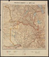
Published / Created:
1886
Call Number:
44 1886
Container / Volume:
BRBL_00255
Image Count:
2
Resource Type:
Maps, Atlases & Globes
Alternative Title:
Konstantinopel und das Marmarameer, Völkerkarte der Balkanhalbinsel, and Vorderasien und Persian
Description:
"Sept. 1886." and Possibly from Richard Andree's allgemeiner Handatlas.
Publisher:
s.n.],
Subject (Geographic):
Balkan Peninsula--Maps
Found in:
Beinecke Rare Book and Manuscript Library > Balkanhalbinsel.
Creator:
Published / Created:
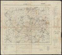
1940
Call Number:
11hd 1942D-54
Container / Volume:
BRBL_00010ZE
Image Count:
1
Resource Type:
Maps, Atlases & Globes
Alternative Title:
Frankreich and St. Amand
Description:
"Stand 29.3.1940, teilweise 7.4.1940." and Includes legend, list of abbreviations, chart of connecting sheets, and map showing political boundaires.
Publisher:
German General Staff,
Subject (Geographic):
France--Maps
Found in:
Beinecke Rare Book and Manuscript Library > Befestigungskarte Frankreich 1:25000 : St. Amand, Nr. 1-2, XXVI-5/1-2.
Creator:
Published / Created:
1940
Call Number:
11hd 1942D-54
Container / Volume:
BRBL_00010ZE
Image Count:
1
Resource Type:
Maps, Atlases & Globes
Alternative Title:
Frankreich and St. Amand
Description:
"Stand 29.3.1940, teilweise 7.4.1940." and Includes legend, list of abbreviations, chart of connecting sheets, and map showing political boundaires.
Publisher:
German General Staff,
Subject (Geographic):
France--Maps
Found in:
Beinecke Rare Book and Manuscript Library > Befestigungskarte Frankreich 1:25000 : St. Amand, Nr. 1-2, XXVI-5/1-2.
Published / Created:
1806
Call Number:
11 1806A
Container / Volume:
BRBL_00007
Image Count:
1
Resource Type:
Maps, Atlases & Globes
Description:
Preliminary record.
Publisher:
im Verlag des Kunst u. Industrie Comptoirs,
Subject (Geographic):
World--maps
Found in:
Beinecke Rare Book and Manuscript Library > Beide Halbkugeln der Erde ... von Joseph Wüstinger.
Published / Created:
1918-1919.
Call Number:
65 1918
Container / Volume:
BRBL_00341
Image Count:
3
Resource Type:
Maps, Atlases & Globes
Alternative Title:
Germany. Reichskolonialamt. Mittelafrika in Karten 1:2 000 000.
Description:
Blatt I -- Blatt II -- Blatt III -- Blatt IV.
Publisher:
Dietrich Reimer (Ernst Vohsen),
Subject (Geographic):
Angola--Maps and Congo (Democratic Republic)--Maps
Subject (Name):
Dietrich Reimer Verlag (Berlin, Germany)
Found in:
Beinecke Rare Book and Manuscript Library > Belgisch-Kongo und Angola [cartographic material] : in 4 Blatt.
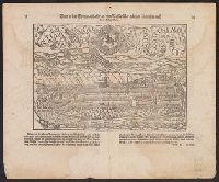
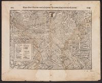
Published / Created:
1549
Call Number:
37 B45 1549
Container / Volume:
BRBL_00150
Image Count:
2
Resource Type:
Maps, Atlases & Globes
Description:
Notes: Above map from another edition is reproduced in Sebastian Münster's Cosmographei, Basel, 1550.
Publisher:
[Sebastian Münster,]
Subject (Geographic):
Bern (Switzerland)--Maps--Early works to 1800
Found in:
Beinecke Rare Book and Manuscript Library > Bern [Switzerland] in der Eydtgenoschafft an dem Wasser Aar gelegen/ figuriert nach ihrer Gelegenheit.
Creator:
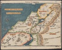
Published / Created:
1582?]
Call Number:
51 1582
Container / Volume:
BRBL_00277
Image Count:
2
Resource Type:
Maps, Atlases & Globes
Description:
Appears in Bünting's Itinerarium Sacrae Scripturae., In top margin corners: 26 -- 27., Relief shown pictorially., Signature mark on verso: G., and Text on verso.
Publisher:
J. Lucius,
Subject (Geographic):
Palestine--Maps--Early works to 1800
Subject (Name):
Bünting, Heinrich, 1545-1606. Itinerarium Sacrae Scripturae
Found in:
Beinecke Rare Book and Manuscript Library > Beschreibung des Heiligen Landes.
Published / Created:
1549
Call Number:
37 B29 1549
Container / Volume:
BRBL_00150
Image Count:
2
Resource Type:
Maps, Atlases & Globes
Description:
Notes: The above map from another edition is reproduced in Sebastian Münster's [facsimile edition] Cosmographei, Basel, 1550.
Publisher:
[Sebastian Münster,]
Subject (Geographic):
Basel (Switzerland)--Maps--Early works to 1800
Found in:
Beinecke Rare Book and Manuscript Library > Beyde Stett Basel mit dem fürsl. fliessenden Rhein und allen fürnemmen Gebewen.
Branch:v1.61.8 ,Deployed:2024-06-20T11:15:15-04:00