Skip to search
Skip to main content
Skip to first result
Search
You Searched For
Genre
Maps
Language
German
New Search
Search Results
Creator:
Published / Created:
[1980]
Call Number:
836 B51 1980
Container / Volume:
BRBL_00592
Image Count:
2
Resource Type:
Maps, Atlases & Globes
Alternative Title:
Bryce Canyon offizieller Führer mit Karte
Description:
"*GPO: 1980--311-309/28.", Includes text and ancillary map of "Bryce Amphitheater trailheads.", Panel title: Bryce Canyon., Relief shown by shading and spot heights., and Text, cross section, and col. ill. on verso.
Publisher:
The Service,
Subject (Geographic):
Bryce Canyon National Park (Utah)--Maps
Found in:
Beinecke Rare Book and Manuscript Library > Bryce Canyon National Park, Utah / National Park Service, U.S. Department of the Interior.
Published / Created:
1944
Call Number:
47 1944B
Container / Volume:
BRBL_00261
Image Count:
1
Resource Type:
Maps, Atlases & Globes
Description:
"Lage im Blattschnitt der Weltkarte 1:1,000,000". and "VI.44. (D 80)".
Publisher:
Publikationsstelle Wien,
Subject (Geographic):
Balkan Peninsula--Maps and Europe, Eastern--Maps
Found in:
Beinecke Rare Book and Manuscript Library > Bulgarien mit Albanien und Europ. Türkei.
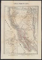
Creator:
Published / Created:
1849
Call Number:
844 1849E
Container / Volume:
BRBL_00601
Image Count:
2
Resource Type:
Maps, Atlases & Globes
Alternative Title:
Dr. C. Hartmann's generalkarte von Californien and Generalkarte von Californien
Description:
Includes inset of "[North and South] America." and Relief shown by hachures and spot heights.
Publisher:
B.F. Voigt,
Subject (Geographic):
California--Maps
Subject (Name):
Voigt, Bernard Friedrich, 1787-1859
Found in:
Beinecke Rare Book and Manuscript Library > Californien.
Creator:
Published / Created:
1941
Call Number:
329 C17 1941
Container / Volume:
BRBL_00074
Image Count:
3
Resource Type:
Maps, Atlases & Globes
Alternative Title:
England 1:10 000 ; GB 7, BB 32a, 32b, 32c and Stadtplan von Cardiff mit Mil.-Geo.-Eintragungen
Description:
"Militärgeogr. Angaben nach den bis zum 30. XI. 1941 vorhandenen Unterlagen.", Relief shown by hachures and spot heights., and Shows features of military interest.
Publisher:
Generalstab des Heeres, Abteilung für Kriegskarten- u. Vermessungswesen (II),
Subject (Geographic):
Cardiff (Wales)--Maps
Found in:
Beinecke Rare Book and Manuscript Library > Cardiff.
Published / Created:
[1903?]
Call Number:
615 1903
Container / Volume:
BRBL_00332
Image Count:
1
Resource Type:
Maps, Atlases & Globes
Alternative Title:
Die Nil-Länder and Nil-Länder
Description:
"IX.03.", In German., and Inset maps: [1.] Massaua. Verhältniss 1:80 000 -- [2.] Massaua und Umgegend. Verhältniss 1:1 000 000.
Publisher:
Carl Fleming, Verlag, Buch- und Kunstdruckerei, A.G.,
Subject (Geographic):
Africa, Northeast--Maps
Found in:
Beinecke Rare Book and Manuscript Library > Carl Flemings Generalkarten. No. 47. Die Nil-Länder / bearbeitet und ergänzt im kartographischen Institut der Verlagsbuchhandlung.
Published / Created:
1838
Call Number:
40 1838A
Container / Volume:
BRBL_00200
Image Count:
1
Resource Type:
Maps, Atlases & Globes
Description:
40 1838A: Stamp: Fürstlich Oettingen-Wallerstein'sche Bibliothek in Seyfriedsberg., In Italian and German. Legend in Italian, German and French., Includes tables, text, and Shows detailed postal route information between Marseille, Augsburg, Warsaw, and Naples.
Publisher:
Poste nelle Prove. Venete,
Subject (Geographic):
France, Germany, and Italy--Maps
Subject (Name):
Botte, Antonio Federico and Fürstlich Oettingen-Wallerstein'sche Bibliothek in Seyfriedsberg Stamp
Subject (Topic):
Post roads--France--Maps, Post roads--Germany--Maps, Post roads--Italy--Maps, Postal service--France--Maps, Postal service--Germany--Maps, and Postal service--Italy--Maps
Found in:
Beinecke Rare Book and Manuscript Library > Carta postale ed itineraria dell'Italia / dedicata al Nobe. Sigr. Cavaliere Massinilia no Otto de Ottenfeld I.R. Effettivo Consigliere Aulico ; da A.F. Botte I.R. Consigle. e Diretteure delle Poste nelle Prove. Venete, compilatore ed Editore ; prem. lit.
Creator:
Published / Created:
[1880]
Call Number:
38CBF 1880
Container / Volume:
BRBL_00168
Image Count:
1
Resource Type:
Maps, Atlases & Globes
Description:
Inset: Corse. and Relief shown by contours, shading, and gradient tints.
Publisher:
Verlag der Dalp'schen Buchhandlung,
Subject (Geographic):
Corsica (France)--Maps and France--Maps
Subject (Name):
Wurster, Randegger & Cie
Found in:
Beinecke Rare Book and Manuscript Library > Carte physique et géographique de la France [cartographic material] / par R. Leuzinger ; étab., top., & lith. de Wurster, Randegger & co.
Published / Created:
1835
Call Number:
427 K66 1835
Container / Volume:
BRBL_00246
Image Count:
1
Resource Type:
Maps, Atlases & Globes
Subject (Geographic):
Carinthia (Austria)--Maps and Klagenfurt--Maps
Found in:
Beinecke Rare Book and Manuscript Library > Carte vom Kreise Klagenfurth im Herzogthume Kaernthen ... / in Stein gravirt von Friedrich Rivier.
Published / Created:
[1885?]
Call Number:
65 1885
Container / Volume:
BRBL_00341
Image Count:
1
Resource Type:
Maps, Atlases & Globes
Publisher:
A. Hartleben's Verlag,
Subject (Geographic):
Africa, Central--Maps
Subject (Name):
Chavanne, Josef, 1846-1902
Found in:
Beinecke Rare Book and Manuscript Library > Central-Afrika, nach den neuesten Forschungen bearbeitet von Dr. Joseph Chavanne [cartographic material].
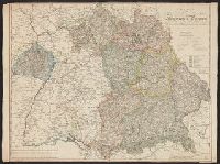
Published / Created:
1827
Call Number:
3627 1827
Image Count:
1
Resource Type:
Maps, Atlases & Globes
Description:
Preliminary record.
Publisher:
Gestochen von M. Hussendorfer,
Subject (Geographic):
Bavaria (Germany)--Maps
Found in:
Beinecke Rare Book and Manuscript Library > Charte Vom Konigreich Bayern. Von Christoph Fembo Nürnberg 1827.
Branch:v1.61.8 ,Deployed:2024-06-20T11:15:15-04:00