Skip to search
Skip to main content
Skip to first result
Search
You Searched For
Extent of Digitization
Partially digitized
Genre
Illustrations
Resource Type
Maps, Atlases & Globes
New Search
Search Results
Call Number:
1973 +32
Collection Title:
La galerie agreable du monde, où l'on voit en un grand nombre de cartes tres-exactes et de belles
Image Count:
1
Resource Type:
Maps, Atlases & Globes
Alternative Title:
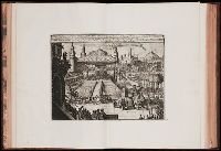
Combat des hommes avec des lions devant le Grand Mogol, pl. 30b, Lachete des officiers de guerre punie par le Grand Mogol, pl. 30b., and Magnifique parure des elephans lors qu'on les presente au Grande Mogol, pl. 30b
Subject (Topic):
Atlases--Early works to 1800 and Geography--Pictorial works
Collection Created:
Le tout mis en ordre & executé à Leide, par Pierre vander Aa [1729?]
Found in:
Beinecke Rare Book and Manuscript Library > Chatiment des gens de la cour disgraciez de
Call Number:
1977 +392
Collection Title:
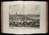
A survey of the cities of London and Westminster : containing the original, antiquity, increase
Image Count:
1
Resource Type:
Maps, Atlases & Globes
Description:
Plate between p. 26-27.
Subject (Geographic):
London (England)--History
Collection Created:
London : Printed for A. Churchill, J. Knapton, R. Knaplock, J. Walthoe [and 6 others], 1720
Found in:
Beinecke Rare Book and Manuscript Library > Cheape Ward with its division into parishes, taken from the last survey, with corrections and additions
Creator:
Published / Created:
1572]-1618
Call Number:
1975 Folio 41
Image Count:
1
Resource Type:
Maps, Atlases & Globes
Alternative Title:
Civitates orbis terrarum ...
Publisher:
[Coloniae Agrippinae,
Subject (Geographic):
Rome--Antiquities--Early works to 1800 and Rome--Antiquities--Maps
Subject (Topic):
Cities and towns, Medieval and Maps, Pictorial -- (LC)
Found in:
Beinecke Rare Book and Manuscript Library > Civitates orbis terrarvm ...
Call Number:
1977 +392
Collection Title:
A survey of the cities of London and Westminster : containing the original, antiquity, increase
Image Count:
1
Resource Type:
Maps, Atlases & Globes
Description:
Plate between p. 52-53.
Subject (Geographic):
London (England)--History
Collection Created:
London : Printed for A. Churchill, J. Knapton, R. Knaplock, J. Walthoe [and 6 others], 1720
Found in:
Beinecke Rare Book and Manuscript Library > Coleman Street Ward and Bashishaw Ward taken from the last survey, with corrections and additions
Call Number:
1977 +392
Collection Title:
A survey of the cities of London and Westminster : containing the original, antiquity, increase
Image Count:
1
Resource Type:
Maps, Atlases & Globes
Description:
Plate between p. 108-109.
Subject (Geographic):
London (England)--History
Collection Created:
London : Printed for A. Churchill, J. Knapton, R. Knaplock, J. Walthoe [and 6 others], 1720
Found in:
Beinecke Rare Book and Manuscript Library > Cornhill Ward with its division into parishes, taken from the last survey &c
Call Number:
1973 +32
Collection Title:
La galerie agreable du monde, où l'on voit en un grand nombre de cartes tres-exactes et de belles
Image Count:
1
Resource Type:
Maps, Atlases & Globes
Subject (Topic):
Atlases--Early works to 1800 and Geography--Pictorial works
Collection Created:
Le tout mis en ordre & executé à Leide, par Pierre vander Aa [1729?]
Found in:
Beinecke Rare Book and Manuscript Library > Cour et Pompe Royale du Grand Mogol, pl. 29
Call Number:
1977 +392
Collection Title:
A survey of the cities of London and Westminster : containing the original, antiquity, increase
Image Count:
1
Resource Type:
Maps, Atlases & Globes
Description:
Plate between p. 60-61.
Subject (Geographic):
London (England)--History
Collection Created:
London : Printed for A. Churchill, J. Knapton, R. Knaplock, J. Walthoe [and 6 others], 1720
Found in:
Beinecke Rare Book and Manuscript Library > Cow Cross being St. Sepulcher's parish without and the Charter House taken from the last survey with corrections
Creator:
Call Number:
1973 Folio 103
Collection Title:
De Nieuwe groote lichtende zee-fakkel ...
Image Count:
1
Resource Type:
Maps, Atlases & Globes
Subject (Topic):
Atlases., Islands, and Nautical charts.
Collection Created:
tAmsterdam, Johannes van Keulen, 1753-81
Found in:
Beinecke Rare Book and Manuscript Library > De Oostin-dische zee / Het Eyland Mayota
Published / Created:
[1729?]
Call Number:
1973 +32
Collection Title:
La galerie agreable du monde, où l'on voit en un grand nombre de cartes tres-exactes et de belles
Image Count:
1
Resource Type:
Maps, Atlases & Globes
Alternative Title:
Benin, ville de la Guinee, en Afrique
Description:
Tab mounted.
Subject (Geographic):
Africa--Pictorial works--Early works to 1800 and Benin (Kingdom) --Pictorial works--Early works to 1800
Subject (Name):
Elmina Castle (Elmina, Ghana)
Subject (Topic):
Atlases--Early works to 1800 and Geography--Pictorial works
Collection Created:
Le tout mis en ordre & executé à Leide, par Pierre vander Aa [1729?]
Found in:
Beinecke Rare Book and Manuscript Library > De Stadt Benin
Creator:
Call Number:
1973 Folio 103
Collection Title:
De Nieuwe groote lichtende zee-fakkel ...
Image Count:
1
Resource Type:
Maps, Atlases & Globes
Subject (Geographic):
Madagascar
Subject (Topic):
Atlases., Islands, and Nautical charts.
Collection Created:
tAmsterdam, Johannes van Keulen, 1753-81
Found in:
Beinecke Rare Book and Manuscript Library > Des rivier legt op de Hoogte von 18 Graaden Zuyder Breedte aan het Land van de Megosie ter Kuste van Quama / Noord kust van't eyland ...
Branch:v1.61.6 ,Deployed:2024-06-12T09:55:19-04:00