Search
You Searched For
Search Results
- Creator:
- Great Britain. War Office. General Staff. Geographical Section
- Published / Created:
- 1928
- Call Number:
- 615 1928
- Container / Volume:
- BRBL_00332
- Image Count:
- 1
- Resource Type:
- Maps, Atlases & Globes
- Alternative Title:
- Geographical Section General Staff ; 2692 and GSGS (Series) ; 2692.
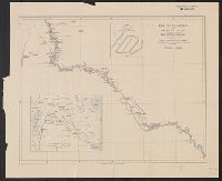
- Description:
- Relief shown by shading. and Shows: international and administrative boundaries, railways, roads, marsh.
- Publisher:
- G.S.G.S.,
- Subject (Geographic):
- Sudan--Maps
- Found in:
- Beinecke Rare Book and Manuscript Library > The Anglo-Egyptian Sudan [cartographic material].
- Published / Created:
- 1916
- Call Number:
- 44 1916
- Container / Volume:
- BRBL_00256
- Image Count:
- 1
- Resource Type:
- Maps, Atlases & Globes
- Description:
- "Supplement to the National Review, October 1916."
- Publisher:
- George Philip & Son, Ltd.,
- Subject (Geographic):
- Balkan Peninsula--Maps
- Found in:
- Beinecke Rare Book and Manuscript Library > The Balkan States and part of Austria-Hungary.
- Published / Created:
- [1756?]
- Call Number:
- 755 1756C
- Container / Volume:
- BRBL_00428
- Image Count:
- 1
- Resource Type:
- Maps, Atlases & Globes
- Publisher:
- Printed for T. Bowles ... & Iohn Bowles & Son ... ,
- Subject (Geographic):
- North America--Maps--Early works to 1800 and United States--History--French and Indian War, 1755-1763--Maps--Early works to 1800
- Subject (Topic):
- British--North America--Maps--Early works to 1800 and French--North America--Maps--Early works to 1800
- Found in:
- Beinecke Rare Book and Manuscript Library > The British & French dominions in North America : particularly shewing the French encroachments through all the British plantations from Nova Scotia down to the Gulf of Mexico.
- Published / Created:
- 1790
- Call Number:
- 33 1790
- Container / Volume:
- BRBL_00077
- Image Count:
- 1
- Resource Type:
- Maps, Atlases & Globes
- Publisher:
- T. Stackhouse,
- Subject (Geographic):
- Netherlands--Maps--Early works to 1800
- Found in:
- Beinecke Rare Book and Manuscript Library > The Catholic Netherlands with the seven united provinces / engraved by S.J. Neele.
- Published / Created:
- 1910
- Call Number:
- 533ex 1910
- Container / Volume:
- BRBL_00288
- Image Count:
- 1
- Resource Type:
- Maps, Atlases & Globes
- Description:
- "The geographical journal, 1910.", Includes inset location map and inset "Plan of the mounds of Munbaya.", and Relief shown by hachures.
- Publisher:
- Royal Geographical Society,
- Subject (Geographic):
- Euphrates River Valley--Discovery and exploration--Maps
- Subject (Name):
- Bell, Gertrude Lowthian,--1868-1926--Travel--Maps and Royal Geographical Society (Great Britain)
- Found in:
- Beinecke Rare Book and Manuscript Library > The Euphrates from Jerablus to Hit [cartographic material] : showing the route of Miss Gertrude Lowthian Bell along the eastern bank.
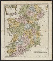
- Creator:
- A. and J. Churchill (Booksellers : London, England)
Morden, Robert, d. 1703
Swall, Abel
- Published / Created:
- [1680?]
- Call Number:
- 327 1680
- Container / Volume:
- BRBL_00072
- Image Count:
- 1
- Resource Type:
- Maps, Atlases & Globes
- Publisher:
- Sold by Abel Swale Awnsham and John Churchill,
- Subject (Geographic):
- Ireland--Maps--Early works to 1800
- Found in:
- Beinecke Rare Book and Manuscript Library > The Kingdom of Ireland / by Robt. Morden.
- Published / Created:
- 1787
- Call Number:
- 39 1787
- Container / Volume:
- BRBL_00185
- Image Count:
- 1
- Resource Type:
- Maps, Atlases & Globes
- Publisher:
- Robert Sayer,
- Subject (Geographic):
- Spain--Maps--Early works to 1800
- Found in:
- Beinecke Rare Book and Manuscript Library > The Kingdoms of Spain and Portugal ...
- Published / Created:
- 1792
- Call Number:
- 59 1792
- Container / Volume:
- BRBL_00316
- Image Count:
- 1
- Resource Type:
- Maps, Atlases & Globes
- Publisher:
- J. Rennell,
- Subject (Geographic):
- India--Maps--Early works to 1800
- Found in:
- Beinecke Rare Book and Manuscript Library > The Marches of the British Armies, ... during the Campaigns of 1790, and 1791 ...
- Published / Created:
- 1707
- Call Number:
- 388hc 1707
- Image Count:
- 1
- Resource Type:
- Maps, Atlases & Globes
- Publisher:
- John Cailloüe,
- Subject (Geographic):
- Languedoc (France)--Maps--Early works to 1800
- Found in:
- Beinecke Rare Book and Manuscript Library > The Theater of the Warr in the Sevennes ... Mr. de Basville intendant of Languedoc ...
- Published / Created:
- 1737
- Call Number:
- 32 1737
- Container / Volume:
- BRBL_00043
- Image Count:
- 1
- Resource Type:
- Maps, Atlases & Globes
- Description:
- Index to names on map and table arms.
- Publisher:
- Jn. Bowles,
- Subject (Geographic):
- England--Maps--Early works to 1800
- Found in:
- Beinecke Rare Book and Manuscript Library > The Travellers Guide through England and Wales ...