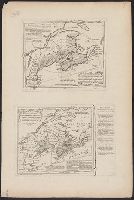
"E.L.B. & R.N.C. 1878 no. 2.", Includes inset map of Magadascar., Issued to accompany: A sketch of the modern languages of the East Indies / by Robert Needham Cust. 1878., and Relief shown by hachures and spot heights.
Publisher:
Stanford's Geogl. Estabt.,
Subject (Geographic):
Southeast Asia--Languages--Maps.
Subject (Name):
Cust, Robert Needham, 1821-1909. Sketch of the modern languages of the East Indies.
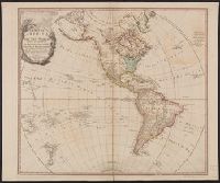
Carte D'une partie de l'Amerique Septentrionale ... prétentions des Anglois au fujét des Limites a' regler avec la France dans cette Partie du Monde.
Description:
Explanation on border., See Phillips 623., and This map is an exact copy from the French Original - T. Jefferys.
Publisher:
T. Jefferys,
Subject (Geographic):
Canada--Maps--Early works to 1800 and East (U.S.)--Maps--Early works to 1800
In lower margin: London: Published 1 Jan. 1795 by A. Arrowsmith, No. 10 Soho Square ... additions to 1802., Includes notes., and Relief shown by hachures.
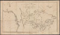
"... Published 15 Oct. 1801 ...", Relief shown by hachures., and Yale's copy 1 with ms. note in ink in bottom margin. Also stamped, "Yale, Horace Brown, 1900S."
Publisher:
Published by Alexander Mack Kenzie,
Subject (Geographic):
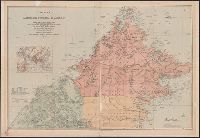
Canada--Discovery and exploration--Maps and Canada--Maps
"... Published 15 Oct. 1801 ...", Relief shown by hachures., and Yale's copy 1 with ms. note in ink in bottom margin. Also stamped, "Yale, Horace Brown, 1900S."
Publisher:
Published by Alexander Mack Kenzie,
Subject (Geographic):
Canada--Discovery and exploration--Maps and Canada--Maps
Covers Brunei, Sabah, and northern Sarawak., Includes inset location map., Land available for sale or sold indicated., Library copy accompanied by manuscript notes., and Relief shown by hachures and spot heights. Soundings in fathoms.
Publisher:
Published by Edward Stanford for the British North Borneo Company,
Anville, Jean Baptiste Bourguignon d', 1697-1782 Chapman, Thomas, fl. 1790-1803 Neele, Samuel John, 1758-1824, engraver Pauw, Cornelius, 1739-1799. Philosophical dissertations on the Egyptians and Chinese
Published / Created:
Jany. 1st, 1795.
Call Number:
1977 Folio 177
Image Count:
2
Resource Type:
Maps, Atlases & Globes
Description:
"Neele, sculpt.", Ms. note at head of title: De Pauw. Sheet measures 50.7 x 63.8 cm. No. 15 of 34 maps bound together., Prime meridians: Ferro., Relief shown pictorially., and Watermark.
Map of China showing the stations of the China Inland Mission
Description:
"China Inland Mission stations with resident missionary are underlined in red.", "Stanford's Geog! Estab., London.", and Covers on verso not digitized.