Skip to search
Skip to main content
Skip to first result
Search
You Searched For
Resource Type
Maps, Atlases & Globes
Language
German
New Search
Search Results
Published / Created:
[18--]
Call Number:
50J 1775
Container / Volume:
BRBL_00274
Image Count:
1
Resource Type:
Maps, Atlases & Globes
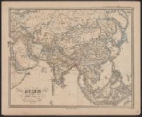
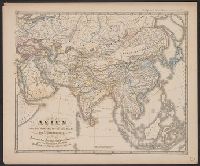
Description:
Spruner's Historical Atlas.
Publisher:
Justus Perthes,
Subject (Geographic):
Asia--Maps--Early works to 1800
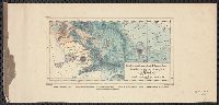
Found in:
Beinecke Rare Book and Manuscript Library > Asien gegen Ende des XVIIIten Jahrhunderts ... C. Stier sc.
Published / Created:
[18--]
Call Number:
50J 450
Container / Volume:
BRBL_00274
Image Count:
1
Resource Type:
Maps, Atlases & Globes
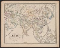
Description:
Spruner's Historical Atlas.
Publisher:
Justus Perthes,
Subject (Geographic):
Asia--Maps--Early works to 1800
Found in:
Beinecke Rare Book and Manuscript Library > Asien gegen die Mitte des Fünften Jahrhunderts ...
Published / Created:
[18--]
Call Number:
50J 1150
Container / Volume:
BRBL_00274
Image Count:
1
Resource Type:
Maps, Atlases & Globes
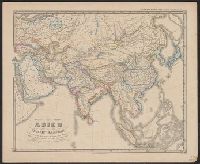
Description:
Spruner's Historical Atlas.
Publisher:
Justus Perthes,
Subject (Geographic):
Asia--Maps--Early works to 1800
Found in:
Beinecke Rare Book and Manuscript Library > Asien im XIten und XIIten Jahrhunderts ... Mädel II sc.
Published / Created:
[18--]
Call Number:
50J 675
Container / Volume:
BRBL_00274
Image Count:
1
Resource Type:
Maps, Atlases & Globes
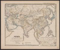
Description:
Inset: Hochasien um die Mitte des VIten Jahrhunderts.
Publisher:
Justus Perthes,
Subject (Geographic):
Asia--Maps--Early works to 1800
Found in:
Beinecke Rare Book and Manuscript Library > Asien vom VIten bis in die erste Hälfte des IXten Jahrhunderts ...
Published / Created:
[18--]
Call Number:
50J 875
Container / Volume:
BRBL_00274
Image Count:
1
Resource Type:
Maps, Atlases & Globes
Description:
Spruner's Historical Atlas.
Publisher:
Justus Perthes,
Subject (Geographic):
Asia--Maps--Early works to 1800
Found in:
Beinecke Rare Book and Manuscript Library > Asien von der Mitte des IXten bis zum Ende des Xten Jahrhunderts ... Mädel II sc.
Creator:
Published / Created:
[1942]
Call Number:
212 1942A
Container / Volume:
BRBL_00014
Image Count:
1
Resource Type:
Maps, Atlases & Globes
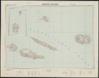
Description:
-- Azoren-Ost., "Azoren-Mitte und -West" includes inset of Corvo and Flores Islands., "XII. 1942 (D.57).", Azoren-Mitte und -West, German, with Portuguese place names., Includes location map and glossary of Portuguese terms., Librar, and Title supplied by cataloger.
Publisher:
Gen St d H, Abt f Kr K u Verm Wes (II),
Subject (Geographic):
Azores--Maps, Topographic
Found in:
Beinecke Rare Book and Manuscript Library > Atlantische Inseln 1:200 000. [Azores] / bearbeitet und herausgegeben von der Heeresplankammer.
Creator:
Published / Created:
1840
Call Number:
30 1840
Container / Volume:
BRBL_00031
Image Count:
4
Resource Type:
Maps, Atlases & Globes
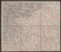
Description:
Copy 2: Imperfect: disbound; all sheets but Belluno, Trient, Padua, and Verona wanting; trimmed along neat line, with loss of marginal data. Sheets dissected and mounted on cloth. Stamps on verso: K.K. Un and Relief shown by hachures and spot heights.
Publisher:
Im Verlage der Herder'schen Kunst und Buchhandlung,
Subject (Geographic):
Europe, Central--Maps
Subject (Name):
K.K. Universitäts-Bibliothek Innsbruck Stamp
Found in:
Beinecke Rare Book and Manuscript Library > Atlas von Südwest-Deutschland und dem Alpenlande : in 48 Blättern und 6 statistischen Tabellen / entworfen u. bearbeitet von J.E. Woerl.
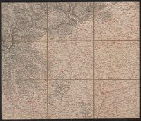
Creator:
Published / Created:
1840
Call Number:
30 1840
Container / Volume:
BRBL_00031
Image Count:
1
Resource Type:
Maps, Atlases & Globes
Description:
Copy 1: Imperfect: disbound; all sheets but Padua, Verona, and Milano wanting; trimmed along neat line, with loss of marginal data. Sheets dissected and mounted on cloth. and Relief shown by hachures and spot heights.
Publisher:
Im Verlage der Herder'schen Kunst und Buchhandlung,
Subject (Geographic):
Europe, Central--Maps
Subject (Name):
K.K. Universitäts-Bibliothek Innsbruck Stamp
Found in:
Beinecke Rare Book and Manuscript Library > Atlas von Südwest-Deutschland und dem Alpenlande : in 48 Blättern und 6 statistischen Tabellen / entworfen u. bearbeitet von J.E. Woerl.
Published / Created:
1838
Call Number:
40cah 1838
Container / Volume:
BRBL_00228
Image Count:
4
Resource Type:
Maps, Atlases & Globes
Subject (Geographic):
Italy--Maps
Found in:
Beinecke Rare Book and Manuscript Library > Atlas zu den Geologischen Beobachtungen über die vulkanischen Erscheinungen und Bildungen in Unter- und Mittel-Italien von H. Abich. Erste lieferung.
Published / Created:
1820
Call Number:
23 1820
Container / Volume:
BRBL_00020
Image Count:
1
Resource Type:
Maps, Atlases & Globes
Description:
Preliminary record.
Publisher:
bey Johanes Walch,
Subject (Geographic):
Oceania--Maps
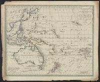
Found in:
Beinecke Rare Book and Manuscript Library > Australien (Südland) Auch Polynesien oder Inselwelt ...
Branch:v1.61.8 ,Deployed:2024-06-20T11:15:02-04:00