Skip to search
Skip to main content
Skip to first result
Search
You Searched For
Format
cartographic
Genre
Maps in books
Language
Latin
New Search
Search Results
Creator:
Published / Created:
1715?
Call Number:
1973 Folio 30
Collection Title:
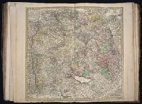
[Atlas factice of 32 maps and 1 distance table, produced by the Homann Erben firm]
Image Count:
2
Publisher:
[Johann Baptist Homann]
Subject (Geographic):
Saxony (Germany) --Maps --Early works to 1800
Subject (Topic):
Atlases, German --Early works to 1800
Collection Created:
[Nuremberg : s.n., 1701-1760]
Found in:
Beinecke Rare Book and Manuscript Library > Circulus Saxoniae inferioris in omnes suos status et principatus / [cartographic material] / accurate divisus ex conatibus Io. Bapt. Homanni
Creator:
Published / Created:
ca. 1743
Call Number:
1983 Folio 23
Collection Title:
[Atlas factice of 50 maps, primarily by Johann Baptist Homann and/or issued by the Homann Erben
Image Count:
1
Alternative Title:
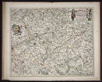
Cercle de Suabe, Cercle de Svabe, and Circuli Sueviae mappa
Publisher:
[Homann Erben]
Subject (Geographic):
Baden-Wuerttemberg (Germany) --Maps --Early works to 1800
Collection Created:
[Nuremberg : Homann Erben, 1710-1786]
Found in:
Beinecke Rare Book and Manuscript Library > Circvli Sveviae mappa / [cartographic material] / ex subsidijs Michalianis delineata & a Dno. I.M. Hasio M.P.P. quoad accuratam singulorums statuum determinationem emendata & ad. L. magis legitimae project. reducta ; opus sum[m]i geographi posthumum, & ad
Creator:
Published / Created:
1572]-1618
Call Number:
1975 Folio 41
Image Count:
1
Resource Type:
Maps, Atlases & Globes
Alternative Title:
Civitates orbis terrarum ...
Publisher:
[Coloniae Agrippinae,
Subject (Geographic):
Rome--Antiquities--Early works to 1800 and Rome--Antiquities--Maps
Subject (Topic):
Cities and towns, Medieval and Maps, Pictorial -- (LC)
Found in:
Beinecke Rare Book and Manuscript Library > Civitates orbis terrarvm ...
Creator:
Published / Created:
Anno a Christi natiuitate 1525. Tertio Kal'. Apriles.
Call Number:
1976 +325
Image Count:
1
Resource Type:
Books, Journals & Pamphlets
Description:
Each map is printed across two leaves of plates. Maps 1 to 49 are numbered and have text on recto of initial leaf; final map is unnumbered, has no text on recto of initial leaf., Imprint information from colophon (leaf Q8 recto)., Index ([68] p., third group) bound at end, after maps., Signatures: A-M⁶ N⁴ 0-P⁶ Q⁸ a-e⁶ f⁴., and Variant order of binding: index precedes maps. Autograph of Giovanni Battista Francino.
Publisher:
Iohannes Grieningerus, communibus Iohannis Koberger impensis excudebat,
Subject (Name):
Francino, Giovanni Battista,--1631-1698--Autograph. and Regiomontanus, Joannes, 1436-1476.
Found in:
Beinecke Rare Book and Manuscript Library > Clavdii Ptolemaei Geographicae enarrationis libri octo / Bilibaldo Pirckeymhero interprete ; Annotationes Ioannis de Regio Monte in errores commissos a Iacobo Angelo in translatione sua.
Creator:
Published / Created:
ca. 1684
Call Number:
Folio 469
Collection Title:
[Atlas factice of 13 maps by Nicolaes Visscher I, Nicolaes Visscher II, Guillaume Sanson, and
Image Count:
1
Publisher:
Nicolaes Visscher
Subject (Geographic):
Europe --Maps --Early works to 1800 and Hainaut (Belgium) --Maps --Early works to 1800
Subject (Topic):
Atlases, Dutch --Early works to 1800
Collection Created:
1677-1692
Found in:
Beinecke Rare Book and Manuscript Library > Comitatus Hannoniae et Archiepiscopatus Cameracensis tabula / [cartographic material] / per Nicolaum Visscher
Creator:
Published / Created:
ca. 1680
Call Number:
Folio 469
Collection Title:
[Atlas factice of 13 maps by Nicolaes Visscher I, Nicolaes Visscher II, Guillaume Sanson, and
Image Count:
1
Publisher:
Justus Danckerts
Subject (Geographic):
Europe --Maps --Early works to 1800 and Netherlands --Maps --Early works to 1800
Subject (Topic):
Atlases, Dutch --Early works to 1800
Collection Created:
1677-1692
Found in:
Beinecke Rare Book and Manuscript Library > Comitatus Hollandiae tabula / [cartographic material] / pluribus locis recens emendata a Iusto Danckerts
Creator:
Published / Created:
ca. 1684
Call Number:
Folio 469
Collection Title:
[Atlas factice of 13 maps by Nicolaes Visscher I, Nicolaes Visscher II, Guillaume Sanson, and
Image Count:
1
Publisher:
Nicolaes Visscher
Subject (Geographic):
Europe --Maps --Early works to 1800 and Namur (County) --Maps --Early works to 1800
Subject (Topic):
Atlases, Dutch --Early works to 1800
Collection Created:
1677-1692
Found in:
Beinecke Rare Book and Manuscript Library > Comitatus Namurci / [cartographic material] / emendata delineatio nuperrime in lucem edita per Nicolaum Visscher
Creator:
Published / Created:
1750
Call Number:
1973 Folio 30
Collection Title:
[Atlas factice of 32 maps and 1 distance table, produced by the Homann Erben firm]
Image Count:
2
Publisher:
[Matthaeus Seutter?]
Subject (Geographic):
Nordhausen (Germany : Landkreis) --Maps --Early works to 1800
Subject (Topic):
Atlases, German --Early works to 1800
Collection Created:
[Nuremberg : s.n., 1701-1760]
Found in:
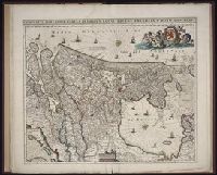
Beinecke Rare Book and Manuscript Library > Comitatus Stolbergensis delineatio geographia, Praefecturas Hohnstein, Stolberg, Hayn Berenroda, Ebersburg, Ufftrungen, Rosla et Questen cum limitibus et vicinia accurate exhibens / [cartographic material] / caelo Matthaei Seutteri. Georgraphi Caesarei ;
Creator:
Published / Created:
a. 1760
Call Number:
1973 Folio 30
Collection Title:
[Atlas factice of 32 maps and 1 distance table, produced by the Homann Erben firm]
Image Count:
2
Alternative Title:
Comitatus Schoenburgensis
Publisher:
Edentibus Homannianis Heredibus
Subject (Geographic):
Zwickau (Germany : Landkreis) --Maps --Early works to 1800
Subject (Topic):
Atlases, German --Early works to 1800
Collection Created:
[Nuremberg : s.n.,
Found in:
Beinecke Rare Book and Manuscript Library > Comitatvs Schoenburgensis [cartographic material] : in quo celsissimorum comitum de Schoenburg regiones ad circulum Saxoniae superiorem Imperii Romano-Germanici pertinentes et in Marchionatu Misniae sitae, subfeuda porro Bohemico-Imperialia, nempe Dynasti
Call Number:
1983 Folio 19
Collection Title:
[Atlas factice of 96 maps by Blaeu, Visscher, Jansson, Hondius and others]
Image Count:
2
Description:
Imperfect: lower left corner [imprint] cut-out and replaced with ms. ill.; edges reinforced with ms waste. Sheet measures 38.5 x 48.9 cm. No. 67 of 92 maps bound together. and Numbered 72 on verso.
Subject (Geographic):
Denmark --Maps --Early works to 1800
Subject (Topic):
Atlases --Early works to 1800
Collection Created:
[1556-1680]
Found in:
Beinecke Rare Book and Manuscript Library > Daniae regni typus
Branch:v1.61.6 ,Deployed:2024-06-12T09:55:36-04:00