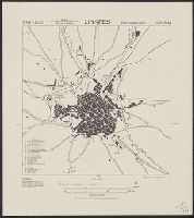
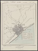
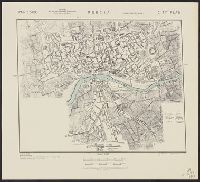
"Copied from Spanish map, 1:50,000, no. 905, Linares, 1919, and references from Europe B24-MG24.", "Reference" gives key to names of some streets and buildings., and At head of title: Spain 1:10,000.
Its A.M.S. ; L991 and Series (Standard map series designation system) ; L991.
Description:
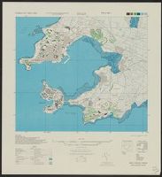
"Place names are transcribed according to the modified Hepburn (Romaji) system.", "Polyconic projection.", "Relief shown by form lines.", At head of title: Formosa city plans ..., Includes "Glossary.", Marginal maps: Index to boundaries.--Coverage diagram., and Mil
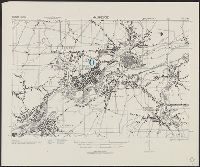
"Army Map Service, U.S. Army ... Reprint January 1943.", "Copied from a map published by the F.M.S. & S.S. Survey Dept. 1928.", "Geographical Section, General Staff, No. 4253. War Office 1942.", 5844 1943:, and Includes reference chart and index to sheets.
"3-43.", "Copied from French map, 1:50,000, Maubeuge no. 28-6, revised to 1930, and French map, 1:50,000, Le Quesnoy no. 27-6, revised to 1931.", "First edition 1943.", "Nord de guerre zone grid.", and Some buildings are named.
Geological Survey (U.S.) United States. Army Map Service
Published / Created:
1974
Call Number:
234 1974
Container / Volume:
BRBL_00020
Image Count:
1
Resource Type:
Maps, Atlases & Globes
Alternative Title:
Series (Standard map series designation system) ; W532. and Series , W532
Description:
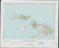
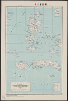
"10,000-meter Universal Mercator grid ticks, zones 4 and 5, international spheroid, shown in blue.", "Hawaiian Islands 1:250,000"--Upper margin., "Maui, Hawaii"--Lower margin., "NF 4-16" -- Upper margin., "Prepared by the Army Map S, and Includes location diagram.
Publisher:
For sale by the Survey, and U.S. Geological Survey ;
Its A.M.S. 9101 and Series (Standard map series designation system) ; 9101.
Description:
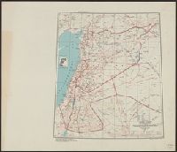
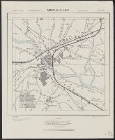
"Mercator projection.", Elevations are shown by hachures and spot heights in meters., Inset shows area of detailed transportation information., and Roads and trails are shown.