
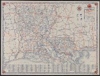
You Searched For
1 - 8 of 8
Search Results
- Creator:
- Rand McNally and Company
- Published / Created:
- [1959].
- Call Number:
- 834gmb 1960
- Container / Volume:
- BRBL_00591
- Image Count:
- 2
- Resource Type:
- Maps, Atlases & Globes
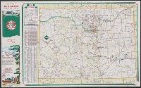
- Alternative Title:
- Colorado. and Denver street map.
- Description:
- "9-5650-5" on Colorado map and "9-574620V-4" on Denver map., Denver street map -- Colorado., Includes indexes, distance table, and ill., On back panel: 59B., Panel title., and Relief shown by spot heights.
- Publisher:
- Rand McNally& Co.,
- Subject (Geographic):
- Colorado--Maps
- Subject (Name):
- Sinclair Oil Corporation
- Subject (Topic):
- Roads--Colorado--Maps
- Found in:
- Beinecke Rare Book and Manuscript Library > Colorado and Denver / [prepared for] Sinclair Oil.
3.
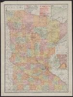
- Creator:
- Rand McNally and Company
- Published / Created:
- 1908
- Call Number:
- 814gme 1908
- Container / Volume:
- BRBL_00559
- Image Count:
- 2
- Resource Type:
- Maps, Atlases & Globes
- Description:
- Includes index to railroads, and insets of Cook County and Minneapolis-St. Paul vicinity. and Index to "Counties, creeks, Indian reservations ..." and advertisement on verso.
- Publisher:
- Rand McNally,
- Subject (Geographic):
- Minnesota--Maps
- Subject (Topic):
- Railroads--Minnesota--Maps
- Found in:
- Beinecke Rare Book and Manuscript Library > Minnesota.
- Creator:
- Rand McNally and Company
- Published / Created:
- c1924.
- Call Number:
- 834gmb 1924
- Container / Volume:
- BRBL_00591
- Image Count:
- 2
- Resource Type:
- Maps, Atlases & Globes
- Alternative Title:
- Auto trails map of Colorado, Auto trails map, Denver and vicinity., Official 1924, auto trails map of Colorado, and Rand McNally detailed auto trails map, Denver and vicinity.
- Description:
- Distributed by the Continental Oil Company., On verso: Rand McNally detailed auto trails map, Denver and vicinity. Scale [ca. 1:500,000]., Relief shown by hachures and spot heights., and Shows trail and highway markings.
- Publisher:
- Rand McNally & Company,
- Subject (Geographic):
- Colorado--Maps
- Subject (Name):
- Continental Oil Company
- Subject (Topic):
- Roads--Colorado--Denver Region--Maps and Roads--Colorado--Maps
- Found in:
- Beinecke Rare Book and Manuscript Library > Rand McNally official 1924 : auto trails map of Colorado.
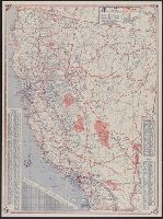
- Creator:
- Rand McNally and Company
- Published / Created:
- [1951?]
- Call Number:
- 844gmb 1951
- Container / Volume:
- BRBL_00616
- Image Count:
- 2
- Resource Type:
- Maps, Atlases & Globes
- Alternative Title:
- Road map of California
- Description:
- "Rand McNally road map, United States" (scale [ca. 1:10,200,960], 1 in. = approx. 161 miles), text, and distance table on verso., Copyright: Rand McNally & Company., In lower right: 1-463629V-7., Includes mileage chart and index., and Relief shown pictorially and by spot heights.
- Publisher:
- The Company,
- Subject (Geographic):
- California--Maps
- Subject (Name):
- Randall Motor Club
- Subject (Topic):
- Roads--California--Maps and Roads--United States--Maps
- Found in:
- Beinecke Rare Book and Manuscript Library > Rand McNally road map, California / issued by Randall Motor Club, Inc., affiliated with E. Broox Randall & Sons, Inc.
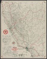
- Creator:
- Rand McNally and Company
- Published / Created:
- 1931
- Call Number:
- 844gmb 1931
- Container / Volume:
- BRBL_00615
- Image Count:
- 2
- Resource Type:
- Maps, Atlases & Globes
- Alternative Title:
- 1931 Texaco road map, California, Nevada, Road map, California, Nevada, and Texaco road map, 1931, United States.
- Description:
- At head of title: 1931., Index, ill., and road maps of United States, Oakland area, Los Angeles and vicinity, and San Francisco area on verso., Insets: Map of Yosemite National Park -- Map of Sequoia & Gen. Grant national parks., and Relief shown by hachures and spot heights.
- Publisher:
- Rand McNally,
- Subject (Geographic):
- California--Maps and Nevada--Maps
- Subject (Name):
- Texas Company
- Subject (Topic):
- Roads--California--Maps, Roads--Nevada--Maps, and Roads--United States--Maps
- Found in:
- Beinecke Rare Book and Manuscript Library > Texaco road map, California, Nevada.
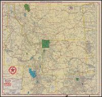
- Creator:
- Rand McNally and Company
- Published / Created:
- [1937]
- Call Number:
- 845 1937
- Container / Volume:
- BRBL_00620
- Image Count:
- 2
- Resource Type:
- Maps, Atlases & Globes
- Alternative Title:
- Idaho, Montana, Wyoming, and North & South Dakota, Texaco road map, Idaho, Montana, Wyoming., and Texaco road map, North Dakota, South Dakota.
- Description:
- "S.2721.", "S.3227.", Includes indexes, text, ill., and maps of "Yellowstone National Park" and "Waterton-Glacier International Peace Park.", Panel title., Relief shown by hachures and spot heights., and Texaco road map, Idaho, Montana, Wyoming -- Texaco road map, North Dakota, South Dakota.
- Publisher:
- Rand McNally,
- Subject (Geographic):
- West (U.S.)--Maps
- Subject (Topic):
- Roads--West (U.S.)--Maps
- Found in:
- Beinecke Rare Book and Manuscript Library > Texaco touring map, Idaho, Montana, Wyoming, and North & South Dakota.

- Creator:
- Rand McNally and Company
- Published / Created:
- [1921]
- Call Number:
- 836 1921
- Container / Volume:
- BRBL_00592
- Image Count:
- 2
- Resource Type:
- Maps, Atlases & Globes
- Alternative Title:
- New commercial atlas map of Utah and Utah automobile road map.
- Description:
- "Utah automobile road map" (scale [ca. 1:965,485]) and advertisement on verso., In lower right margin: 253c., Indexed., Relief shown by hachures., and Shows railroads and counties.
- Publisher:
- Rand McNally,
- Subject (Geographic):
- Utah--Maps
- Subject (Topic):
- Railroads--Utah--Maps and Roads--Utah--Maps
- Found in:
- Beinecke Rare Book and Manuscript Library > The Rand McNally new commercial atlas map of Utah.