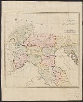
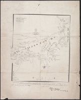
In top left margin: 24., Prime meridians: London and Ferro., Relief shown pictorially., Title in English, place names in Latin., and Watermarks: J. Buttanshaw; coat of arms over G.R.
Publisher:
T. Stackhouse,
Subject (Geographic):
Italy--Historical geography--Maps--Early works to 1800, Italy--History--To 476--Maps--Early works to 1800, and Rome--Maps--Early works to 1800
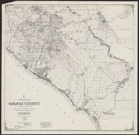
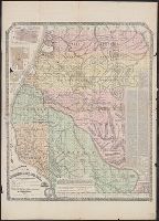
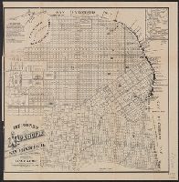
"By an act of the Board of Supervisors passed Feby. 9th, 1865.", Includes text, distance list, Calif. Surveyor General's certification, and statistics., Insets: Map of Eureka -- Map of Arcata., Relief shown by hachures., and Shows drainage, partial land ownership, townships, township and section lines, trails, etc.
From Thomas Stackhouse's New history of the Holy Bible (London, 1752)., In lower left corner, "Pl. 3"; in lower right corner, "page 24.", Prime meridian: Ferro., Relief shown pictorially., and Watermark.
Publisher:
[Printed for John Hinton],
Subject (Geographic):
Middle East--Historical geography--Maps--Early works to 1800. and Middle East--Maps--Early works to 1800.
Subject (Name):
Hinton, John, -1781 and Stackhouse, Thomas, approximately 1680-1752. New history of the Holy Bible.