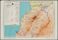
"1145 2-37"--Lower right margin., "D'après les cartes hydrographiques de la Marine française et de l'Amirauté anglais, les travaux des missions dirigées par M.M. les capitaines Montégu et Renault et les levés de M.M. les sergents Guyot et Hengoat.", "Imprimé au Service géographique de l'Armée"--Lower left margin., Imperfect: trimmed, with some loss of text. Manuscript annotations in red on map., Includes inset (scale 1:5,000,000) showing depths., and Relief shown by contours and spot heights. Depths shown by contours.
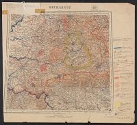
"Imprimerie xincographique du Service géographique de l'armée.", Includes key map., Relief shown by contours and shading., and Shows administrative boundaries, railways, roads, principal buildings named.
"Mai 1904.", Relief shown by shading and spot heights. Depths shown by soundings and bathymetric contours., and Shows Guandong Peninsula, southern Liaoning Sheng.
Publisher:
Service géographique de l'Armée,
Subject (Geographic):
Dalian Region (China)--Maps and Lüshun Region (China)--Maps
Ms. legend along right side of sheet corresponding with ms. notes on map. Paper affixed to upper left corner of sheet with note "This map and others similarly annotated were supplied to the American Peace Commission by the French Geographi
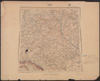
Includes index of adjoining sheets. and Ms. legend along right side of sheet corresponding with ms. notes on map. Imperfect: Mutilated with loss of text.