- Creator:
- United States. Army Map Service
- Published / Created:
- 1943
- Call Number:
- 7391 1943
- Container / Volume:
- BRBL_00394
- Image Count:
- 2
- Resource Type:
- Maps, Atlases & Globes
- Alternative Title:
- AMS ; A521 and Series (Standard map series designation system) ; A521.
- Description:
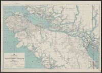
- Map originallly published by British Columbia Dept. of Lands., Northerly portion Vancouver Island, 1929, Map No. 2C -- Southerly portion Vancouver Island, 1938, Map No. 2A., Relief shown by s, and South sheet contains index map, location map, and mileage charts.
- Publisher:
- U.S. Army Map Service,
- Subject (Geographic):
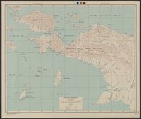
- Vancouver Island (B.C.)--Maps
- Subject (Name):
- British Columbia. Dept. of Lands
- Found in:
- Beinecke Rare Book and Manuscript Library > Vancouver Island / Army Map Service.
Search
Limit your search
- Public113
- cartographic113
- Maps, Atlases & Globes✖[remove]113
- United States. Army Map Service✖[remove]113
- Manila Fire Insurance Association8
- Great Britain. War Office. General Staff. Geographical Section7
- U.S. Coast and Geodetic Survey3
- U.S. Lake Survey2
- United States. Aeronautical Chart Service2
- Great Britain. War Office1
- United States. Army. Infantry Regiment, 17th1
- United States. Army. Philippine Scouts1
- Military maps7
- Railroads--Soviet Union--Maps6
- Aeronautical charts--East China Sea5
- Aeronautical charts--Japan, Sea of5
- Aeronautical charts--South China Sea5
- Ocean currents--China--Maps5
- Winds--China--Maps5
- Cities and towns--Korea (North)--Maps3
- Aeronautical charts--Japan2
- Cities and towns--Korea (South)--Maps2
- United States. Army Air Forces15
- United States. Aeronautical Chart Service12
- United States. Army Map Service2
- United States. Army Map Service. Eastern Asia, 1:1,000,0002
- British Columbia. Dept. of Lands1
- Great Britain. Hydrographic Dept1
- Pneu Michelin (Firm)1
- Spain. Patronato Nacional de Turismo1
- Spain. Servicio Hidrográfico1
- Washington, D.C. :✖[remove]113
- [London] :1
Current results range from 1941 to 1947