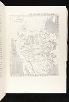
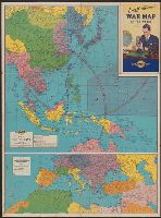
Map of Southern Europe, the Mediterranean area and the Near East., Map of the Far East., War map of Atlantic Ocean area, Eurasia and Africa., War map of Pacific Ocean and the Far East., and War map of the world
Description:
Includes notes, inset of "World time zones," and col. ill., Map of the Far East. Scale [ca. 1:13,000,000] -- Map of Southern Europe, the Mediterranean area and the Near East. Scale [ca. 1:14,500,000] -- Verso: War map of Atlantic Ocean, and On panel title: "B."
Publisher:
Rand McNally & Co.,
Subject (Name):
Thomas, Lowell, 1892-1981
Subject (Topic):
Time--Systems and standards--Maps and World War, 1939-1945--Maps
Map of the eastern provinces of Canada with relief shown by hachures. and Plate 42 from: The London atlas of universal geography, exhibiting the physical & political divisions of the various countries of the world, constructed from original materials. London;
Publisher:
Pubd. 15 Feby. 1838, by J. Arrowsmith, 35 Essex Street Strand,
Subject (Geographic):
Canada, Eastern--Maps
Subject (Name):
Arrowsmith, John, 1790-1873. The London atlas of universal geography
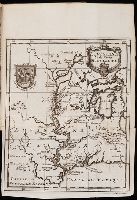
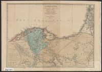
Lower Egypt is one of the alternative names used for "Nile River Delta" Region or "al-Wajh al-Baḥrī" in Arabic., Names of the places are based on the names used during the Greco Roman period, 332 B.C.-640 A.D., and Relief by hachures.
Subject (Geographic):
Egypt--Civilization--Maps, Nile River Delta (Egypt)--Maps, and Palestine--Maps