Skip to search
Skip to main content
Skip to first result
Search
You Searched For
Extent of Digitization
Completely digitized
Genre
Maps
Creator
Rand McNally and Company
Publication Place
Chicago
New Search
Search Results
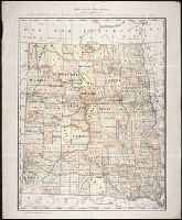
Creator:
Published / Created:
c1884
Call Number:
BrSides Zc35 876rae
Image Count:
1
Resource Type:
Maps, Atlases & Globes
Description:
Scale [1:1,267,200]. 1 in. = approx. 20 miles.
Publisher:
Rand, McNally & Co.
Subject (Geographic):
Dakota Territory, North Dakota., and South Dakota.
Found in:
Beinecke Rare Book and Manuscript Library > Map of Dakota / printed expressly for E.P. Gates, president Merchants Bank and negotiator of farm loans, Grand Forks, Dakota
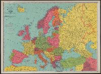
Creator:
Published / Created:
[n.d.]
Call Number:
30 1920E
Container / Volume:
BRBL_00032A
Image Count:
2
Resource Type:
Maps, Atlases & Globes
Description:
On verso: Europe in 1921, with railways. - Western fron. - Section of Maginot line fortification. - Europe air mileage distances. - Unification of Germany, 1866-1871. - Text., Shows 1914 boundarie, and Title on cover when folded: Rand McNally war map of Europe.
Subject (Geographic):
Europe--Maps
Subject (Topic):
World War, 1914-1918--Maps
Found in:
Beinecke Rare Book and Manuscript Library > Rand McNally standard map of Europe.
Branch:v1.61.6 ,Deployed:2024-06-12T09:55:31-04:00