Skip to search
Skip to main content
Skip to first result
Search
You Searched For
Resource Type
Maps, Atlases & Globes
Language
French
New Search
Search Results
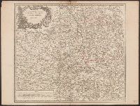
Published / Created:
[1753?]
Call Number:
3856 1753
Container / Volume:
BRBL_00180
Image Count:
1
Resource Type:
Maps, Atlases & Globes
Subject (Geographic):
Nivernais (France)--Maps--Early works to 1800
Found in:
Beinecke Rare Book and Manuscript Library > Gouvernements Generaux du Berry, du Nivernois, et du Bourbonois Par le Sr. Robert.
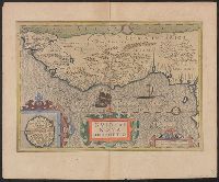
Published / Created:
[1805?]
Call Number:
3816 1805
Container / Volume:
BRBL_00174
Image Count:
2
Resource Type:
Maps, Atlases & Globes
Subject (Geographic):
Anjou (France)--Maps
Found in:
Beinecke Rare Book and Manuscript Library > Gouvernment D'Anjou Gravé par P.F. Tardieu Ecrit par Dubuisson.
Creator:
Published / Created:
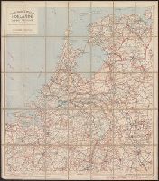
[1911?].
Call Number:
331gmb 1911
Container / Volume:
BRBL_00080
Image Count:
1
Resource Type:
Maps, Atlases & Globes
Alternative Title:
Cartes Tarides ; no. 33.
Description:
5 classes of roads with distances; railroads; customs offices.
Publisher:
Cartes Taride,
Subject (Geographic):
Netherlands--Road maps
Found in:
Beinecke Rare Book and Manuscript Library > Grande carte routière de la Hollande (Pays-Bas, Nederland) à l'usage des automobilistes, cyclistes, touristes, etc. [map].
Creator:
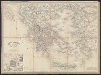
Published / Created:
1856
Call Number:
48 1856
Container / Volume:
BRBL_00264
Image Count:
1
Resource Type:
Maps, Atlases & Globes
Publisher:
Paulin & Le Chevalier,
Subject (Geographic):
Greece--Maps
Subject (Name):
Dyonnet, Ch
Found in:
Beinecke Rare Book and Manuscript Library > Gréce moderne / dressée par A.H. Dufour, gravée par Ch. Dyonnet.
Creator:
Published / Created:
1628]
Call Number:
655 1628
Container / Volume:
BRBL_00345
Image Count:
2
Resource Type:
Maps, Atlases & Globes
Alternative Title:
Gvineae nova descriptio
Description:
From the author's Gerardi Mercatoris atlas. 1628., Inset: I. S. Thomae., Map text in Latin. Text on verso in French., Relief shown pictorially., and Text on verso titled "Guinee, avec les isles de S. Thomas, du Prince, et d'Anobon," p. 637 and 640.
Publisher:
Sumptibus & typis aeneis Henrici Hondij,
Subject (Geographic):
Africa, West--Maps--Early works to 1800
Subject (Name):
Hondius, Hendrik, 1597-1651 and Mercator, Gerhard, 1512-1594. Gerardi Mercatoris Atlas
Found in:
Beinecke Rare Book and Manuscript Library > Guineae nova descriptio.
Creator:
Published / Created:
1743
Call Number:
655 1743
Container / Volume:
BRBL_00345
Image Count:
1
Resource Type:
Maps, Atlases & Globes
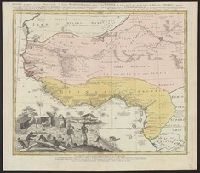
Alternative Title:
Guinea propria, nec non Nigritiæ vel Terræ Nigrovrm maxima pars, Guinee de meme que la plus grande partie du Pais des Negres, and Gvinee de meme que la plus grande partie du Pais des Negres
Description:
Covers West Africa from Gabon in the south to Niger, Mali, and Mauritania in the north., Has watermark., Includes indexed ill. depicting the dress, dwellings, and work of native Africans., Prime meridian: Ferro., and Relief shown pictorially.
Publisher:
Homannianorum Heredum,
Subject (Geographic):
Africa, West--Maps--Early works to 1800
Subject (Name):
Anville, Jean Baptiste Bourguignon d', 1697-1782 and Marchais, R. de
Found in:
Beinecke Rare Book and Manuscript Library > Gvinea propria, nec non Nigritiæ vel Terrae Nigrorvm maxima pars : geographis hodiernis dicta utraq[ue] Aethiopia inferior, & hujus quidem pars australis / ex delineationibus Anvillianis itineri guineensi D. de Marchais insertis secundum leges projectioni
Published / Created:
1659
Call Number:
11 1659
Container / Volume:
BRBL_00003
Image Count:
1
Resource Type:
Maps, Atlases & Globes
Description:
Preliminary record.
Publisher:
Sanson,
Subject (Geographic):
World--Maps--Early works to 1800
Found in:
Beinecke Rare Book and Manuscript Library > Harmonie ou Correspondance du globe avecq la sphere par les points, lignes, cerches, &c ... par le S. Sanson d'Abbeville ... Jean Somer Pruthenus, Sculpsit.
Published / Created:
1762
Call Number:
19 1762
Container / Volume:
BRBL_00013
Image Count:
1
Resource Type:
Maps, Atlases & Globes
Description:
Preliminary record. and Routes of Navigators shown.
Subject (Geographic):
Antarctica--Maps--Early works to 1800
Found in:
Beinecke Rare Book and Manuscript Library > Hemisphere Meridional dressé en 1754 par M. Le Comte de Redern, Curateur ... Académie Royale des Sciences ... executé par ordre de l'Academie en 1762.
Published / Created:
1782
Call Number:
13 1782
Container / Volume:
BRBL_00011
Image Count:
1
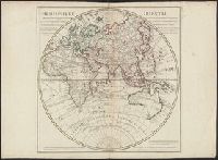
Resource Type:
Maps, Atlases & Globes
Description:
Showing routes of Captain Cook and other navigators.
Publisher:
Dezauche,
Subject (Geographic):
Eastern Hemisphere--Maps--Early works to 1800
Found in:
Beinecke Rare Book and Manuscript Library > Hemisphere Oriental ...
Published / Created:
1762
Call Number:
18 1762
Container / Volume:
BRBL_00012
Image Count:
1
Resource Type:
Maps, Atlases & Globes
Description:
Contemporary notation in ink, verso: Nördliche Halb Kugel and Routes of Navigators shown.
Subject (Geographic):
Arctic Regions--Maps--Early works to 1800
Found in:
Beinecke Rare Book and Manuscript Library > Hemisphere Septentrional dressé en 1754 par Mr. le Comte de Redern, Curateur de l'Académie des Sciences ... par ordre de l'Académie.
Branch:v1.61.6 ,Deployed:2024-06-12T09:55:37-04:00