Skip to search
Skip to main content
Skip to first result
Search
You Searched For
Genre
Maps
Language
English
New Search
Search Results
Published / Created:
1850
Call Number:
1975 Folio 26
Collection Title:
A new universal atlas containing maps of the various empires, kingdoms, states and republics of the
Image Count:
1
Resource Type:
Maps, Atlases & Globes
Subject (Name):
P.S. Duval & Son
Collection Created:
Philadelphia, Thomas, Cowperthwait & Co., No. 253 Market street, 1852
Found in:
Beinecke Rare Book and Manuscript Library > A new map of Maine
Published / Created:
1846
Call Number:
1976 Folio 93
Collection Title:
Mitchell’s universal atlas
Image Count:
1
Resource Type:
Maps, Atlases & Globes
Subject (Geographic):
Maine
Collection Created:
Philadelphia, S.A. Mitchell, 1847, c1844
Found in:
Beinecke Rare Book and Manuscript Library > A new map of Maine
Published / Created:
1833
Call Number:
1976 Folio 98
Collection Title:
A new universal atlas, containing maps of the various empires, kingdoms, states and republics of
Image Count:
1
Resource Type:
Maps, Atlases & Globes
Subject (Geographic):
Maine
Collection Created:
Philadelphia, Published by the author, 1836
Found in:
Beinecke Rare Book and Manuscript Library > A new map of Maine
Published / Created:
1850
Call Number:
1976 Folio 96
Collection Title:
A new universal atlas containing maps of the various empires, kingdoms, states and republics of the
Image Count:
1
Resource Type:
Maps, Atlases & Globes
Publisher:
Thomas, Cowperthwait & Co
Subject (Geographic):
Maine
Collection Created:
Philadelphia, Cowperthwait, DeSilver & Butler, 1854, c1850
Found in:
Beinecke Rare Book and Manuscript Library > A new map of Maine
Call Number:
1976 Folio 94
Collection Title:
A new universal atlas containing maps of the various empires, kingdoms, states and republics of the
Image Count:
1
Resource Type:
Maps, Atlases & Globes
Subject (Geographic):
Maine
Collection Created:
Philadelphia, S.A. Mitchell, 1849
Found in:
Beinecke Rare Book and Manuscript Library > A new map of Maine
Published / Created:
[1794?]
Call Number:
764 1794
Container / Volume:
BRBL_00452
Image Count:
1
Resource Type:
Maps, Atlases & Globes
Description:
note: Watermark, A. Blackwell 1794? and Preliminary record.
Publisher:
J. Norman,
Found in:
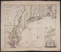
Beinecke Rare Book and Manuscript Library > A new map of Massachusetts State including Rhode Island and Connecticut .. revised by Osgood Carelton ... Boston.
Published / Created:
[1690?]
Call Number:
755 1690
Container / Volume:
BRBL_00424
Image Count:
1
Resource Type:
Maps, Atlases & Globes
Description:
Inset: Environs of New York City. and Negative on file.
Publisher:
Philip Lea,
Subject (Geographic):
East (U.S.)--Maps--Early works to 1800
Found in:
Beinecke Rare Book and Manuscript Library > A new map of New England, New York, New Jarsey, Pensilvania, Maryland and Virginia.
Call Number:
1976 1233
Collection Title:
Forty-two new maps of Asia, Africa, and America ... : all engrav’d, according to the latest
Image Count:
1
Alternative Title:
Newfoundland, New Scotland, &c
Description:
In pencil on verso: 38. and Table of contents for maps 2-20 in section "America" misnumbered.
Subject (Geographic):
New Brunswick --Maps, Newfoundland --Maps --Early works to 1800, and Nova Scotia --Maps --Early works to 1800
Subject (Name):
Nicholson, John, d. ca. 1717, bookseller
Subject (Topic):
Atlases --Early works to 1800
Collection Created:
London : Printed for J. Nicholson ..., 1716 ...
Found in:
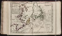
Beinecke Rare Book and Manuscript Library > A new map of Newfound land, New Scotland the isles of Breton, Anticoste, St, Iohns &c. together with the fishing bancks
Call Number:
1976 1233
Collection Title:
Forty-two new maps of Asia, Africa, and America ... : all engrav’d, according to the latest
Image Count:
1
Alternative Title:
North America
Description:
In pencil on verso: 34. and Table of contents for maps 2-20 in section "America" misnumbered.
Subject (Geographic):
North America --Maps --Early works to 1800
Subject (Name):
Nicholson, John, d. ca. 1717, bookseller
Subject (Topic):
Atlases --Early works to 1800
Collection Created:
London : Printed for J. Nicholson ..., 1716 ...
Found in:
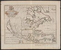
Beinecke Rare Book and Manuscript Library > A new map of North America according to the newest observations
Creator:
Published / Created:
between 1700 and 1722?]
Call Number:
71 1722
Container / Volume:
BRBL_00362
Image Count:
1
Resource Type:
Maps, Atlases & Globes
Description:
"Dedicated to His Highness William Duke of Glocester.", Dates inferred from variant listed in Tooley's Mapping of America, dated "[1700]" and variant in Phillips' Maps of America, described as in 1722 ed. of Wells' A new sett of maps., and Library's copy stampe
Publisher:
s.n.,
Subject (Geographic):
Caribbean Area--Maps--Early works to 1800 and North America--Maps--Early works to 1800
Subject (Name):
Burghers, M, University of Oxford, and Wells, Edward, 1667-1727. New sett of maps both of antient and present geography
Found in:
Beinecke Rare Book and Manuscript Library > A new map of North America shewing its principal divisions, chief cities, townes, rivers, mountains &c. / delin. M. Burg. ; sculpt. Univ. Oxon.
Branch:v1.61.8 ,Deployed:2024-06-20T11:15:04-04:00