Skip to search
Skip to main content
Skip to first result
Search
You Searched For
Resource Type
Maps, Atlases & Globes
Language
Latin
New Search
Search Results
Published / Created:
[1675?]
Call Number:
3332 1675
Container / Volume:
BRBL_00083
Image Count:
1
Resource Type:
Maps, Atlases & Globes
Subject (Geographic):
Netherlands--Maps--Early works to 1800
Found in:
Beinecke Rare Book and Manuscript Library > Comitatus Hollandiae Tabula Pluribus locis Recens emendata a Frederico de Wit.
Creator:
Published / Created:
ca. 1700?]
Call Number:
1973 Folio 18
Image Count:
1
Resource Type:
Maps, Atlases & Globes
Description:
"Cum privil.", "I. Bormeester, eccu.", Bar scales given in "Gemene Duÿtsche Mÿlen 15 in een Graedt" and "Uren gaens de 4 maken 3 Mÿlen"., BEIN 1973 Folio 18: Backed with paper. Ms. no. "41" in upper-right corner. Sheet measures 53.6 x 62.7 cm. No. 40 of 87 maps bound together., Inset: De resterende Eÿlanden van Hollant alhier bÿgevoecht., North oriented to the upper-right., Prime meridian: Ferro., Relief shown pictorially., and Title in Latin; place names in Dutch.
Publisher:
Petrum Schenk exc.,
Subject (Geographic):
Netherlands--Maps--Early works to 1800.
Subject (Name):
Bormeester, Joachim, engraver.
Found in:
Beinecke Rare Book and Manuscript Library > Comitatus Hollandiae tabula [cartographic material] / pluribus locis recens emendata a Francisco Caroli.
Published / Created:
[1650?]
Call Number:
364 1650
Container / Volume:
BRBL_00143
Image Count:
2
Resource Type:
Maps, Atlases & Globes
Description:
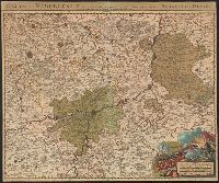
Inset: Ravensberg Comitatus ca. 1:600,000. and Verso: Text.
Subject (Geographic):
North-Rhine-Westphalia (Germany)--Maps--Early works to 1800
Found in:
Beinecke Rare Book and Manuscript Library > Comitatus Marchia et Ravensberg.
Published / Created:
1712
Call Number:
3366 1712
Container / Volume:
BRBL_00089
Image Count:
1
Resource Type:
Maps, Atlases & Globes
Description:
Preliminary record.
Publisher:
Jean Cóvens et Corneille Mortier,
Subject (Geographic):
Namur (Belgium)--Maps--Early works to 1800
Found in:
Beinecke Rare Book and Manuscript Library > Comitatus Namurcensis cum Finitimis Regionibus ad Usum Serenissimi Burgundiae Ducis.
Published / Created:
[1580?]
Call Number:
3247 1580
Container / Volume:
BRBL_00066
Image Count:
2
Resource Type:
Maps, Atlases & Globes
Subject (Geographic):
England--Maps--Early works to 1800
Found in:
Beinecke Rare Book and Manuscript Library > Comitatus Northantonensis vernacule Northamtonshire.
Published / Created:
1690?]
Call Number:
3251 1690
Container / Volume:
BRBL_00067
Image Count:
1
Resource Type:
Maps, Atlases & Globes
Description:
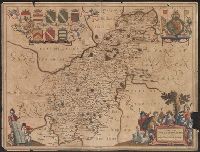
Preliminary record.
Subject (Geographic):
Rutland (England)--Maps--Early works to 1800
Found in:
Beinecke Rare Book and Manuscript Library > Comitatus Rotelandiae Tabula Nova & Aucta.
Published / Created:
[1700?]
Call Number:
3887 1700
Image Count:
2
Resource Type:
Maps, Atlases & Globes
Description:
Verso: Text.
Subject (Geographic):
Pyrénées-Orientales (France)--Maps--Early works to 1800
Found in:
Beinecke Rare Book and Manuscript Library > Comitatus Ruscinonis Vulgo Roussilon in quo Episcopatus Helenensis, Gallici Evesché d'Esne ou de Perpignan.
Creator:
Published / Created:
[before 1724?]
Call Number:
BrSides Double Folio 2019 42
Image Count:
1
Resource Type:
Maps, Atlases & Globes
Description:
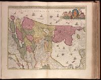
Bar scales given in "mill. Germanica," "mill. Gallica," and "mill. Italica.", Imperfect: torn along bottom fold, with no loss of text. Watermark. Manuscript number in right corner. From the Karpinski-von Wieser Map Collection., Includes illustration "Die Vestung Kofel.", Relief shown pictorially., and With privilege statement, "Cum privilegio Sac. Cas. Maj." at bottom of cartouche.
Publisher:
[Johann Baptist Homann],
Subject (Geographic):
Tyrol (Austria)--Maps--Early works to 1800.
Found in:
Beinecke Rare Book and Manuscript Library > Comitatus principalis Tirolis : in quo Episc. Tridentin[us] et Brixensis, Comitatus Brigantinus, Feldkirchiae Sonnebergae et Pludentii accuratè exhibentur / editore Ioh. Baptista Homanno, Sacrae Caes. Majestatis Geographo.
Creator:
Published / Created:
[after 1724]
Call Number:
428 1720
Container / Volume:
BRBL_00247
Image Count:
1
Resource Type:
Maps, Atlases & Globes
Description:
Bar scales given in "mill. Germanica," "mill. Gallica," and "mill. Italica.", Includes illustration "Die Vestung Kofel.", Ms. no. on verso: LII. Sheet measures 53 x 65.4 cm., and Relief shown pictorially.
Publisher:
[Johann Baptist Homann],
Subject (Geographic):
Tyrol (Austria)--Maps--Early works to 1800
Found in:
Beinecke Rare Book and Manuscript Library > Comitatus principalis Tirolis : in quo Episc. Tridentin[us] et Brixensis, Comitatus Brigantinus, Feldkirchiae Sonnebergae et Pludentii accuratè exhibentur / editore Ioh. Baptista Homanno, Sacrae Caes. Majestatis Geographo.
Published / Created:
[1635?]
Call Number:
3825 1635
Container / Volume:
BRBL_00176
Image Count:
2
Resource Type:
Maps, Atlases & Globes
Description:
Verso: Text.
Publisher:
G. Blaeu,
Subject (Geographic):
Artois (France)--Maps--Early works to 1800
Found in:
Beinecke Rare Book and Manuscript Library > Comitatuum Boloniae et Guines descriptio.
Branch:v1.64.3 ,Deployed:2024-09-25T10:53:04-04:00