Search
You Searched For
Search Results
- Published / Created:
- [1724?]
- Call Number:
- 2003 +64
- Collection Title:
- Papers relating to an act of the Assembly of the province of New-York, for encouragement of the
- Image Count:
- 1
- Found in:
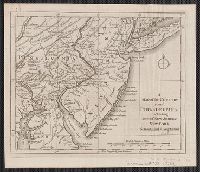
- Beinecke Rare Book and Manuscript Library > A map of the countrey of the Five Nations belonging to the province of New York and of the lakes near which the nations of far Indians live with part of Canada taken from the map of the Louisiane done by Mr. DeLisle in 1718
- Published / Created:
- 1853
- Call Number:
- 783.9643821
- Container / Volume:
- BRBL_00508
- Image Count:
- 1
- Resource Type:
- Maps, Atlases & Globes
- Found in:
- Beinecke Rare Book and Manuscript Library > A map of the country between Albemarle Sound, and Lake Erie, comprehending the whole of Virginia, Maryland, Delaware and Pensylvania, with parts of several other of the United States of America / engraved for Jefferson's notes on Virginia, London, 1787.
- Creator:
- Phillips, R. (Richard), Sir, 1767-1840
- Published / Created:
- [1806]
- Call Number:
- BrSides Folio 2017 61
- Image Count:
- 1
- Resource Type:
- Maps, Atlases & Globes
- Found in:
- Beinecke Rare Book and Manuscript Library > A map of the country from Rariton River in East Jersey, to Elk Head in Maryland [cartographic material] : shewing the several operations of the American & British armies, in 1776 & 1777 / Neele sc., Strand.
- Published / Created:
- 1780
- Call Number:
- 76hc 1777
- Container / Volume:
- BRBL_00446A
- Image Count:
- 1
- Resource Type:
- Maps, Atlases & Globes
- Found in:
- Beinecke Rare Book and Manuscript Library > A map of the country in wich the army under Lt. General Burgoyne acted in the campaing of 1777, shewing the marches of the army & the places of the principal actions.
- Published / Created:
- 1776]
- Call Number:
- 755 1776R
- Container / Volume:
- BRBL_00728
- Image Count:
- 1
- Resource Type:
- Maps, Atlases & Globes
- Found in:
- Beinecke Rare Book and Manuscript Library > A map of the country round Philadelphia : including part of New Jersey, New York, Staten Island & Long Island.
- Published / Created:
- 1696?]
- Call Number:
- 3225 1696
- Container / Volume:
- BRBL_00060
- Image Count:
- 1
- Resource Type:
- Maps, Atlases & Globes
- Found in:
- Beinecke Rare Book and Manuscript Library > A map of the county of Essex ... by John Oliver.
- Creator:
- L'Isle, Guillaume de, 1675-1726
- Published / Created:
- [1720?]
- Call Number:
- 3826 1710
- Container / Volume:
- BRBL_00684
- Image Count:
- 1
- Resource Type:
- Maps, Atlases & Globes
- Found in:
- Beinecke Rare Book and Manuscript Library > A map of the county of Flanders / [cartographic material] / by William de l'Isle ...
- Published / Created:
- [1772?]
- Call Number:
- 23 1772B
- Container / Volume:
- BRBL_00018
- Image Count:
- 1
- Resource Type:
- Maps, Atlases & Globes
- Found in:
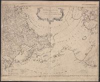
- Beinecke Rare Book and Manuscript Library > A map of the discoveries made by the Russians on the North West Coast of America. London, Printed for John Bowles ... & Carington ...
- Published / Created:
- 1771
- Call Number:
- 23 1771
- Container / Volume:
- BRBL_00018
- Image Count:
- 1
- Resource Type:
- Maps, Atlases & Globes
- Found in:
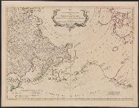
- Beinecke Rare Book and Manuscript Library > A map of the discoveries made by the Russians on the north west coast of America ... London, Printed for Carington Bowles ...
- Published / Created:
- [1761]
- Call Number:
- 23 1761
- Container / Volume:
- BRBL_00018
- Image Count:
- 1
- Resource Type:
- Maps, Atlases & Globes
- Found in:
- Beinecke Rare Book and Manuscript Library > A map of the discoveries made by the Russians on the north west coast of America. Published by the Royal Academy of Sciences at Petersburg.