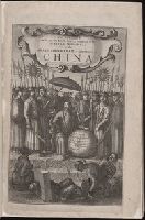
Embassy from the East India Company of the United Provinces to the Grand Tartar Cham, emperor of China. and Gezantschap der Neerlandtsche Oost-Indische Compagnie aan den grooten Tartarischen Cham, den tegenwoordigen Keizer van China. English
Description:
Added engraved t.p., Errors in paging: 185-204 omitted in numbering., and Imperfect: t.p. trimmed and mounted.
Publisher:
Printed by John Macock for the author,
Subject (Geographic):
China--Description and travel., China--History--Early works to 1800., and China--Politics and government--Early works to 1800.
Subject (Name):
Goyer, Pieter de., Keizer, Jacob de., Kircher, Athanasius, 1602-1680. China monumentis qua sacris qua profanis. English., Nederlandsche Oost-Indische Compagnie., Ogilby, John, 1600-1676., and Schall von Bell, Johann Adam, 1592?-1666.
Bat. cum Privil. Ordin. Gener, Belgii Faederati--Title cartouche., Features include ornate title cartouche (top left) with cherubs, male and female figures and royal coat-of-arms supported by lion and unicorn, arms of Scotland supported by cherubs (above scale cartouche at top right), compass indicator and coasts shaded outwards., In Latin with some place names in English; explanations and title for index to places in Dutch and English., No. 7 of 69 maps bound together in composite atlas., Relief shown pictorially., Scale [ca. 1:960 000]., Scale statement reads: Milliaria Germanica Communia 15 in uno Gradu, with scale bar graded [0]-10; Milliaria Scotica Communia quorum 50 in uno Gradu, with scale bar graded [0]-34; Milliaria Gallica quae et Horae Itineris 20 in uno Gradu, with scale bar graded [0]-14., Shows grid, rivers and tributaries, lochs (shaded), trees, place and county names, settlements (symbols classified by importance in legend), territorial boundaries., Shows Scotland including the Hebrides and Orkney Islands., and The four cardinal points are written in the borders.
Descriptio ac delineatio geographica detectionis freti, sive, transitus ad occasum supra terras
Image Count:
1
Abstract:
Map depicts the Coat of Arms of the United Kingdom (era of the Union of the Crowns), reigning between the years 1603-1707.
Alternative Title:
Tabula nautica, qua repraesentantur orae maritimae, meatus, ac freta, noviter a H. Hudsono Anglo ad Caurum supra Novam Franciam
Description:
Bound in after p. [2]., In pencil on recto: 170., Map cut and folded irregularly., Map has multiple small stains on both the recto and verso., and Scale [ca. 1:9,000,000].
Charts and title pages in English, text in Dutch., Map oriented with North at bottom left., and Volvelle on p. [17].
Publisher:
Jodocus Hondius excudit,
Subject (Geographic):
Europe --Maps --Early works to 1800, Great Britain --Maps --Early works to 1800, Netherlands --Maps --Early works to 1800, and North Sea --Maps --Early works to 1800