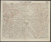
Germany. Heer. Abteilung für Kriegskarten- und Vermessungswesen. IV. Mil.-Geo
Published / Created:
1941
Call Number:
329 T14 1941
Container / Volume:
BRBL_00074
Image Count:
2
Resource Type:
Maps, Atlases & Globes
Alternative Title:
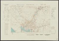
England 1:10 000 ; GB 7, BB 26c, 26d and Stadtplan von Aberavon-Port Talbot mit Mil.-Geo.-Eintragungen
Description:
"Militärgeogr. Angaben nach den bis zum 30. XI. 1941 vorhandenen Unterlagen.", Relief shown by contours and spot heights., and Shows features of military interest.
Publisher:
Generalstab des Heeres, Abteilung für Kriegskarten u. Vermessungswesen (IV. Mil.-Geo.),
Subject (Geographic):
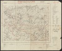
Aberavon (Wales)--Maps and Port Talbot (Wales)--Maps
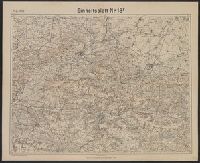
Germany. Heer. Abteilung für Kriegskarten- und Vermessungswesen II
Published / Created:
1941
Call Number:
329 C17 1941
Container / Volume:
BRBL_00074
Image Count:
3
Resource Type:
Maps, Atlases & Globes
Alternative Title:
England 1:10 000 ; GB 7, BB 32a, 32b, 32c and Stadtplan von Cardiff mit Mil.-Geo.-Eintragungen
Description:
"Militärgeogr. Angaben nach den bis zum 30. XI. 1941 vorhandenen Unterlagen.", Relief shown by hachures and spot heights., and Shows features of military interest.
Publisher:
Generalstab des Heeres, Abteilung für Kriegskarten- u. Vermessungswesen (II),
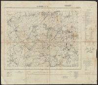
"Die braunen Schichtlinien umgrenzen Stufen von 10 meter Höhen-Abstand.", "Febr.1918." above upper left margin., "Kartographische Abteilung d. Kgl. Preuβ. Landesaufnahme.", German and French., Includes index of connecting sheets., and Shows area surrounding St. Q
"Die braunen Schichtlinien umgrenzen Stufen von 10 meter Höhen-Abstand.", "Febr.1918." above upper left margin., "Kartographische Abteilung d. Kgl. Preuβ. Landesaufnahme.", German, Includes index of connecting sheets., and Shows area surrounding Soissons, France.
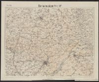
"April.1918." above upper left margin., "Die braunen Schichtlinien umgrenzen Stufen von 10 meter Höhen-Abstand.", "Kartographische Abteilung d. Kgl. Preuβ. Landesaufnahme.", German and French., Includes index of connecting sheets., and Shows area surrounding Chal
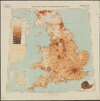
Germany. Heer. Abteilung für Kriegskarten- und Vermessungswesen. IV. Mil.-Geo Great Britain. Ordnance Survey
Published / Created:
1940
Call Number:
32eb 1940
Container / Volume:
BRBL_00075
Image Count:
1
Resource Type:
Maps, Atlases & Globes
Description:
Based on Ordnance Survey map of 1934, from 1931 census., Includes insets of London County, and county boundaries., Population density shown by layer coloring., and Relief shown by spot heights.
Publisher:
Generalstab des Heeres, Abteilung für Kriegskarten- und Vermessungswesen (Mil.-Geo.),