Search
You Searched For
Search Results
- Creator:
- Wilson, A. D. (Allen D.)
- Published / Created:
- 1882
- Call Number:
- 847 Y12 1882A
- Container / Volume:
- BRBL_00627
- Image Count:
- 2
- Resource Type:
- Maps, Atlases & Globes
- Found in:
- Beinecke Rare Book and Manuscript Library > Map of Yakima Region, Washington Ter. / Northern Transcontinental Survey, Raphael Pumpelly, director ; A.D. Wilson, chief topographer ; R.U. Goode, topographer ; Frank Tweedy, Asst. ; Fred D. Owen, chief draughtsman.
- Creator:
- British Columbia. Dept. of Lands and Works
- Published / Created:
- 1903
- Call Number:
- 739 Y12 1903
- Container / Volume:
- BRBL_00391
- Image Count:
- 1
- Resource Type:
- Maps, Atlases & Globes
- Found in:
- Beinecke Rare Book and Manuscript Library > Map of Yale district and portion of adjacent districts, British Columbia / compiled and drawn in the Lands and Works Department, Victoria, B.C.
- Creator:
- Canada. Dept. of the Interior
- Published / Created:
- 1921
- Call Number:
- 739fcm 1921
- Container / Volume:
- BRBL_00391
- Image Count:
- 1
- Resource Type:
- Maps, Atlases & Globes
- Found in:
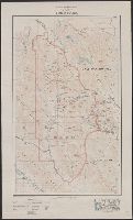
- Beinecke Rare Book and Manuscript Library > Map of Yoho Park [cartographic material].
- Published / Created:
- [1947?]
- Call Number:
- 844 Y78 1947
- Container / Volume:
- BRBL_00611
- Image Count:
- 2
- Resource Type:
- Maps, Atlases & Globes
- Found in:
- Beinecke Rare Book and Manuscript Library > Map of Yolo County, California / compiled with the cooperation of the Yolo County, Davis, and Winters Chambers of Commerce and those represented in this folder.
- Published / Created:
- 1872
- Call Number:
- 761 Y82 1872
- Container / Volume:
- BRBL_00449
- Image Count:
- 2
- Resource Type:
- Maps, Atlases & Globes
- Found in:
- Beinecke Rare Book and Manuscript Library > Map of York Co. Maine.
- Published / Created:
- [1400?]
- Call Number:
- 32 1400
- Container / Volume:
- BRBL_00042
- Image Count:
- 2
- Resource Type:
- Maps, Atlases & Globes
- Found in:
- Beinecke Rare Book and Manuscript Library > Map of York, Shrewesbury, Lancaster, Richmond.
- Creator:
- Geological Survey (U.S.)
- Published / Created:
- 1909
- Call Number:
- 844fcm Y83 1909
- Container / Volume:
- BRBL_00615
- Image Count:
- 1
- Resource Type:
- Maps, Atlases & Globes
- Found in:
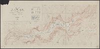
- Beinecke Rare Book and Manuscript Library > Map of Yosemite Valley, Mariposa County, California / U.S. Geological Survey, George Otis Smith, Director ; E.M. Douglas, geographer ; State of California, George C. Pardee, Govenor.
- Creator:
- Geological Survey (U.S.)
- Published / Created:
- [1918]
- Call Number:
- 844fcm Y83 1918
- Container / Volume:
- BRBL_00615
- Image Count:
- 1
- Resource Type:
- Maps, Atlases & Globes
- Found in:
- Beinecke Rare Book and Manuscript Library > Map of Yosemite Valley, Yosemite National Park, California, Mariposa County / U.S. Geological Survey ; State of California ; E.M. Douglas, geographer ; R.B. Marshall, in charge of section ; topography by F.E. Matthes ; triangulation by C.F. Urquhart.
- Creator:
- Texas. General Land Office
- Published / Created:
- March 1898.
- Call Number:
- 796 Y68 1898
- Container / Volume:
- BRBL_00528
- Image Count:
- 1
- Resource Type:
- Maps, Atlases & Globes
- Found in:
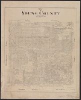
- Beinecke Rare Book and Manuscript Library > Map of Young County / litg. Geo. D. Barnard & Co.
- Creator:
- Canada. Department of the Interior
- Published / Created:
- 1903
- Call Number:
- 741 1903
- Container / Volume:
- BRBL_00395
- Image Count:
- 1
- Resource Type:
- Maps, Atlases & Globes
- Found in:
- Beinecke Rare Book and Manuscript Library > Map of Yukon District [cartographic material] : with the adjacent northern part of British Columbia.