Skip to search
Skip to main content
Skip to first result
Search
You Searched For
Extent of Digitization
Completely digitized
Repository
Beinecke Rare Book and Manuscript Library
Publication Place
London :
New Search
Search Results
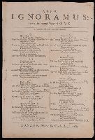
Published / Created:
1681
Call Number:
BrSides By6 1681
Image Count:
1
Description:
A reply to Ignoramus: an excellent new song ... 1681., Printed in 2 columns., and Reprinted in Roxburghe ballads, v. 5, p. 202-203.
Publisher:
Printed for Charles Leigh,
Subject (Name):
Shaftesbury, Anthony Ashley Cooper,--Earl of,--1621-1683
Subject (Topic):
Brit Tracts--1681 and Popish Plot, 1678
Found in:
Beinecke Rare Book and Manuscript Library > A New ignoramus being the second new song, to the same old tune, Law lyes a bleeding.
Published / Created:
1811
Call Number:
319 1811
Container / Volume:
BRBL_00040
Image Count:
1
Resource Type:
Maps, Atlases & Globes
Description:
Preliminary record.
Publisher:
J. Cary,
Subject (Geographic):
British Isles--Maps
Found in:
Beinecke Rare Book and Manuscript Library > A New map of the British Isles ... By John Cary, Engraver.
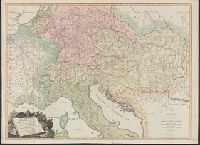
Published / Created:
1793
Call Number:
304gmd 1793
Container / Volume:
BRBL_00034B
Image Count:
1
Resource Type:
Maps, Atlases & Globes
Description:
Preliminary record.
Publisher:
Robert Sayer,
Subject (Geographic):
Europe,Central--Maps--Early works to 1800
Found in:
Beinecke Rare Book and Manuscript Library > A New map of the Emperor's Dominions exhibiting the Post Roads of Germany, Hungary, and the Netherlands ... parts of France, Italy, Switzerland and Poland ...
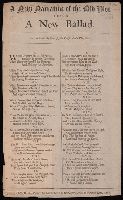
Published / Created:
1683
Call Number:
BrSides By6 1683
Image Count:
1
Description:
Begins: "When traytors did at pop'ry rail."
Publisher:
Printed for Charles Corbet at Oxford-Arms in Warwick-lane,
Subject (Topic):
Brit tracts--1683 and Popish Plot, 1678
Found in:
Beinecke Rare Book and Manuscript Library > A New narrative of the old plot : being a new ballad, to the tune of, Some say the papists had a plot, &c ...
Published / Created:
1828
Call Number:
38GMD 1828
Container / Volume:
BRBL_00171
Image Count:
1
Resource Type:
Maps, Atlases & Globes
Description:
Inset: Corsica. and Preliminary record.
Publisher:
C. Smith,
Subject (Geographic):
France--Maps
Found in:
Beinecke Rare Book and Manuscript Library > A Physical and Topographical map of France ... the post Roads & Relays ... inland Navigation &c. Pickett Sculp. J. Smith Delin.
Published / Created:
1776
Call Number:
792cea Am32 1776
Container / Volume:
BRBL_00519
Image Count:
1
Resource Type:
Maps, Atlases & Globes
Description:
From the North American Pilot 1783.
Publisher:
R. Sayer & J. Bennett,
Subject (Geographic):
Florida--Maps--Early works to 1800
Found in:
Beinecke Rare Book and Manuscript Library > A Plan of Amelia Harbour and Barr in east Florida ...
Published / Created:
1776
Call Number:
786cea P838 1776
Container / Volume:
BRBL_00516
Image Count:
1
Resource Type:
Maps, Atlases & Globes
Description:
From the North America Pilot 1783.
Publisher:
R. Sayer & J. Bennett,
Subject (Geographic):
Port Royal (S.C.)--Maps--Early works to 1800
Found in:
Beinecke Rare Book and Manuscript Library > A Plan of Port Royal in South Carolina ...
Published / Created:
1755
Call Number:
97 L62 1755
Container / Volume:
BRBL_00678
Image Count:
1
Resource Type:
Maps, Atlases & Globes
Publisher:
John Rocque,
Subject (Geographic):
Lima (Peru)--Maps--Early works to 1800
Found in:
Beinecke Rare Book and Manuscript Library > A Scenographic Plan of the City of the Kings, otherwise called Lima, the capital of the Kingdonm of Peru ... as it was before the late earthquakes.
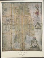
Creator:
Published / Created:
1983
Call Number:
32 L84 1694/1983
Container / Volume:
BRBL_00739
Image Count:
2
Resource Type:
Maps, Atlases & Globes
Alternative Title:
Publication (London Topographical Society) ; no. 128., Publication ; no. 128, and Suruey of Hatton-Garden belonging to ye Right Hon'b. Christopher, Lord Viscount Hatton of Gretton, Barron Hatton of Kirby.
Description:
Accompanied by text: The survey of Hatton Garden in 1694 by Abraham Arlidge / PS Hunting ([1] leaf ; 27 x 21 cm.)., Facsim. of ms. cadastral map showing buildings, lot numbers, and householders' names., and Includes indexes of householders' names and coat of arms.
Publisher:
London Topographical Society,
Subject (Geographic):
Hatton Garden (London, England)--Maps--Early works to 1800
Subject (Topic):
Early maps--Facsimiles and Real property--England--Hatton Garden (London)--Maps--Early works to 1800
Found in:
Beinecke Rare Book and Manuscript Library > A Survey of Hatton Garden : a suruey of Hatton-Garden belonging to ... Barron Hatton of Kirby / by Abraham Arlidge.
Published / Created:
1776
Call Number:
771 C358 1776C
Container / Volume:
BRBL_00482
Image Count:
1
Resource Type:
Maps, Atlases & Globes
Description:
Inset: A particular plan of Lake George. Surveyed in 1756 by Capt. Jackson. Scale [ca. 1:150 000].
Publisher:
Robt. Sayer & Jno. Bennett,
Subject (Geographic):
Champlain, Lake--Maps--Early works to 1800 and New York (State)--Maps--Early works to 1800
Subject (Name):
Robert Sayer and John Bennett (Firm)
Found in:
Beinecke Rare Book and Manuscript Library > A Survey of Lake Champlain including Lake George, Crown Point, and St. John ... by William Brassier, Draughtsman. 1762.
Branch:v1.64.0 ,Deployed:2024-09-11T10:25:40-04:00