Skip to search
Skip to main content
Skip to first result
Search
You Searched For
Genre
Maps
New Search
Search Results
Published / Created:
1896
Call Number:
32 Al23 1896
Container / Volume:
BRBL_00046
Image Count:
1
Resource Type:
Maps, Atlases & Globes
Publisher:
Ordnance Survey,]
Subject (Geographic):
Aldershot (England)--Maps
Found in:
Beinecke Rare Book and Manuscript Library > Aldershot District Maneuver Map.
Call Number:
1977 +392
Collection Title:
A survey of the cities of London and Westminster : containing the original, antiquity, increase
Image Count:
1
Resource Type:
Maps, Atlases & Globes
Description:
Plate between p. 54-55.
Subject (Geographic):
London (England)--History
Collection Created:
London : Printed for A. Churchill, J. Knapton, R. Knaplock, J. Walthoe [and 6 others], 1720
Found in:
Beinecke Rare Book and Manuscript Library > Aldgate Ward with its division into parishes. Taken from the last survey, with corrections & additions
Published / Created:
[1640?]
Call Number:
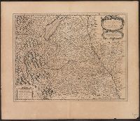
3627 Sw12 1630A
Container / Volume:
BRBL_00140
Image Count:
2
Resource Type:
Maps, Atlases & Globes
Description:
Verso: Text.
Subject (Geographic):
Swabia (Germany)--Maps--Early works to 1800
Found in:
Beinecke Rare Book and Manuscript Library > Alemannia sine Suevia Superior. A Christophoro Hurtero.
Creator:
Published / Created:
ca. 1662?]
Call Number:
53 1662
Container / Volume:
BRBL_00283
Image Count:
2
Resource Type:
Maps, Atlases & Globes
Description:
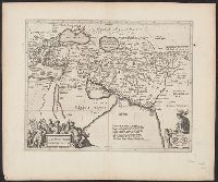
From: Nieuwen atlas ... Amstelodami : Apud Ioannem Ianssonium, [1662?]., Relief shown pictorially., Sheet measures 50 x 60 cm., and Verso: Text in Latin, with signature 3Q.
Publisher:
Jan Jansson,
Subject (Geographic):
Middle East--Maps--Early works to 1800
Subject (Name):
Jansson, Jan, 1588-1664. Atlas novus. Dutch
Found in:
Beinecke Rare Book and Manuscript Library > Alexandri Magni Macedonis expeditio.
Creator:
Published / Created:
1943
Call Number:
39 Al42 1943
Container / Volume:
BRBL_00189
Image Count:
1
Resource Type:
Maps, Atlases & Globes
Alternative Title:
[Series] M981 and A.M.S. M981
Description:
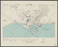
"Copied from I. S. I. S. report, 1:10,000, Alicante, CB 1811, no. 19, 1942.", At head of title: Spain 1:10,000., Military grid., and Some streets and buildings are named.
Subject (Geographic):
Alicante (Spain)--Maps
Found in:
Beinecke Rare Book and Manuscript Library > Alicante [cartographic material] : city plan.
Published / Created:
1918
Call Number:
774 P53 1918
Container / Volume:
BRBL_00500
Image Count:
2
Resource Type:
Maps, Atlases & Globes
Description:
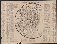
Round map with legend showing 150 mile diam. around Philadelphia. and Text detailing driving distances between cities and travel stops enroute.
Publisher:
George D. Proud ,
Subject (Geographic):
Philadelphia (Pennsylvania)--Maps and Wilmington (Delaware)--Maps
Found in:
Beinecke Rare Book and Manuscript Library > All roads lead to Hotel DuPont, Wilmington, Del.
Published / Created:
[1874?].
Call Number:
75gma 1874
Container / Volume:
BRBL_00411
Image Count:
1
Resource Type:
Maps, Atlases & Globes
Publisher:
Rand, McNally & Co.,
Subject (Geographic):
United States--Maps
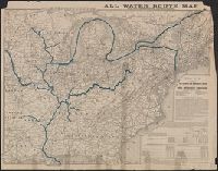
Found in:
Beinecke Rare Book and Manuscript Library > All water route map from the Mississippi to the Eastern Atlantic / [Printed for] The Illinois and Mississippi River and Canal Improvement Commission, Davenport, Iowa.
Creator:
Published / Created:
c1895.
Call Number:
771 Al52 1895
Container / Volume:
BRBL_00480
Image Count:
1
Resource Type:
Maps, Atlases & Globes
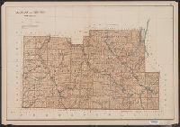
Description:
"Copyright 1895, Julius Bien & Company N.Y.", From: Atlas of the state of New York. New York : Julius Bien & Co., 1895., Maps prepared by Joseph Bien., Relief shown by spot heights., and Shows roads, railroads, settlements, original patents, towns, Oil Spring Res
Publisher:
Julius Bien & Co.,
Subject (Geographic):
Allegany County (N.Y.)--Maps and Steuben County (N.Y.)--Maps
Subject (Name):
Bien, Joseph R. Atlas of the state of New York and Julius Bien & Co
Subject (Topic):
Land grants--New York (State)--Allegany County--Maps and Land grants--New York (State)--Steuben County--Maps
Found in:
Beinecke Rare Book and Manuscript Library > Allegany and Steuben counties.
Published / Created:
1815
Call Number:
11 1818
Container / Volume:
BRBL_00007
Image Count:
1
Resource Type:
Maps, Atlases & Globes
Description:
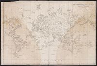
Preliminary record.
Subject (Geographic):
World--maps
Found in:
Beinecke Rare Book and Manuscript Library > Allgemeine Welt Charte nach Mercators Projection Entworfen von A.I. Krusenstern, Capitain der Russischen Marine. I. Walker, sculp. Verhessert bis zum 1818.
Creator:
Published / Created:
[1941] :
Call Number:
36hc 1941
Container / Volume:
BRBL_00134
Image Count:
1
Resource Type:
Maps, Atlases & Globes
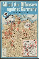
Description:
"51-8502.", Copy 1: Variant with Ruhr region in main map outlined in red., and Includes inset of the Ruhr region.
Publisher:
H.M. Stationery Office,
Subject (Topic):
World War, 1939-1945--Germany--Maps
Found in:
Beinecke Rare Book and Manuscript Library > Allied air offensive against Germany : up to January 1st, 1941.
Branch:v1.61.6 ,Deployed:2024-06-12T09:55:36-04:00