Great Britain. War Office. General Staff. Geographical Section
Published / Created:
1918
Call Number:
36ed 1918
Container / Volume:
BRBL_00127
Image Count:
2
Resource Type:
Maps, Atlases & Globes
Alternative Title:
GSGS (Series) ; 3703a. and GSGS ; 3703a
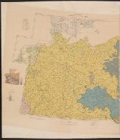
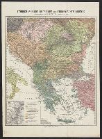
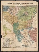
Description:
Germany -- Poland -- Northern Italy -- South east Europe., Imperfect: sheets northern Italy and southeast Europe wanting. Ms. annotations on map., and Insets: Density of population.
Publisher:
War Office,
Subject (Geographic):
Balkan Peninsula--Maps, Germany--Maps, Italy, Northern--Maps, and Poland--Maps
Ms. notes in red and yellow ink, outlining "Ceded Territory," and areas inhabited by different ethnic groups. "Ceded Territory" may refer to lands acquired by Russia at the end of the Russo-Turkish War of 1877-1878.
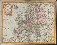
L'Isle, Guillaume de, 1675-1726 Lotter, Tobias Conrad, 1717-1777
Published / Created:
176-?]
Call Number:
30 1720A
Container / Volume:
BRBL_00029
Image Count:
1
Resource Type:
Maps, Atlases & Globes
Description:
Cartouche with Apollo and Athena at bottom., Includes eight bar scales., Prime meridian: Ferro., Relief shown pictorially., and Sheet measures 48.5 x 61.6 cm.