Skip to search
Skip to main content
Skip to first result
Search
You Searched For
Resource Type
Maps, Atlases & Globes
Publication Place
London :
New Search
Search Results
Published / Created:
1858
Call Number:
32 L84 1858A
Container / Volume:
BRBL_00050
Image Count:
1
Resource Type:
Maps, Atlases & Globes
Publisher:
Jas. Wyld,
Subject (Geographic):
London (England)--Maps
Found in:
Beinecke Rare Book and Manuscript Library > Wyld's new plan of London for 1858.
Published / Created:
[1845?]
Call Number:
530 No. 12
Container / Volume:
BRBL_00287
Image Count:
1
Resource Type:
Maps, Atlases & Globes
Publisher:
C. Knight,
Subject (Geographic):
Middle East--Maps
Found in:
Beinecke Rare Book and Manuscript Library > [Ancient Near East] Asia Minor Antiqua by William Henry Francis Plate L.L.D. ... J. & C. Walker, Sculp.
Published / Created:
[19--?]
Call Number:
32 L84 1900
Container / Volume:
BRBL_00051
Image Count:
5
Resource Type:
Maps, Atlases & Globes
Publisher:
G.W. Bacon & Co. Ltd.,
Subject (Geographic):
London (England)--Maps
Found in:
Beinecke Rare Book and Manuscript Library > [Map of London and Environs].
Call Number:
11ba 1915
Container / Volume:
BRBL_00010A
Image Count:
1
Resource Type:
Maps, Atlases & Globes
Description:
Sectional globe, showing steamship routes and transcontinental railways.
Publisher:
London Geographical Institute
Subject (Geographic):
World--maps
Found in:
Beinecke Rare Book and Manuscript Library > [Philips' 12 inch terrestrial globe.]
Published / Created:
1915
Call Number:
11ba 1915A
Container / Volume:
BRBL_00010A
Image Count:
1
Resource Type:
Maps, Atlases & Globes
Description:
Shows sectional globe.
Publisher:
George Philip & Son, Ltd.,
Subject (Geographic):
World--maps
Found in:
Beinecke Rare Book and Manuscript Library > [Philips' 4 inch graphic globe.]
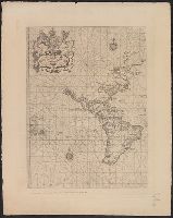
Published / Created:
1825
Call Number:
23cea 1825A
Container / Volume:
BRBL_00021
Image Count:
2
Resource Type:
Maps, Atlases & Globes
Description:
Insets: Honoruru or Fair Haven; Karakakooa Bay; chart of Sandwich Islands; Port Sn. Diego; the entrance of San Francisco Harbor. and Preliminary record.
Publisher:
J.W. Norie & Co.,
Subject (Geographic):
Pacific Ocean--Maps
Found in:
Beinecke Rare Book and Manuscript Library > [Two charts of the Pacific Ocean, showing the Northwestern America and Sandwich Islands and ports].
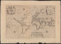
Published / Created:
March 1880.
Call Number:
11 1584
Container / Volume:
BRBL_00722
Image Count:
2
Resource Type:
Maps, Atlases & Globes
Alternative Title:
The Wright-Molineaux world map.
Description:
"The Typographic Etching Company Photo sc. ... ", Facsimile of original from "The Principal Navigators, Voyages ... " by Richard Hakluyt, London, 1599., and The so-called Wright-Molineaux anonymous world map, London, 1600.
Publisher:
The Hakluyt Society ... ,
Subject (Topic):
Maps--Facsimiles and World maps--Early works to 1800--Facsimiles
Found in:
Beinecke Rare Book and Manuscript Library > [World map].
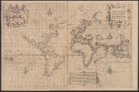
Published / Created:
March 1880.
Call Number:
11 1600
Container / Volume:
BRBL_00002
Image Count:
1
Resource Type:
Maps, Atlases & Globes
Alternative Title:
The Wright-Molineaux world map.
Description:
"The Typographic Etching Company Photo sc. ... ", Facsimile of original from "The Principal Navigators, Voyages ... " by Richard Hakluyt, London, 1599., and Preliminary record.
Publisher:
The Hakluyt Society ... ,
Subject (Topic):
Maps--Facsimiles and World maps--Early works to 1800--Facsimiles
Found in:
Beinecke Rare Book and Manuscript Library > [World map].
Published / Created:
March 1880.
Call Number:
11 1600
Image Count:
1
Resource Type:
Maps, Atlases & Globes
Alternative Title:
The Wright-Molineaux world map.
Description:
"The Typographic Etching Company Photo sc. ... ", Facsimile of original from "The Principal Navigators, Voyages ... " by Richard Hakluyt, London, 1599., and Preliminary record.
Publisher:
The Hakluyt Society ... ,
Subject (Topic):
Maps--Facsimiles and World maps--Early works to 1800--Facsimiles
Found in:
Beinecke Rare Book and Manuscript Library > [World map].
Branch:v1.61.6 ,Deployed:2024-06-12T09:55:36-04:00