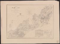
"Engd. by A. Petersen & E.A. Maedel" lower right and MUDDGDC T 11.1:857/(I).8: "No.10" printed outside upper left margin. "Transferred & printed by Lang & Lang, Lith. 66 Fulton St., N.Y." printed outside upper right margin; otherwise identical to 764cea 1857.
Publisher:
U.S. Coast Survey,
Subject (Geographic):
Woods Hole (Mass.)--Maps
Subject (Topic):
Harbors--Massachusetts--Woods Hole--Maps and Nautical charts--Massachusetts--Woods Hole
Mitchell, John Murray, 1858-1905 Norris Peters Co United States. Hydrographic Office
Published / Created:
[1896?]
Call Number:
231 1896
Container / Volume:
BRBL_00020
Image Count:
1
Resource Type:
Maps, Atlases & Globes
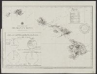
Alternative Title:
North Pacific Ocean, the Hawaiian Islands
Description:
"The Norris P, At head of title: North Pacific Ocean., Includes chart showing trade of the United States with the Hawaiian Islands in 1896, and table of distances from Honolulu to various cities on the Pacific Rim., and Manuscript annotations on verso.
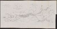
"Outline drawn and corrected from Greenleaf's state map of Maine by Lieuts. Ward and Cooper.", Top left corner: "Doc. 144.", and With north oriented towards the right.
Publisher:
[United States Army Corps of Engineers],
Subject (Geographic):
Kennebec River (Me.)--Maps
Subject (Name):
Bache, Hartman, 1797-1872, Cooper, J. F, Greenleaf, Moses, 1777-1834, and Ward, G. W
"Reprinted by BMP no. 1, GHQ, AFPAC, U.S. Army, September,1945.", Index of principal spots., Inset: map of Marunouchi., and Shows streets without names, tramways classified, railways, subways, Tokyo sightseeing route, public buildings, schools, hotels, theatres,
Publisher:
United States Army,
Subject (Geographic):
Tokyo (Japan)--Maps
Subject (Topic):
Local transit--Japan--Tokyo--Maps, Street-railroads--Japan--Tokyo--Maps, and Subways--Japan--Tokyo--Maps
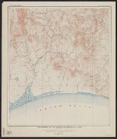
"Surveyed in 1909 and 1913 ; topography by Alaskan Branch, R.H. Sargent, topographic engineer.", Includes regional location map., and Relief shown by contours and spot heights.
Contour interval 100 feet. Datum is mean sea level., Includes examples of "Conventional signs" used on the map in the upper right margin., and Relief shown by contours and spot heights.
Publisher:
Engraved and printed by the U.S. Geological Survey,