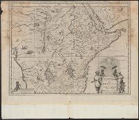
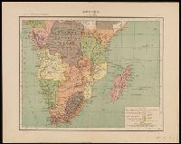
Appears in Blaeu's Atlas major., Bar scale given in milliaria Germanica communia., Ferro meridian., Includes illustration of animals and ornamental cartouche., No. 60 of 69 maps bound together in composite atlas., Relief shown pictorially., and Scale [ca. 1:12 000 000].
Publisher:
[Joan Blaeu]
Subject (Geographic):
Africa, Central --Maps --Early works to 1800 and Africa, Eastern --Maps --Early works to 1800
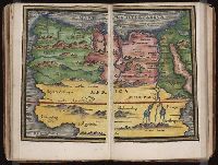
From the author's Theatrum orbis terrarum, sive atlas novus, 1635., Includes ill. of animals and ornamental cartouche., Lanman collection., Latin text on recto and verso., Relief shown pictorially., Running footer "Africa" on verso., Signature "K" on verso., and Text titled "Regnvm Abissinorvm," p. 86 on verso.
Publisher:
apud G. et I. Blaeu,
Subject (Geographic):
Africa, Central--Maps--Early works to 1800 and Africa, Eastern--Maps--Early works to 1800
Subject (Name):
Blaeu, Joan, 1596-1673. Theatrum orbis terrarum and Blaeu, Willem Janszoon, 1571-1638. Theatrum orbis terrarum
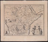
Aethiopia superior vel interior, vulgo Abissinorum sive Presbiteri Ioannis imperium
Description:
From the author's Atlas major. 1662., Includes ill. of animals and ornamental cartouche., Relief shown pictorially., and Verso: text with running title "Abyssinorvm Imperivm," page numbers "86", "85"; signature "Bb".
Publisher:
J. Blaeu,
Subject (Geographic):
Africa, Central--Maps--Early works to 1800 and Africa, Eastern--Maps--Early works to 1800
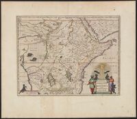
Aethiopia superior vel interior, vulgo Abissinorum sive Presbiteri Ioannis imperium
Description:
Appears in the author's Atlas major., Includes ill. of animals and ornamental cartouche., Relief shown pictorially., and Sheet measures 42.6 x 56.1 cm. Blank sheet (6.8 x 56 cm.) pasted to bottom.
Publisher:
J. Blaeu,
Subject (Geographic):
Africa, Central--Maps--Early works to 1800 and Africa, Eastern--Maps--Early works to 1800
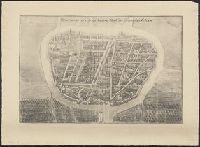
Kaerte van de rivieren van London en Rochester of Chetham
Description:
Includes inset of Medway River below Rochester, ill., and text., Relief shown pictorially., and Shows approach to England of the Dutch fleet commanded by De Ruyter on 19-23 June 1667, during the second Anglo-Dutch war.
Publisher:
Nicolaes Visscher, in de Kalverstraet, in de Visscher,
Subject (Geographic):
Medway, River (England)--Maps--Early works to 1800 and Thames Valley (England)--Maps--Early works to 1800
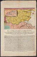
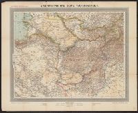
"Atlas de geographia universal" in upper left corner., "Carta 29a" in upper right corner., From Julio Gaspar Ferreira da Costa's Atlas de geographia universal., and Relief shown by hachures.
Publisher:
[Empresa Editora do Atlas de Geographia Universal],
Subject (Geographic):
Africa, Southern--Maps
Subject (Name):
Costa, Julio Gaspar Ferreira da. Atlas de geographia universal.