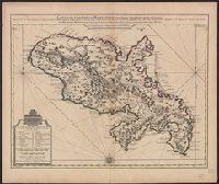
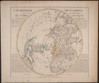
Bar scales given in "Lieues Marines et d'Espagne de 17 1/2 au Degré" and "Lieues Com. de France dont 25 font un Degré.", From Guillaume de L'Isle's Atlas nouveau, contenant toutes les parties du monde. Amsterdam : Chez Jean Cóvens & Corneille Mortier, [1742]., and Prime meridian: Ferro.
Publisher:
Chez Jean Covens et Corneille Mortier, geographes,
Subject (Geographic):
Martinique--Maps--Early works to 1800
Subject (Name):
Buache, Philippe, 1700-1773, Cóvens et Mortier, printer, and L'Isle, Guillaume de, 1675-1726. Atlas nouveau
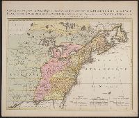
Kaart van de Engelsche en Fransche bezittingen in het vaste land van Noord America. and Possessions angloises & françoises du continet de l'Amérique septentrionale.
Description:
Based on Jean Palairet's Carte des possessions angloises françoises du continent de l'Amérique septentrionale, 1755., Hand colored., LC copy 2 accompanied by Jean Palairet's Beknopte beschr, Prime meridian: London and Île de Fer., and Relief shown pictorially.
Publisher:
Chez R. et J. Ottens, geográphes,
Subject (Geographic):
North America--Maps--Early works to 1800
Subject (Name):
Ottens, J. (Josua), 1704-1765 and Palairet, Jean, 1697-1774. Carte des possessions angloises françoises du continent de l'Amérique septentrionale
Jovrnal ou Description dv merveillevx voyage de Gvillavme Schovten, hollandois natif de Hoorn
Image Count:
1
Description:
Bound in facing p. 24., Imperfect: map has a defect just left of center in the form of a narrow vertical wrinkle that occurred at the time of printing, resulting in a line where no ink was deposited on the page, which also caused a small amount of loss of text., Map has several small brown and yellow marks on both the recto and verso., Map has small drop of black ink just left of the word "Latitudinis"., and Scale not given.
Subject (Geographic):
Horn, Cape (Chile), Le Maire Strait (Argentina), New Guinea --Maps --Early works to 1800, Oceania --Maps --Early works to 1800, and Tierra del Fuego (Argentina) --Maps --Early works to 1800
Subject (Name):
Schouten, Willem Corneliszoon, d. 1625
Collection Created:
A Amstredam : Chez Harman Ianson, marchand libraire, demeurant en la VVarmoes-straet, a le Sereine, 1619
Jovrnal ou Description dv merveillevx voyage de Gvillavme Schovten, hollandois natif de Hoorn
Image Count:
1
Description:
Bound in facing p. 20., Map has several small brown marks on both the recto and verso as well as a larger one in the center that can be seen on both the recto and verso., and Scale not given.
Subject (Geographic):
Horn, Cape (Chile), Le Maire Strait (Argentina), and Tierra del Fuego (Argentina) --Maps --Early works to 1800
Subject (Name):
Schouten, Willem Corneliszoon, d. 1625
Collection Created:
A Amstredam : Chez Harman Ianson, marchand libraire, demeurant en la VVarmoes-straet, a le Sereine, 1619
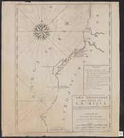
"Corrigée de nouveau sur la carte de Mr. Johannes Kyrilow ... ", Hand col. Lada-Mocarski Collection., Includes text of letter (in French and Dutch) written by "Monsieur Swartz ... a St. Petersbourg, and Title and place names in French. Text in French and Dutch.
"Rectifier selon la carte de Monsieur Jean Kyrilow, premier secretaire de conseil de l'Empire de Russie publier en l'anne ́1734 ... ", Cross collection no. 54., Includes text of letter written by "Monsieur Sw, Prime meridian: Ferro., and Relief shown pictorially.
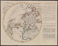
Descriptio ac delineatio geographica detectionis freti, sive, transitus ad occasum supra terras
Image Count:
1
Abstract:
Map depicts the Coat of Arms of the United Kingdom (era of the Union of the Crowns), reigning between the years 1603-1707.
Alternative Title:
Tabula nautica, qua repraesentantur orae maritimae, meatus, ac freta, noviter a H. Hudsono Anglo ad Caurum supra Novam Franciam
Description:
Bound in after p. [2]., In pencil on recto: 170., Map cut and folded irregularly., Map has multiple small stains on both the recto and verso., and Scale [ca. 1:9,000,000].