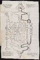
An historical, geographical, commercial, and philosophical view of the American United States, and
Image Count:
1
Description:
Facing p. 396.
Publisher:
Printed for the editor; J. Ridgway [etc.]
Subject (Geographic):
America --Description and travel, America --History --To 1810, Ohiopyle (Pa.), Pennsylvania --Pictorial works, and United States --Description and travel
Collection Created:
London, Printed for the editor; J. Ridgway [etc.] 1795
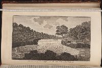
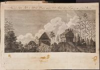
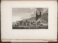
Travels through the interior parts of America. In a series of letters. By an officer ...
Image Count:
1
Description:
1 Jan. 1789., Between p. 350 & p. 351., and Teaching resource: Professor John Mack Faragher, History 141: The American West.
Subject (Geographic):
Canada --Description and travel, United States --Description and travel --Early works to 1800, and United States --History --Revolution, 1775-1783 --Personal narratives, British
Also appeared in Faden's [General atlas. London : William Faden, 1811?]., Includes relief profiles and inset map of "Positions ascertained by courses and distances given; on a scale reduced to the third.", No. 42 of 43 maps bound together in composite atlas., Relief shown pictorially; depths by soundings., and Scale [ca. 1:2,700,000].
Publisher:
Wm. Faden
Subject (Geographic):
Antilles, Lesser --Maps --Early works to 1800
Subject (Topic):
Nautical charts --Antilles, Lesser --Early works to 1800
Delarochette, L. (Louis), 1731-1802 Dicquemare, (Jacques-Francois), M. l'abbe, 1733-1789, creator Faden, William, 1749-1836
Published / Created:
1780 June 17
Call Number:
1982 Folio 10
Image Count:
1
Description:
By Monsr. L Abbe Diquemare ; with several emendations, and many useful additions &c. by L.S. De La Rochette., Depths shown by soundings., No. 8 of 43 maps bound together in composite atlas., and Scale [ca. 1:3,100,000].
Publisher:
Engraved & published by W. Faden
Subject (Geographic):
Biscay, Bay of (France and Spain) --Navigation --Maps --Early works to 1800, English Channel --Navigation --Maps --Early works to 1800, and North Sea --Navigation --Maps --Early works to 1800
Subject (Topic):
Coasts --England --Maps --Early works to 1800, Coasts --France --Maps --Early works to 1800, Nautical charts --English Channel --Early works to 1800, and Nautical charts --North Sea --Early works to 1800