- Creator:
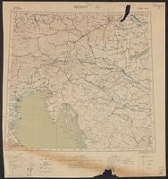
- Ordnance Survey of Great Britain and Ireland
Royal Geographical Society (Great Britain). Geographical Section - Published / Created:
- 1915
- Call Number:
- 11hcf 1919E-10
- Container / Volume:
- BRBL_00010Z
- Image Count:
- 1
- Resource Type:
- Maps, Atlases & Globes
- Alternative Title:
- Europe 1:1,000,000, G.S.G.S. ; no. 2758, and GSGS (Series) ; no. 2758.
- Description:
- Copy 2 imperfect. Mutilated. Browned. Inscription: Charles Seymour. and Includes index to adjoining sheets, index to boundaries, and pronunciation glossary.
- Publisher:
- Ordnance Survey,
- Subject (Geographic):
- Croatia--Maps, Italy--Maps, and Yugoslavia--Maps
- Subject (Name):
- Seymour, Charles,--1885-1963--Autograph
- Subject (Topic):
- World War, 1914-1918--Maps
- Found in:
- Beinecke Rare Book and Manuscript Library > Triest : North L 33. / compiled at the Royal Geographical Society under the direction of the Geographical Section; drawn and printed by Ordnance Survey.
Search
Limit your search
- Completely digitizedโ[remove]22
- Public22
- Maps22
- English22
- Ordnance Survey of Great Britain and Irelandโ[remove]22
- Royal Geographical Society (Great Britain). Geographical Section22
- London :โ[remove]22
Current results range from 1914 to 1918