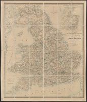
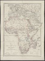
At head of sheet: "Wylds Military Map". and Insets: Enlarged map [of the route from Coomassie to Anamaboe and Cape Coast Castle; Location maps of Africa and West Africa].
Insets: City of Washington and District of Columbia. Scale ca. 1:190,000. 13 x 14 cm. Country round Washington. Scale ca. 1:1,020,000. 18 x 24 cm.-Pensacola bay and its fortifications. Scale ca. 1:155,000. 12 x 14 cm.-Charleston and the harbour. Scale ca.
Publisher:
James Wyld
Subject (Geographic):
United States--History--Civil War, 1861-1865--Maps
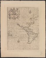
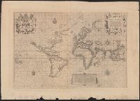
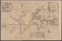
"The Typographic Etching Company Photo sc. ... ", Facsimile of original from "The Principal Navigators, Voyages ... " by Richard Hakluyt, London, 1599., and The so-called Wright-Molineaux anonymous world map, London, 1600.
Publisher:
The Hakluyt Society ... ,
Subject (Topic):
Maps--Facsimiles and World maps--Early works to 1800--Facsimiles
"The Typographic Etching Company Photo sc. ... ", Facsimile of original from "The Principal Navigators, Voyages ... " by Richard Hakluyt, London, 1599., and Preliminary record.
Publisher:
The Hakluyt Society ... ,
Subject (Topic):
Maps--Facsimiles and World maps--Early works to 1800--Facsimiles
"The Typographic Etching Company Photo sc. ... ", Facsimile of original from "The Principal Navigators, Voyages ... " by Richard Hakluyt, London, 1599., and Preliminary record.
Publisher:
The Hakluyt Society ... ,
Subject (Topic):
Maps--Facsimiles and World maps--Early works to 1800--Facsimiles