Search
You Searched For
Search Results
- Published / Created:
- 1776
- Call Number:
- 792cea Am32 1776
- Container / Volume:
- BRBL_00519
- Image Count:
- 1
- Resource Type:
- Maps, Atlases & Globes
- Description:
- From the North American Pilot 1783.
- Publisher:
- R. Sayer & J. Bennett,
- Subject (Geographic):
- Florida--Maps--Early works to 1800
- Found in:
- Beinecke Rare Book and Manuscript Library > A Plan of Amelia Harbour and Barr in east Florida ...
- Published / Created:
- 1776
- Call Number:
- 786cea P838 1776
- Container / Volume:
- BRBL_00516
- Image Count:
- 1
- Resource Type:
- Maps, Atlases & Globes
- Description:
- From the North America Pilot 1783.
- Publisher:
- R. Sayer & J. Bennett,
- Subject (Geographic):
- Port Royal (S.C.)--Maps--Early works to 1800
- Found in:
- Beinecke Rare Book and Manuscript Library > A Plan of Port Royal in South Carolina ...
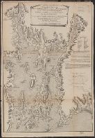
- Published / Created:
- 1755
- Call Number:
- 97 L62 1755
- Container / Volume:
- BRBL_00678
- Image Count:
- 1
- Resource Type:
- Maps, Atlases & Globes
- Publisher:
- John Rocque,
- Subject (Geographic):
- Lima (Peru)--Maps--Early works to 1800
- Found in:
- Beinecke Rare Book and Manuscript Library > A Scenographic Plan of the City of the Kings, otherwise called Lima, the capital of the Kingdonm of Peru ... as it was before the late earthquakes.
- Published / Created:
- 1776
- Call Number:
- 771 C358 1776C
- Container / Volume:
- BRBL_00482
- Image Count:
- 1
- Resource Type:
- Maps, Atlases & Globes
- Description:
- Inset: A particular plan of Lake George. Surveyed in 1756 by Capt. Jackson. Scale [ca. 1:150 000].
- Publisher:
- Robt. Sayer & Jno. Bennett,
- Subject (Geographic):
- Champlain, Lake--Maps--Early works to 1800 and New York (State)--Maps--Early works to 1800
- Subject (Name):
- Robert Sayer and John Bennett (Firm)
- Found in:
- Beinecke Rare Book and Manuscript Library > A Survey of Lake Champlain including Lake George, Crown Point, and St. John ... by William Brassier, Draughtsman. 1762.
- Published / Created:
- 1776
- Call Number:
- 771 C358 1776
- Container / Volume:
- BRBL_00482
- Image Count:
- 1
- Resource Type:
- Maps, Atlases & Globes
- Description:
- Inset: Lake George. Scale ca. 1:150 000
- Publisher:
- Map & Sea Chartsellers,
- Subject (Geographic):
- Champlain, Lake--Maps--Early works to 1800 and New York (State)--Maps--Early works to 1800
- Found in:
- Beinecke Rare Book and Manuscript Library > A Survey of Lake Champlain including Lake George, Crown Point, and St. John : surveyed by order of his Excellency major General Sr. Jeffery Amherst ... / by William Brassier, Draughtsman, 1762.
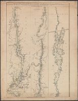
- Published / Created:
- 1776
- Call Number:
- 771 H864 1776A
- Container / Volume:
- BRBL_00483
- Image Count:
- 1
- Resource Type:
- Maps, Atlases & Globes
- Description:
- Engraved by William Faden.
- Publisher:
- Wm. Faden,
- Subject (Geographic):
- Hudson River (N.Y. and N.J.)--Maps--Early works to 1800
- Found in:
- Beinecke Rare Book and Manuscript Library > A Topographical map of Hudsons River ... Communication with Canada by Lake George and lake Champlain ... by Claude Joseph Sauthier ...
- Published / Created:
- 1776
- Call Number:
- 771 H864 1776
- Container / Volume:
- BRBL_00483
- Image Count:
- 1
- Resource Type:
- Maps, Atlases & Globes
- Description:
- Engraved by William Faden Succesor to the late Mr. Jefferys geographer to the King Charing Cross.
- Publisher:
- Wm. Faden,
- Subject (Geographic):
- Hudson River (N.Y. and N.J.)--Maps--Early works to 1800
- Found in:
- Beinecke Rare Book and Manuscript Library > A Topographical map of Hudsons River ... Communication with Canada by Lake George and lake Champlain ... by Claude Joseph Sauthier ...
- Published / Created:
- 1777
- Call Number:
- 765cea N16 1777
- Container / Volume:
- BRBL_00464
- Image Count:
- 1
- Resource Type:
- Maps, Atlases & Globes
- Publisher:
- Wm. Faden,
- Subject (Geographic):
- Narragansett Bay (R.I.)--Maps--Early works to 1800
- Found in:
- Beinecke Rare Book and Manuscript Library > A Topological Chart of the Bay of Narragansett in the Province of New englannd ... by Charles Blaskowitz.
- Creator:
- Boydell, John, 1719-1804
Shakspeare Gallery
- Published / Created:
- 1789
- Call Number:
- 1982 +7
- Image Count:
- 1
- Description:
- Preface signed: John Boydell.
- Publisher:
- Sold at the place of exhibition,
- Subject (Name):
- Hilles, Frederick Whiley,--1900---Bookplate.--696 % sp13 and Shakespeare, William,--1564-1616--Illustrations
- Found in:
- Beinecke Rare Book and Manuscript Library > A cataloque of the pictures in the Shakspeare Gallery, Pall-Mall.
- Published / Created:
- 1776
- Call Number:
- 775cea 1776
- Container / Volume:
- BRBL_00502
- Image Count:
- 1
- Resource Type:
- Maps, Atlases & Globes
- Description:
- From North American Pilot 1782.
- Publisher:
- Robt. Sayer & Jno. Bennett,
- Subject (Geographic):
- Delaware Bay (Del and N.J.)--Maps--Early works to 1800
- Found in:
- Beinecke Rare Book and Manuscript Library > A chart of Delaware Bay and River ... by joshua Fisher.