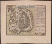
Appears in Blaeu's Atlas major, Fre, Hand col. Sheet measures 54 x 63 cm. Lanman Collection., Russian, Latin and French., Title text in cyrillic; transliteration in Koeman., and Verso: Title "Moskow, ville metropolitaine de Moscovie"; pg. no. 20,b; signature F 2.
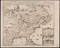
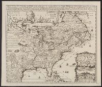
Appears in Chatelain's Atlas historique according to McCorkle., Cross collection no. 149., In upper right: Tom: VI. No: 23. Pag: 91., Includes notes, table of coordinates for certain locations, and ill., and Insets: Les environs de Quebec -- Veüe de Quebec -- Les costes de la Louisiane.
Publisher:
Chez L'Honoré & Châtelain Libraires?,
Subject (Geographic):
New France--Maps--Early works to 1800 and North America--Maps--Early works to 1800
Appears in Chatelain's Atlas historique according to McCorkle., Cross collection no. 149., In upper right: Tom: VI. No: 23. Pag: 91., Includes notes, table of coordinates for certain locations, and ill., McCorkle attributes authorshi, and Relief shown pictorially.
Publisher:
Chez L'Honoré & Châtelain Libraires?,
Subject (Geographic):
New France--Maps--Early works to 1800 and North America--Maps--Early works to 1800
Appears in Chatelain's Atlas historique according to McC, In upper right: Tom: VI. No: 23. Pag: 91., Includes notes, table of coordinates for certain locations, and ill., McCorkle attributes authorship of this map to Nicolas de Fer., and Relief shown pictorially.
Publisher:
Chez L'Honoré & Châtelain Libraires?,
Subject (Geographic):
New France--Maps--Early works to 1800 and North America--Maps--Early works to 1800
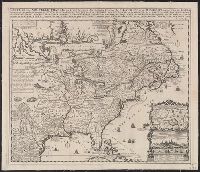
Based on Guillaume de L'Isle's Carte du Canada ... 1703., From Chatelain's Atlas historique ... Amsterdam : Chez L'Honoré & Châtelain, 1718-21., In upper right corner: Tom: VI. No: 20. Pag: 82., Includes text., Reli, and Sheet measures 45.3 x 57.1 cm.
Publisher:
Chez l'Honore & Chatelain Libraires,
Subject (Geographic):
Canada--Maps--Early works to 1800 and New France--Maps--Early works to 1800
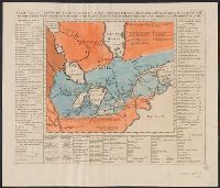
Above neat line at right: Tom VI. no. 21 pag: 90., Chatelain copy of Lahontan's 1703 map of Canada., Fr, Hand col. Mounted on linen. Sheet measures 43.8 x 51.8 cm. Cross Collection no. 190., and Map bordered by tables listing Indian nations and animals of Canada.
Publisher:
Henri Abraham Chatelain,
Subject (Geographic):
Canada--Maps--Early works to 1800 and Great Lakes (North America)--Maps--Early works to 1800
Subject (Name):
Chatelain, Henri Abraham. Atlas historique and Lahontan, Louis Armand de Lom d'Arce, baron de, 1666-1715?
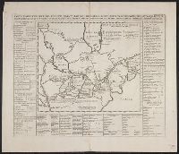
Chatelain copy of Lahontan's 1703 map of Canada., From Chatelain's Atlas historique ... Amsterdam : Chez François L'Honoré & Compagnie ..., [1719], Map bordered by tables listing Indian nations and animals of Canada., and Sheet measures 45.2 x 50.8
Publisher:
Henri Abraham Chatelain,
Subject (Geographic):
Canada--Maps--Early works to 1800 and Great Lakes (North America)--Maps--Early works to 1800
Subject (Name):
Chatelain, Henri Abraham. Atlas historique and Lahontan, Louis Armand de Lom d'Arce, baron de, 1666-1715?
Above neat line at right: Tom VI. no. 21 pag: 90., Chatelain copy of Lahontan's 1703 map of Canada., From Chatelain's Atlas historique ... Amsterdam : Chez François L'Honoré & Compagnie ..., [1719], Map bordered by, and Sheet measures 45.2 x 52.9 cm.
Publisher:
Henri Abraham Chatelain,
Subject (Geographic):
Canada--Maps--Early works to 1800 and Great Lakes (North America)--Maps--Early works to 1800
Subject (Name):
Chatelain, Henri Abraham. Atlas historique and Lahontan, Louis Armand de Lom d'Arce, baron de, 1666-1715?