Skip to search
Skip to main content
Skip to first result
Search
You Searched For
Extent of Digitization
Unspecified
Genre
Maps
Publication Place
Philadelphia
New Search
Search Results
Creator:
Published / Created:
1822
Call Number:
2003 Folio 81
Collection Title:
The New American Atlas ...
Container / Volume:
No. IV [4]
Image Count:
1
Description:
Already scanned for Mellon exhibit catalog, North America, S.W. sheet, and Printed by Wm. Duffee
Publisher:
H.S. Tanner
Subject (Geographic):
Mexico--Maps and North America--Maps
Collection Created:
Philadelphia : H.S. Tanner, 1822
Found in:
Beinecke Rare Book and Manuscript Library > A Map of North America, Constructed According to the Latest Information by H. S. Tanner
Published / Created:
1818
Call Number:
1978 Folio 21
Collection Title:
Carey's General atlas, improved and enlarged; being a collection of maps of the world and quarters
Image Count:
1
Publisher:
M. Carey and Son
Collection Created:
Philadelphia: M. Carey and Son, 1818
Found in:
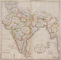
Beinecke Rare Book and Manuscript Library > An Accurate Map of Hindostan or India, from the best authorities
Published / Created:
1868
Call Number:
Zc19 K13k 868ka
Collection Title:
Letter of John D. Perry, President of the Union Pacific Railway, Eastern Division, together with
Image Count:
1
Description:
Preceding p. 1
Publisher:
Review Printing House
Subject (Geographic):
West (U.S.) --Maps
Subject (Name):
Union Pacific Railroad Company--Maps
Subject (Topic):
Railroads --West (U.S.) --Maps
Collection Created:
Philadelphia, Review Printing House, 1868
Found in:
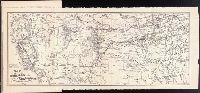
Beinecke Rare Book and Manuscript Library > Map of the Routes of the Union Pacific Railroads with their Eastern Connections
Creator:
Published / Created:
1759
Call Number:
2003 Folio 85
Image Count:
1
Alternative Title:
Map of the improved part of the province of Pennsylvania
Description:
BEIN 2003 Folio 85: No. 20 of 45 maps bound together with binder's spine title: Atlas of America; ms. table of contents. Bookplate: Robinson. Bookplate of Paul Mellon., Hand colored., Relief shown pictorially., Scale [ca. 1:250,000]., and Shows county boundaries.
Publisher:
Sold by the author, Nicholas Scull
Subject (Geographic):
Pennsylvania -- Administrative and political divisions -- Maps -- Early works to 1800 and Pennsylvania -- Maps -- Early works to 1800
Found in:
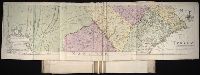
Beinecke Rare Book and Manuscript Library > To the Honourable Thomas Penn and Richard Penn, Esqrs: true & absolute proprietaries & Governours of the Province of Pennsylvania & counties of New-Castle, Kent & Sussex on Delaware, this map of the improved part of the Province of Pennsylvania is humbly
Branch:v1.61.6 ,Deployed:2024-06-12T09:55:31-04:00