Skip to search
Skip to main content
Skip to first result
Search
You Searched For
Genre
Engravings
Genre
Maps
Language
Latin
New Search
Search Results
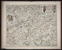
Creator:
Published / Created:
ca. 1684
Call Number:
Folio 469
Collection Title:
[Atlas factice of 13 maps by Nicolaes Visscher I, Nicolaes Visscher II, Guillaume Sanson, and
Image Count:
1
Publisher:
Nicolaes Visscher
Subject (Geographic):
Europe --Maps --Early works to 1800 and Hainaut (Belgium) --Maps --Early works to 1800
Subject (Topic):
Atlases, Dutch --Early works to 1800
Collection Created:
1677-1692
Found in:
Beinecke Rare Book and Manuscript Library > Comitatus Hannoniae et Archiepiscopatus Cameracensis tabula / [cartographic material] / per Nicolaum Visscher
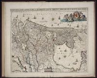
Creator:
Published / Created:
ca. 1680
Call Number:
Folio 469
Collection Title:
[Atlas factice of 13 maps by Nicolaes Visscher I, Nicolaes Visscher II, Guillaume Sanson, and
Image Count:
1
Publisher:
Justus Danckerts
Subject (Geographic):
Europe --Maps --Early works to 1800 and Netherlands --Maps --Early works to 1800
Subject (Topic):
Atlases, Dutch --Early works to 1800
Collection Created:
1677-1692
Found in:
Beinecke Rare Book and Manuscript Library > Comitatus Hollandiae tabula / [cartographic material] / pluribus locis recens emendata a Iusto Danckerts
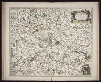
Creator:
Published / Created:
ca. 1684
Call Number:
Folio 469
Collection Title:
[Atlas factice of 13 maps by Nicolaes Visscher I, Nicolaes Visscher II, Guillaume Sanson, and
Image Count:
1
Publisher:
Nicolaes Visscher
Subject (Geographic):
Europe --Maps --Early works to 1800 and Namur (County) --Maps --Early works to 1800
Subject (Topic):
Atlases, Dutch --Early works to 1800
Collection Created:
1677-1692
Found in:
Beinecke Rare Book and Manuscript Library > Comitatus Namurci / [cartographic material] / emendata delineatio nuperrime in lucem edita per Nicolaum Visscher
Creator:
Published / Created:
1750
Call Number:
1973 Folio 30
Collection Title:
[Atlas factice of 32 maps and 1 distance table, produced by the Homann Erben firm]
Image Count:
2
Publisher:
[Matthaeus Seutter?]
Subject (Geographic):
Nordhausen (Germany : Landkreis) --Maps --Early works to 1800
Subject (Topic):
Atlases, German --Early works to 1800
Collection Created:
[Nuremberg : s.n., 1701-1760]
Found in:
Beinecke Rare Book and Manuscript Library > Comitatus Stolbergensis delineatio geographia, Praefecturas Hohnstein, Stolberg, Hayn Berenroda, Ebersburg, Ufftrungen, Rosla et Questen cum limitibus et vicinia accurate exhibens / [cartographic material] / caelo Matthaei Seutteri. Georgraphi Caesarei ;
Creator:
Published / Created:
a. 1760
Call Number:
1973 Folio 30
Collection Title:
[Atlas factice of 32 maps and 1 distance table, produced by the Homann Erben firm]
Image Count:
2
Alternative Title:
Comitatus Schoenburgensis
Publisher:
Edentibus Homannianis Heredibus
Subject (Geographic):
Zwickau (Germany : Landkreis) --Maps --Early works to 1800
Subject (Topic):
Atlases, German --Early works to 1800
Collection Created:
[Nuremberg : s.n.,
Found in:
Beinecke Rare Book and Manuscript Library > Comitatvs Schoenburgensis [cartographic material] : in quo celsissimorum comitum de Schoenburg regiones ad circulum Saxoniae superiorem Imperii Romano-Germanici pertinentes et in Marchionatu Misniae sitae, subfeuda porro Bohemico-Imperialia, nempe Dynasti
Call Number:
1983 Folio 19
Collection Title:
[Atlas factice of 96 maps by Blaeu, Visscher, Jansson, Hondius and others]
Image Count:
2
Description:
Imperfect: lower left corner [imprint] cut-out and replaced with ms. ill.; edges reinforced with ms waste. Sheet measures 38.5 x 48.9 cm. No. 67 of 92 maps bound together. and Numbered 72 on verso.
Subject (Geographic):
Denmark --Maps --Early works to 1800
Subject (Topic):
Atlases --Early works to 1800
Collection Created:
[1556-1680]
Found in:
Beinecke Rare Book and Manuscript Library > Daniae regni typus
Creator:
Published / Created:
1750
Call Number:
1973 Folio 30
Collection Title:
[Atlas factice of 32 maps and 1 distance table, produced by the Homann Erben firm]
Image Count:
2
Publisher:
[Matthaeus Seutter?]
Subject (Geographic):
Saxony-Anhalt (Germany) --Maps --Early works to 1800
Subject (Topic):
Atlases, German --Early works to 1800
Collection Created:
[Nuremberg : s.n., 1701-1760]
Found in:
Beinecke Rare Book and Manuscript Library > Delineatio geographica comitatus Mansfeldensis ad jurisdictionem tum Saxonicam tum Brandenburgicam spectans, cum praefectura Sangerhusana, Querfurtensi, Sittenbacensi, Allstaedensi, et loci finitimis / [cartographic material] / cura Matth. Seutteri, Geogr
Creator:
Published / Created:
ca. 1757
Call Number:
1973 Folio 30
Collection Title:
[Atlas factice of 32 maps and 1 distance table, produced by the Homann Erben firm]
Image Count:
2
Publisher:
[Tobias Conrad Lotter?]
Subject (Geographic):
Greiz (Germany : Landkreis) --Maps --Early works to 1800
Subject (Topic):
Atlases, German --Early works to 1800
Collection Created:
[Nuremberg : s.n.,
Found in:
Beinecke Rare Book and Manuscript Library > Delineatio geographica specialis territorii celsissimorum S.R.I. comitum Ruthenorum de Plauia [cartographic material] : utriusque linea senioris et iunioris partem Vogtlandiae / opera et studio Ioh. Gottlieb Schulzii, S.C.M. Ingen. Lieut. ; accurate edita
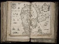
Creator:
Published / Created:
[1596]
Call Number:
Taylor 216A
Collection Title:
John Huighen van Linschoten, his Discours of Voyages into ye Easte & West Indies
Image Count:
1
Description:
[Scale ca. 1:19,000,000]. and Bound in following page 216.
Subject (Geographic):
Australia --Maps --Early works to 1800
Subject (Name):
Wolfe, John, d. 1601, printer
Subject (Topic):
Voyages and travels --Early works to 1800
Collection Created:
[London] : Printed at London by [John Windet for] Iohn Wolfe, printer to ye Honorable Cittie of London, [1598]
Found in:
Beinecke Rare Book and Manuscript Library > Delineatio omnium orarum totius Australis partis Americae, dictae Peruvianae, a R. de la Plata, Brasiliam, Pariam, & Castellam ...
Creator:
Published / Created:
[ca. 1596]
Call Number:
Taylor 219
Collection Title:
Navigatio ac itinerarivm Iohannis Hvgonis Linscotani in Orientalem sive Lvsitanorvm Indiam
Image Count:
1
Description:
[Scale ca. 1:19,000,000]., Bound in following page 36., and Map has significant tears at bottom right and left, as well as a tear along the bottom center fold.
Subject (Geographic):
Brazil --Maps --Early works to 1800, Chile --Maps --Early works to 1800, Peru --Maps, and South America --Maps --Early works to 1800
Subject (Name):
Claesz, Cornelis, ca. 1546-1609, Elzevier, Gillis, bookseller, and Hendricksz, Aelbrecht, fl. 1573-1605, printer
Subject (Topic):
Voyages and travels --Early works to 1800
Collection Created:
Hagae-Comitis : Ex officina Alberti Henrici, impensis authoris & Cornelii Nicolai, prostantque apud Aegidium Elseuirum, anno 1599
Found in:
Beinecke Rare Book and Manuscript Library > Delineatio omnium orarum totius Australis partis Americae, dictae Peruvianae, a R. de la Plata, Brasiliam, Pariam, & Castellam ...
Branch:v1.61.6 ,Deployed:2024-06-12T09:55:36-04:00